

Posted: 12/30/2018 13:00CDT
On the third day, we hiked out of the Grand Canyon. After some debate, we decided to hike up the Bright Angel Trail over the South Kaibab Trail. This decision was made becasue there are more people, water sources and shade along the Bright Angel Trail.
The Bright Angel Trail begins at the Silver Bridge and continues along the river. Wrapping around on a trail carved into the cliff face. High above the Colorado River, we were traveled before the sun was high overhead. The heat and humidity was stifiling.
We made good progress to the Pipe Creek Rest House. Not being aware of the next parts, we foolishly stopped to take a few pictures and watch the river for one last time. The end of pipe creek has a composing toilet, which I would only use if I was desperate. The beach is rocky and often used by rafts for short stopovers.
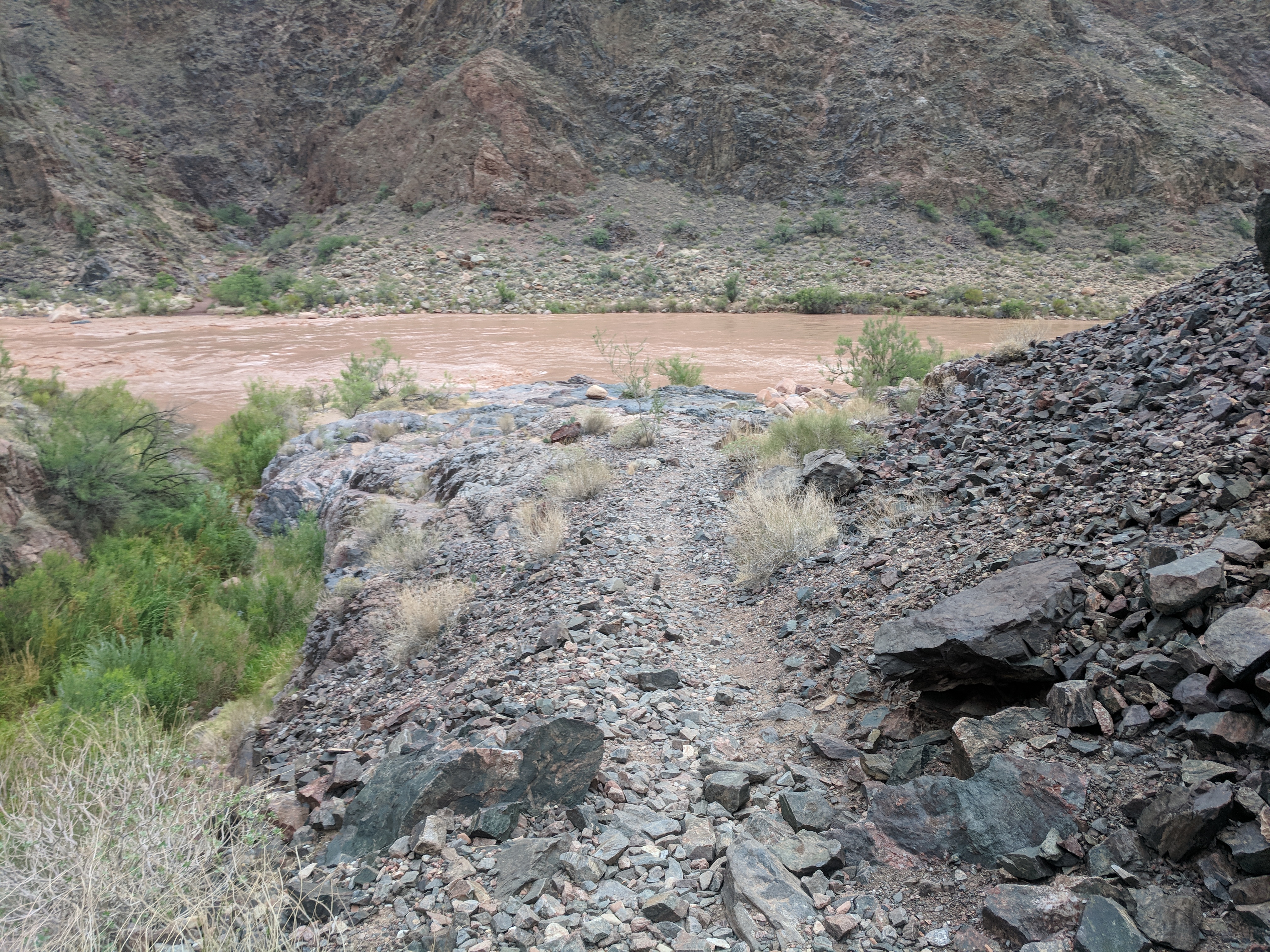
Image 1: Beach at the Pipe Creek |
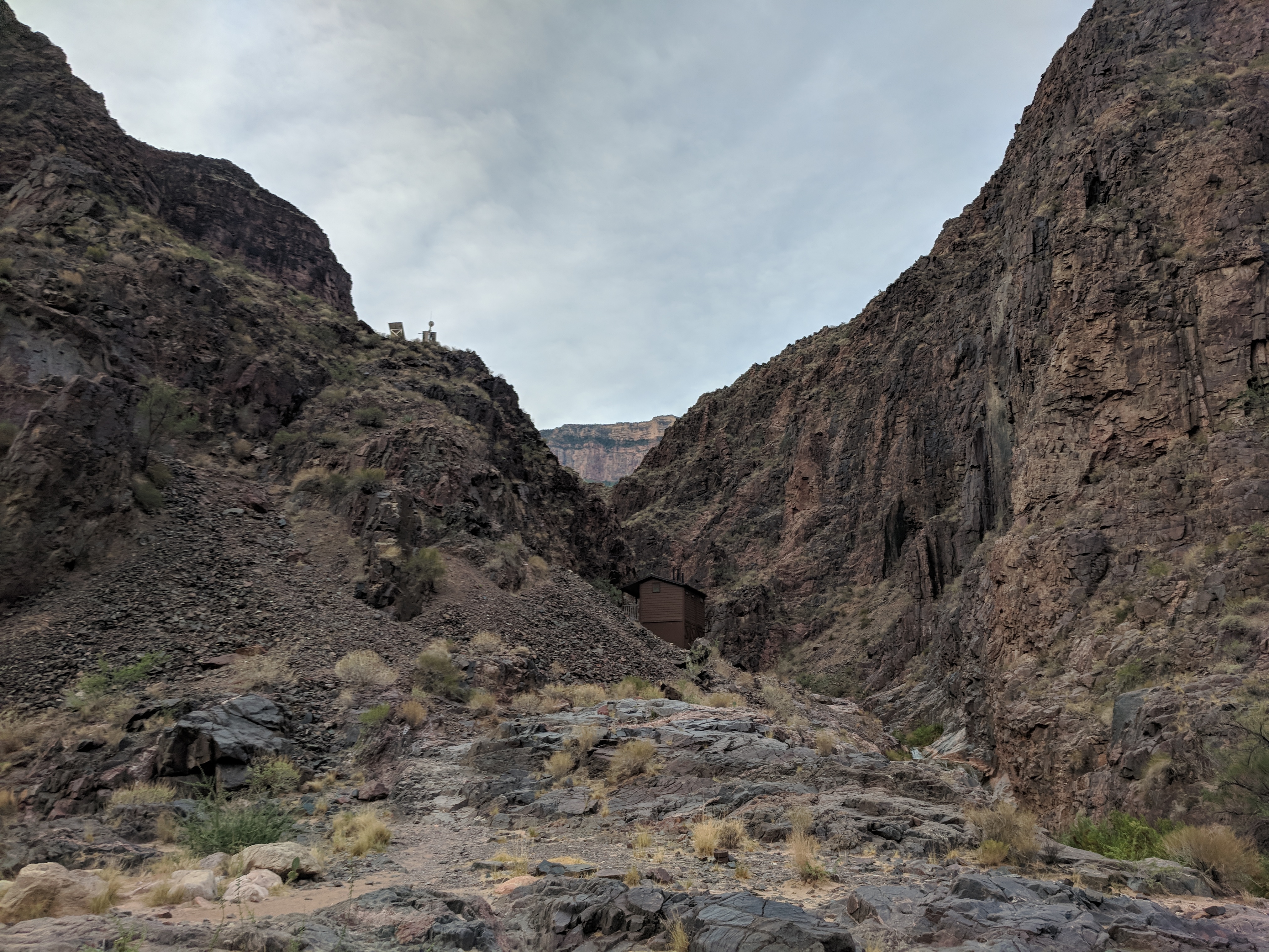
Image 2: Pipe Creek Rest House from the Beach |
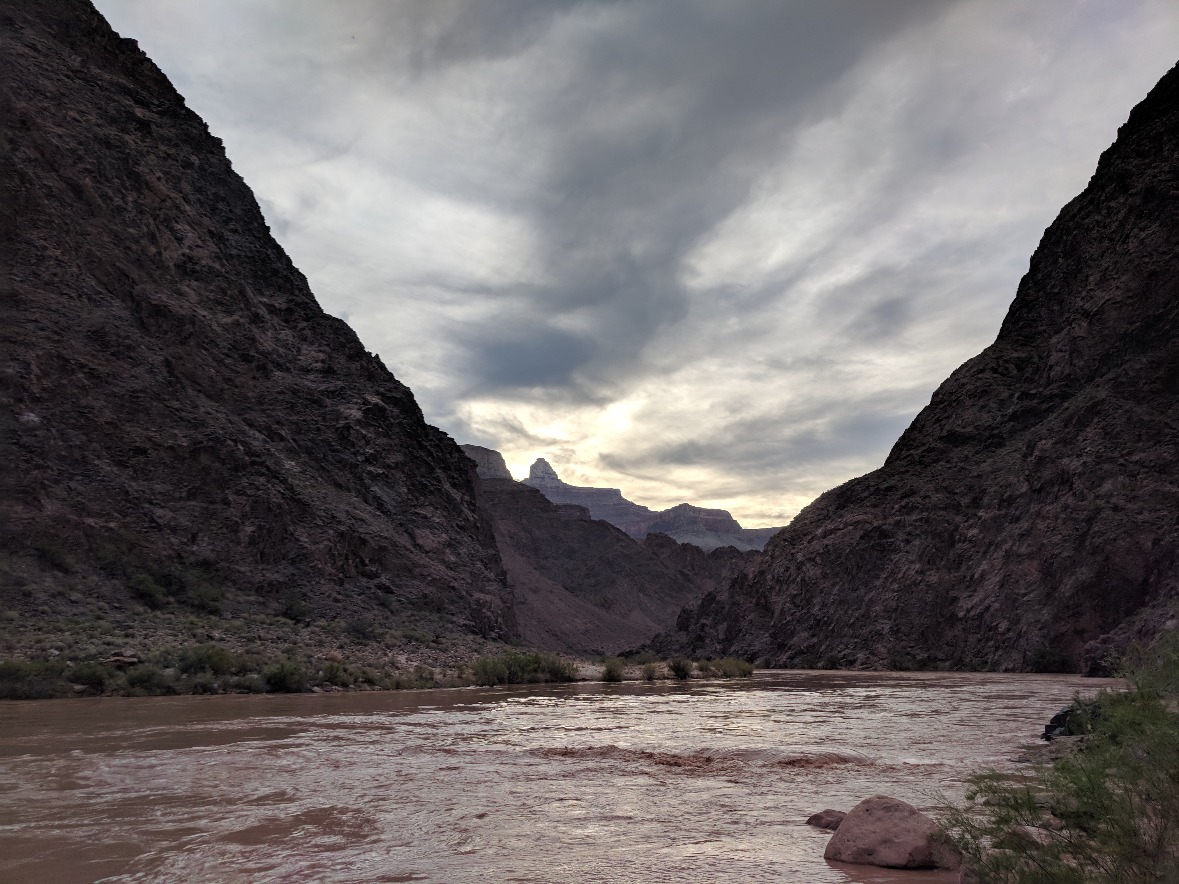
Image 3: Colorado River from the Pipe Creek Beach |
As we left the beach, we entered into the section of the Trail called Hell's Canyon. The deeper sections of the canyons get into rocky deposits that do not have significant soil deposits. As a result, there is very little plant growth and heavy rocky terrain. Like the Box on the North Kaibab, Hell's Canyon becomes unbearably hot when the sun is shining into the canyon. The late departure to have breakfast and the stop at Pipe creek beach left us with a rising sun as we traveled through the canyon.
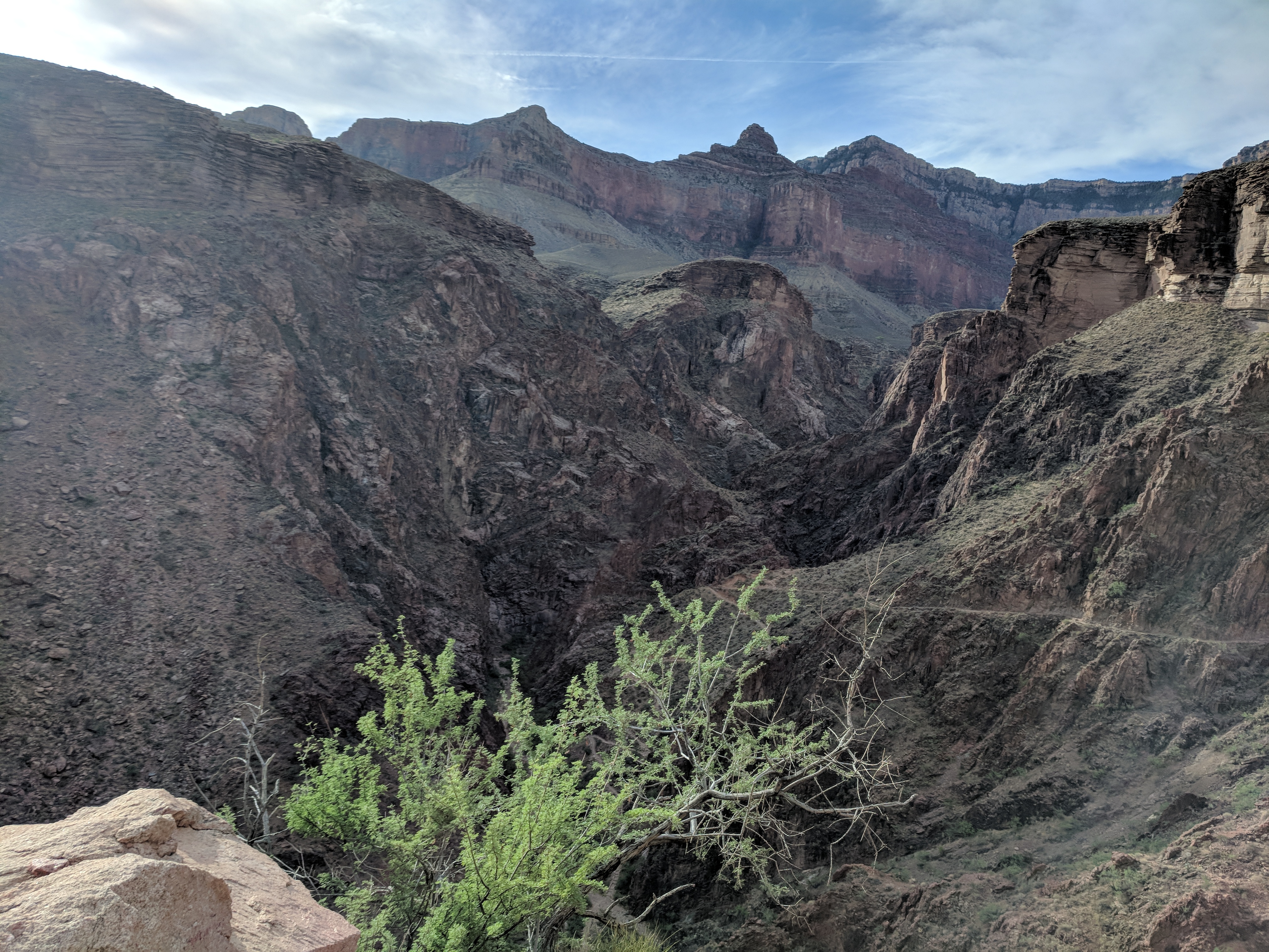
Image 4: Looking back at Hell's Canyon |
As we exited hell's canyon, we took note of the first greenery. A sign that we were coming to the garden, where we could expect shade and water. For most of this walk, the creek was visble, but inaccessable.
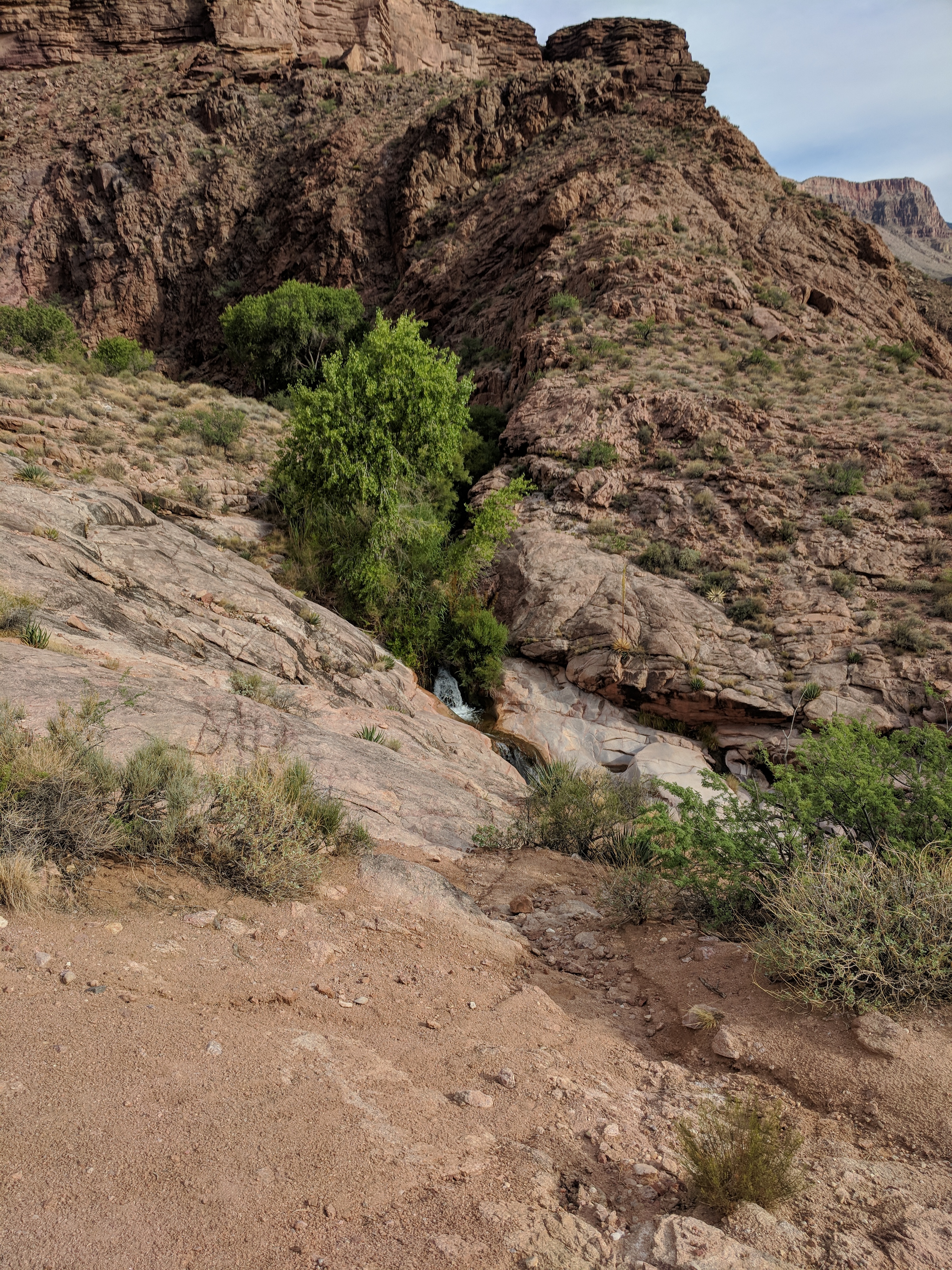
Image 5: First Greenery after Leaving Hell's Canyon |
A few uphill switchbacks later, we found water. While we did not need water, it was a refreshing break. The water was cool, and I could not help rolling around in it to soak my shirt and cool off my head. The image below shows me about to dunk my head into the river. Looks like I am worshiping at the creek. It was not that bad.
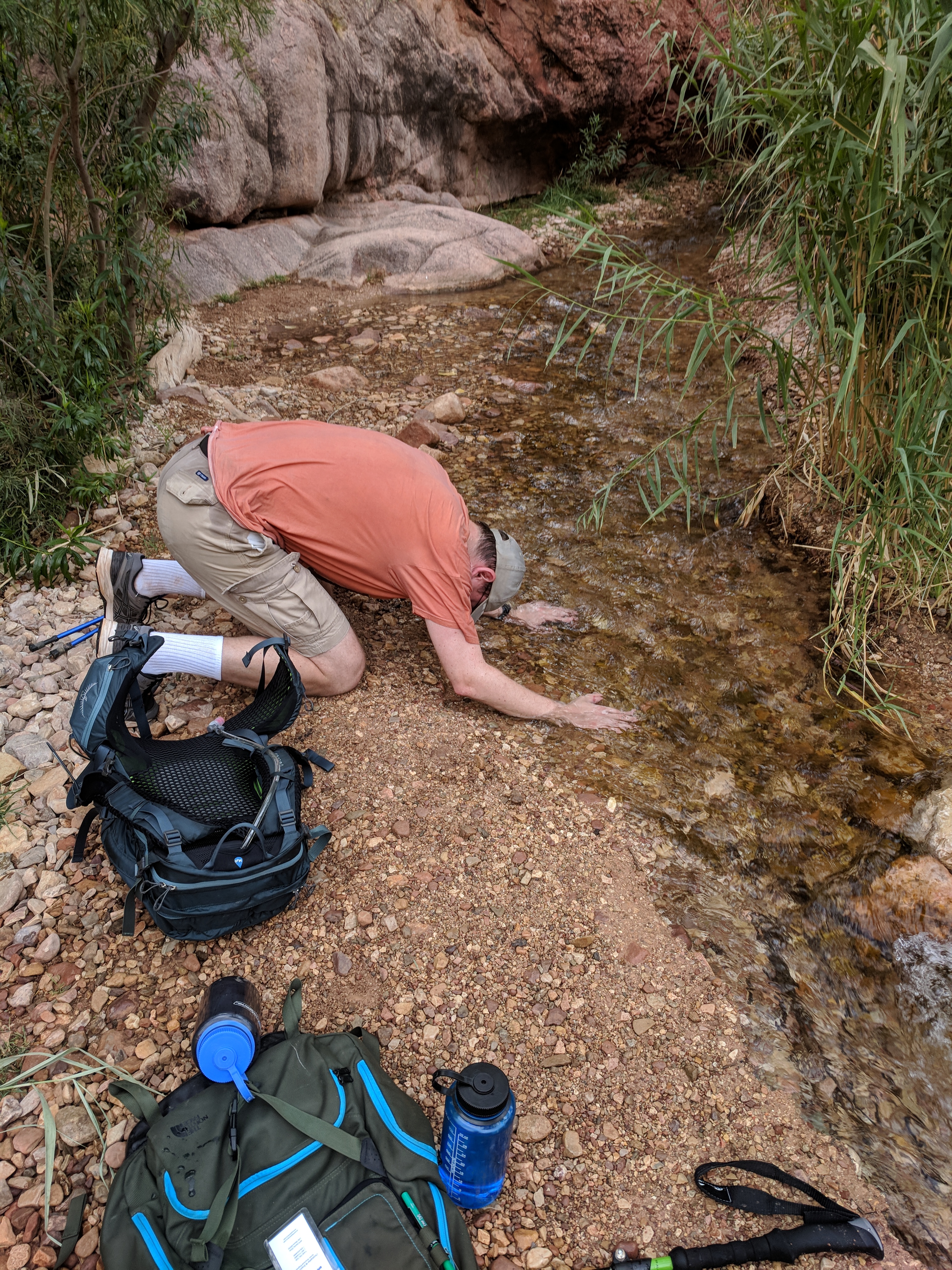
Image 6: Cooling in the Garden Creek |
A litte further up the trail, we had a beautiful view of the Garden Creek Waterfall. Shade was plentiful here, but we did not stop for long.
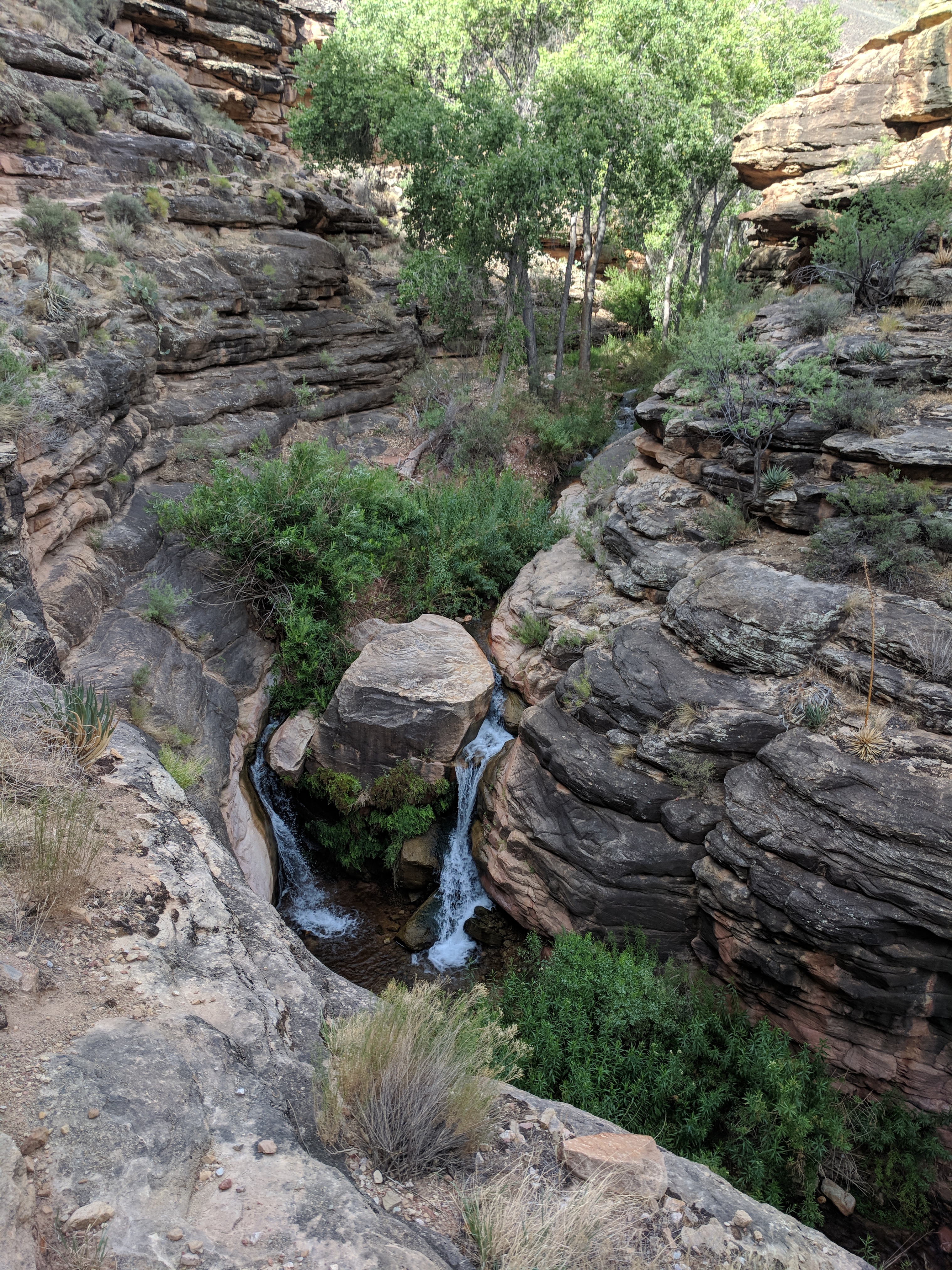
Image 7: Garden Creek Waterfall |
As we walked out of the canyon with the waterfall. We were on a lush green plane looking up at a garden and the upper portion of the Bright Angel Valley. This was my favorite picture of the trip.
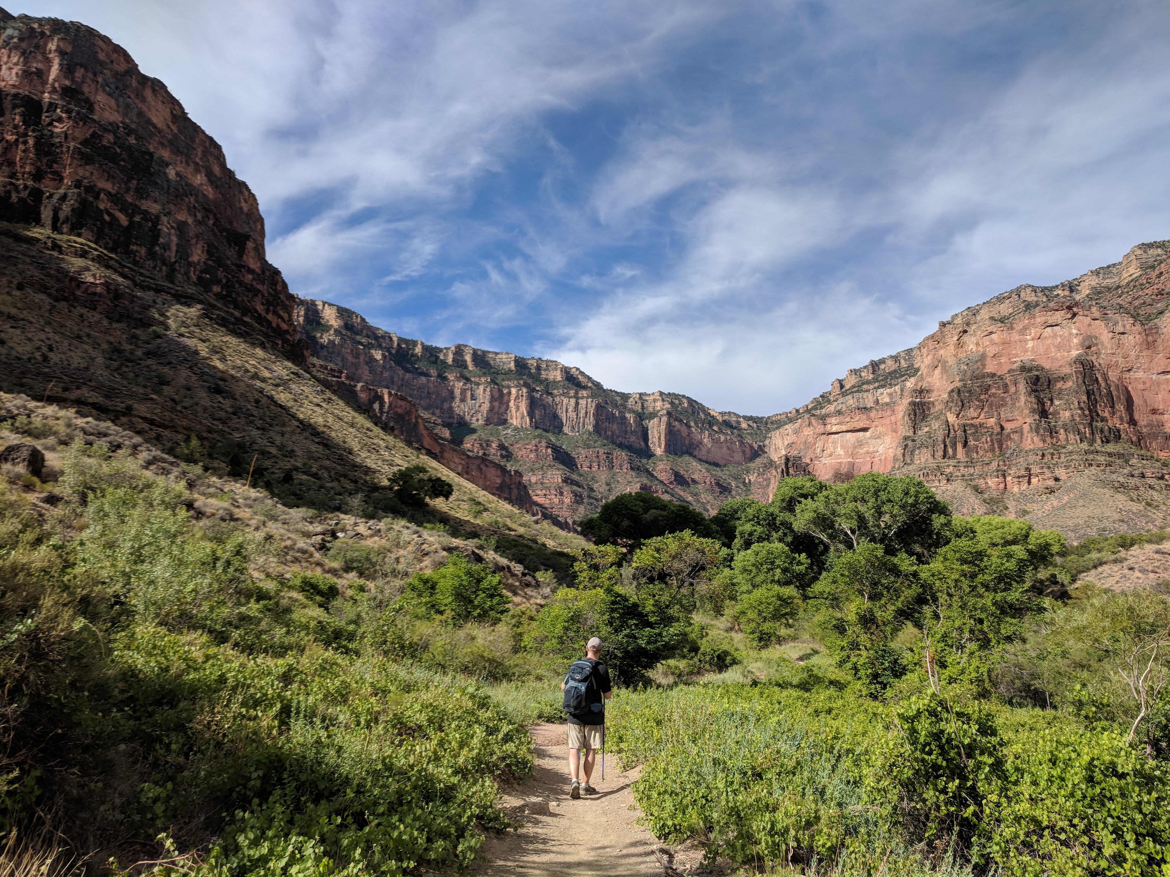
Image 8: Walking into the Indian Garden |
Wandering through the garden, we ended up at the pump house and water spigot. There were several benches and rocks that served as seats for the weary hikers. Looking up at the valley, we saw the complete lack of shade. At this point, we contemplated resting here and waiting for the sun to lower in the sky before contiuing. We reviewed that we had about five miles to go, with two rest stops with water. We decided to proceed.

Image 9: Indian Garden Watering Hole |
Leaving the relative paradise of the garden, we kept looking back to see our progress. Looking up at the rim was far less encouraging. I took it one step at a time and stopped to drink and rest when I felt hot or light headed.
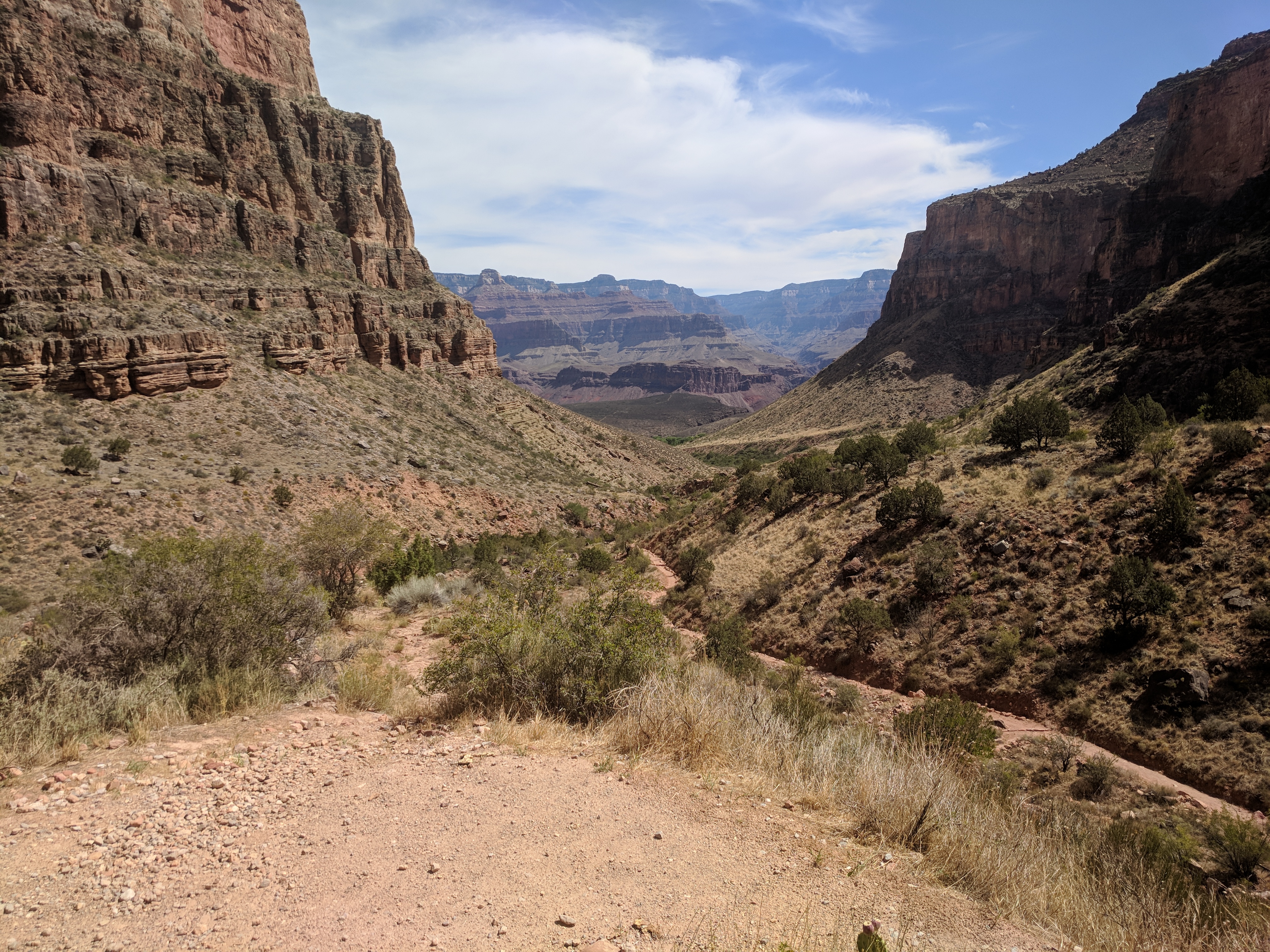
Image 10: Looking Back at the Garden |

Image 11: Looking Back at the Garden II |
Eventually the garden fell out of view as the canyon curved around a bend. Below was our last glimpse of the garden.
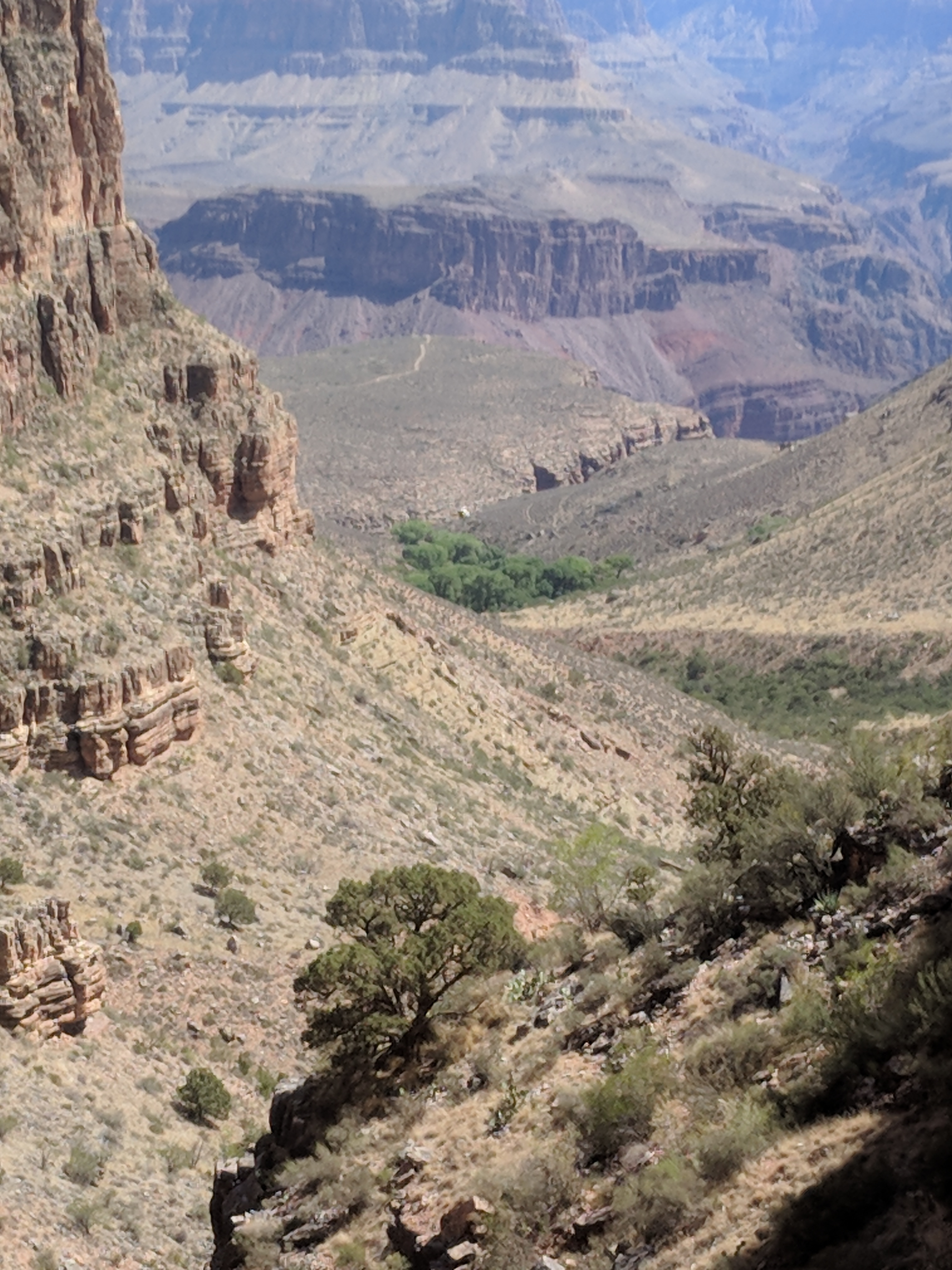
Image 12: Last Glimpse of the Garden |
This was the hardest part of the hike. No shade, no sign of the end. We just had endless switchbacks. Once we reached the three mile rest stop, we knew how much we had to do. I felt great as I had done this hike about 18 years earlier. This time I was quite fatigued, but I knew I could get this done. My phone buzzed with cell service, and I let my wife know were on our way. The image below was looking down to plateau point. We did not hike out to this point.
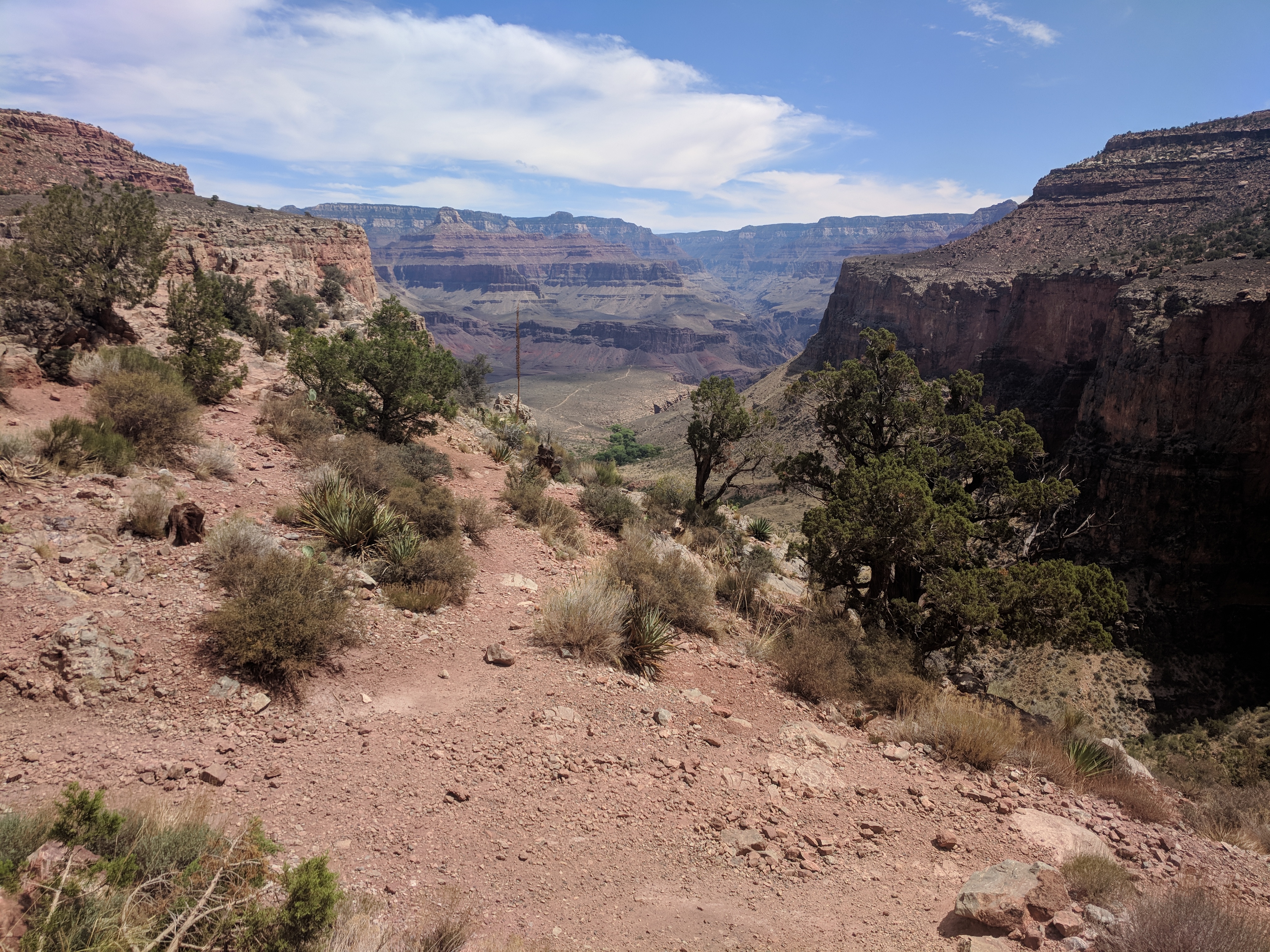
Image 13: Looking Down the Valley towards Plateau Point |
We crossed the final switch backs and were greeted by our family at the top of the trail.
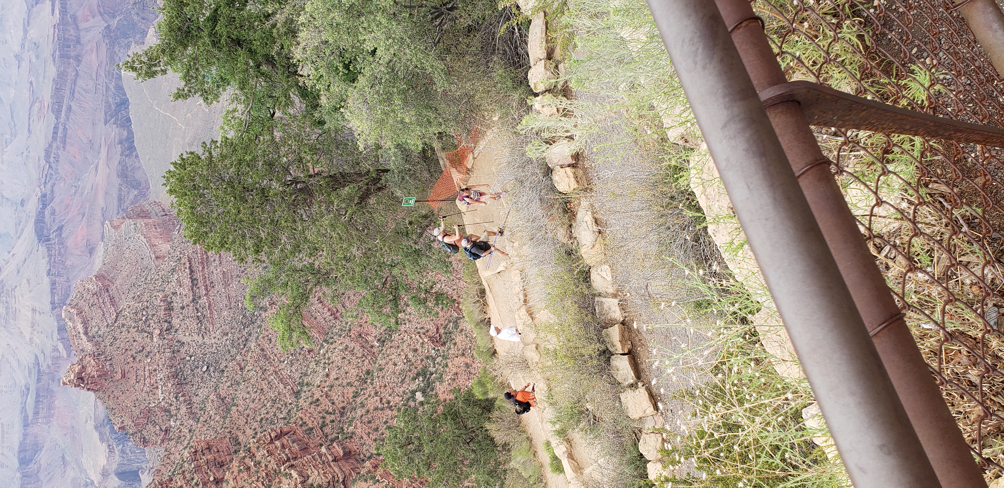
Image 14: Final Switchbacks |
Over the course of the next two days, I made my way over to a portion of the canyon rim where the Phantom Ranch Camground could be seen from the rim. Below is me pointing at it.
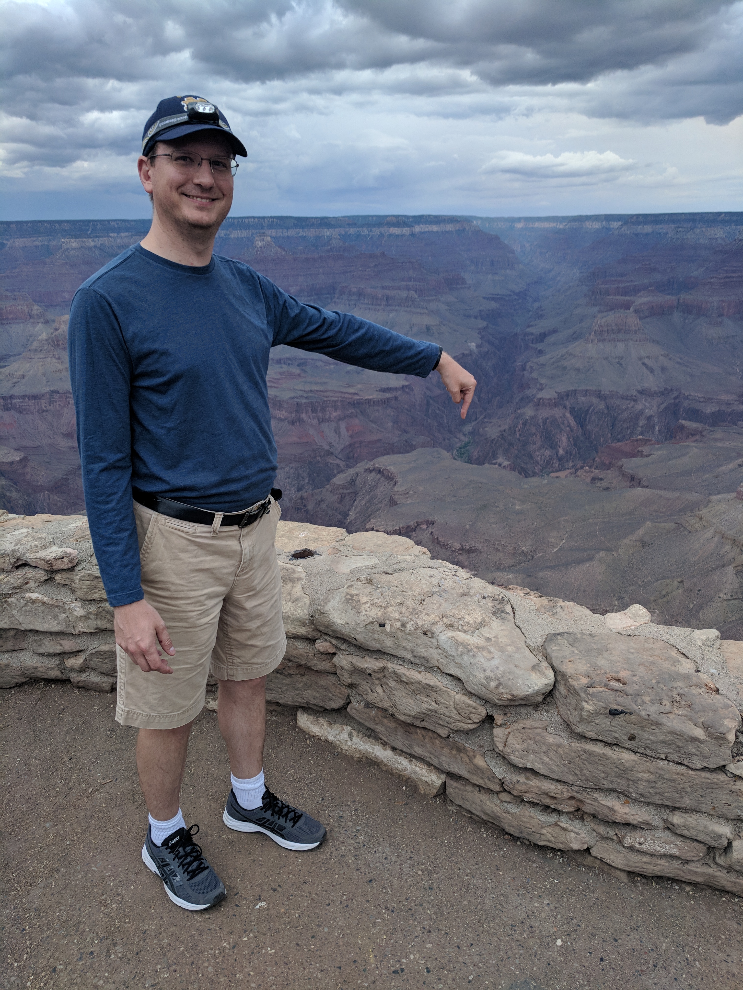
Image 16: Pointing at the Phantom Ranch from the Top |
Great trip, happy to share. I may add another edition to summarize more. But for now, here is where this story ends.
Christopher W. Erwin
Posted: 12/29/2018 15:00CDT
This posts describes my two night stay at the Phantom Ranch. After hiking down the North Kiabab trail, we stayed in the dormatories. I will describe how the ranch works and what I did on my full day around the ranch.
Arriving in the phantom ranch, we immedately went to the Canteen to check in. The Canteen closes an hour before dinner to allow for preparation and re-opens an hour after the second dinner session is over. Because of this, we had to check in at a side window for our meals and room information. We were given a dormatory number and we wend to grab our bunks.
We placed our bags on our bunks and showered. Once clean, we headed to the canteen to get eat. By this time my legs were starting to cramp up quite badly, and I was hobbling with ginger strides. The stew meal was cubed steak potatoes and carrots. It was not good, and the steak cubes were show leather tough. The corn bread was good, and I ate quite a bit of that while choking down the steak and vegetables. Overall, I was less than impressed with my first meal.
After dinner the sun had not set, so Dan and I walked over to a ranger presentation on local wild life in a little benched area referred to as the ampetheater. The presentation was more of a talk with a few prop exhibits. It was interesting at the time, months later I cannot remember it to save my life. We wandered around while the sun set and headed back to the dormatories to go to sleep.
The beds were hard and very hot. With 100% humidity, the cooling units in the ranch, which work great in low humidity were largely ineffective. I laid atop my sheets praying for sleep. When I awoke around 4am as my bunk mates rustled about preparing to leave, I was swam in sweat. I layed in the puddle until they left. Then I decided it was time to get up and wander around.
I wandered around the Ranch until my breakfast appointment. I found this sign near the Canteen.

Image 1: Phantom Ranch Sign |
This was a view of the Canteen front door as we waited for it to open for the second breakfast shift. Once again, the food was nothing to write about. The scrambled eggs were undercooked, bacon manged to be both chewy and overcooked. The pancakes were edible when drenched in the syrup. The sac lunches are handed out after breakfast. Hikers can purchase them if any are available after the second breakfast session. Policies change, so check with the Phantom Ranch before acting on this information.
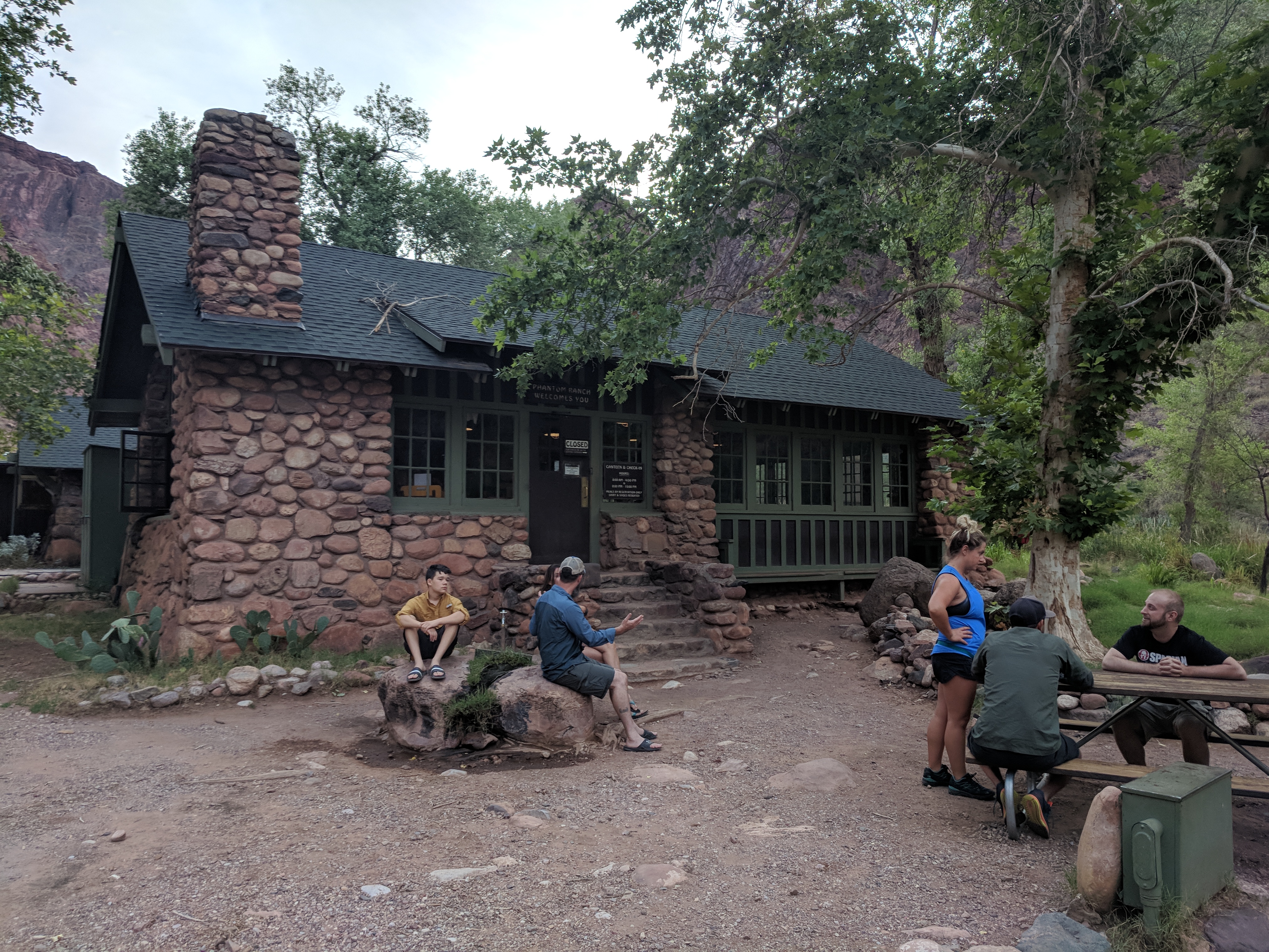
Image 2: The Canteen Front Door |
Fun fact, the park service did not have a picture of the Canteen on their website when I was planning the trip. I posted the picture above to google maps and it had 68,000 views in three months. Since that, the Park Service has added an image of the Canteen to the website.
The image below was taken in the Canteen in afternoon. Teh desk in the rear center is to the left when you enter the door. This is where you can purchase trinkets, food, drinks, maps, and any other supplies they have in stock. You can also place an order to have your bag sent out on a mule here. More on that later.
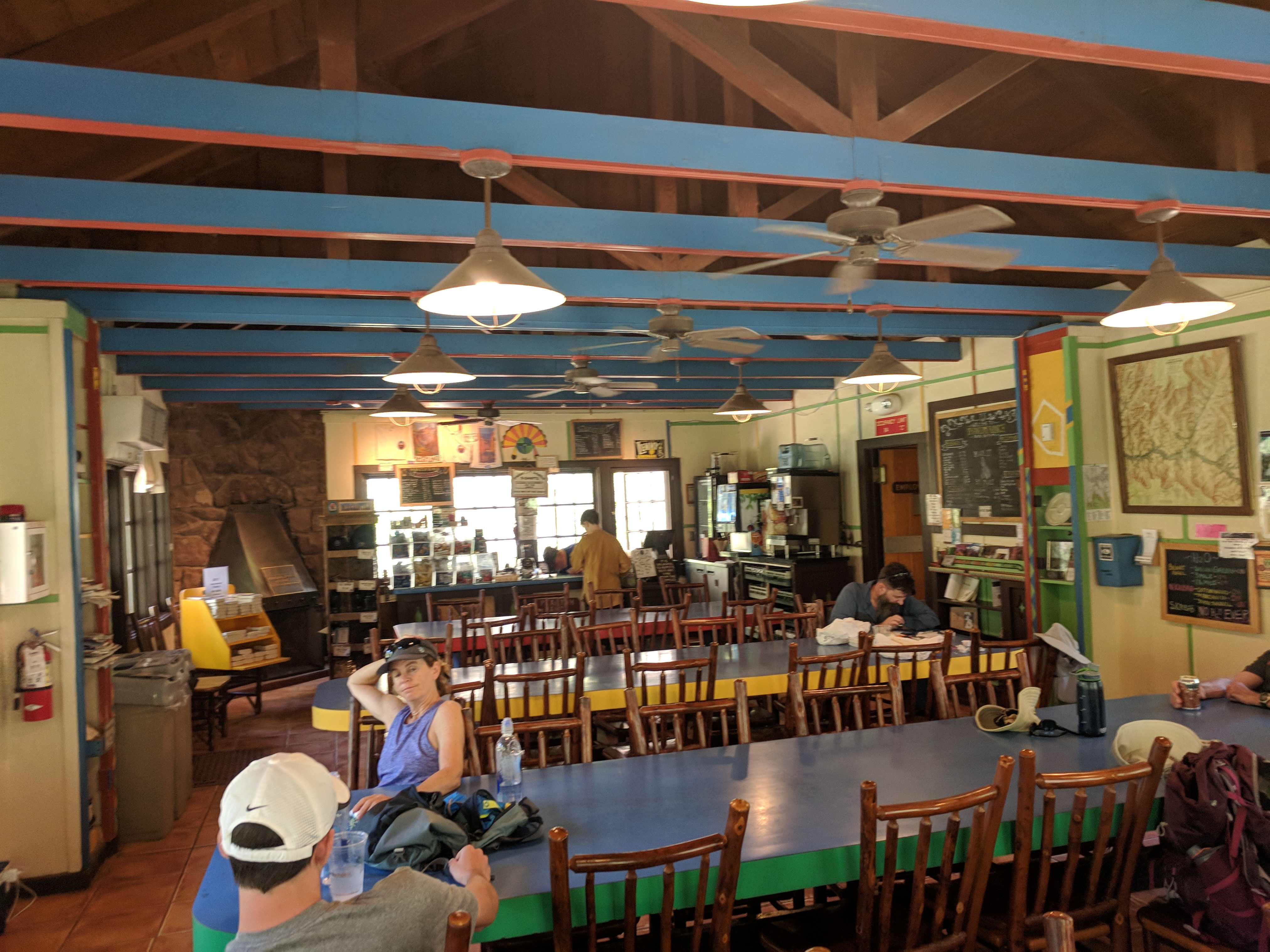
Image 3: Inside the Canteen in the afternoon |
Walking around the camp, there was no phone service in the canyon. Since my main photo taking device was a phone, I did not keep it on for most of the journey. I also had a tablet that I used the GPS on to track my hiking progress and take photos. With no signal, the batterys depleted quickly. The next images were taken during my walk around.
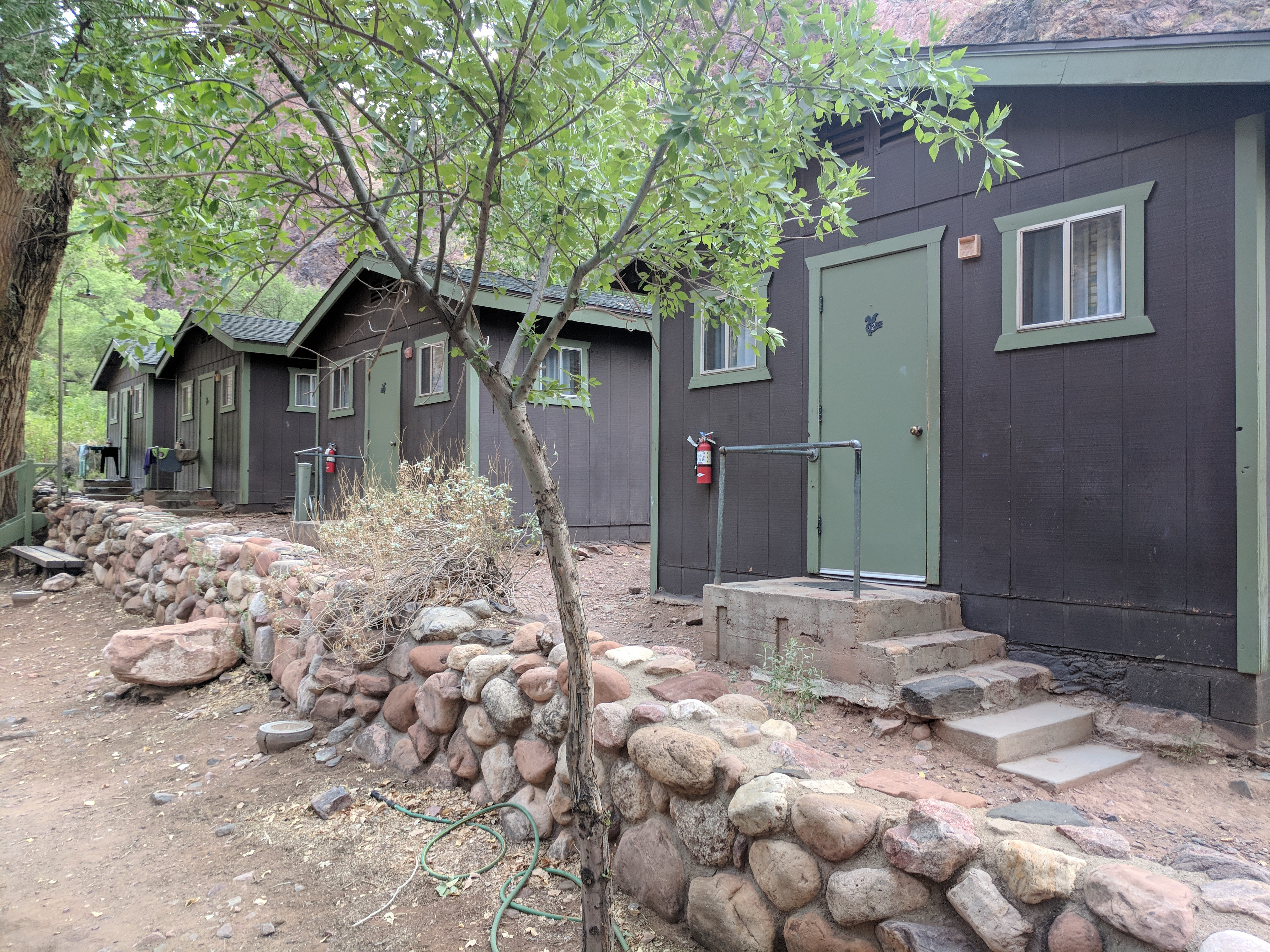
Image 4: Dormatories 1 |
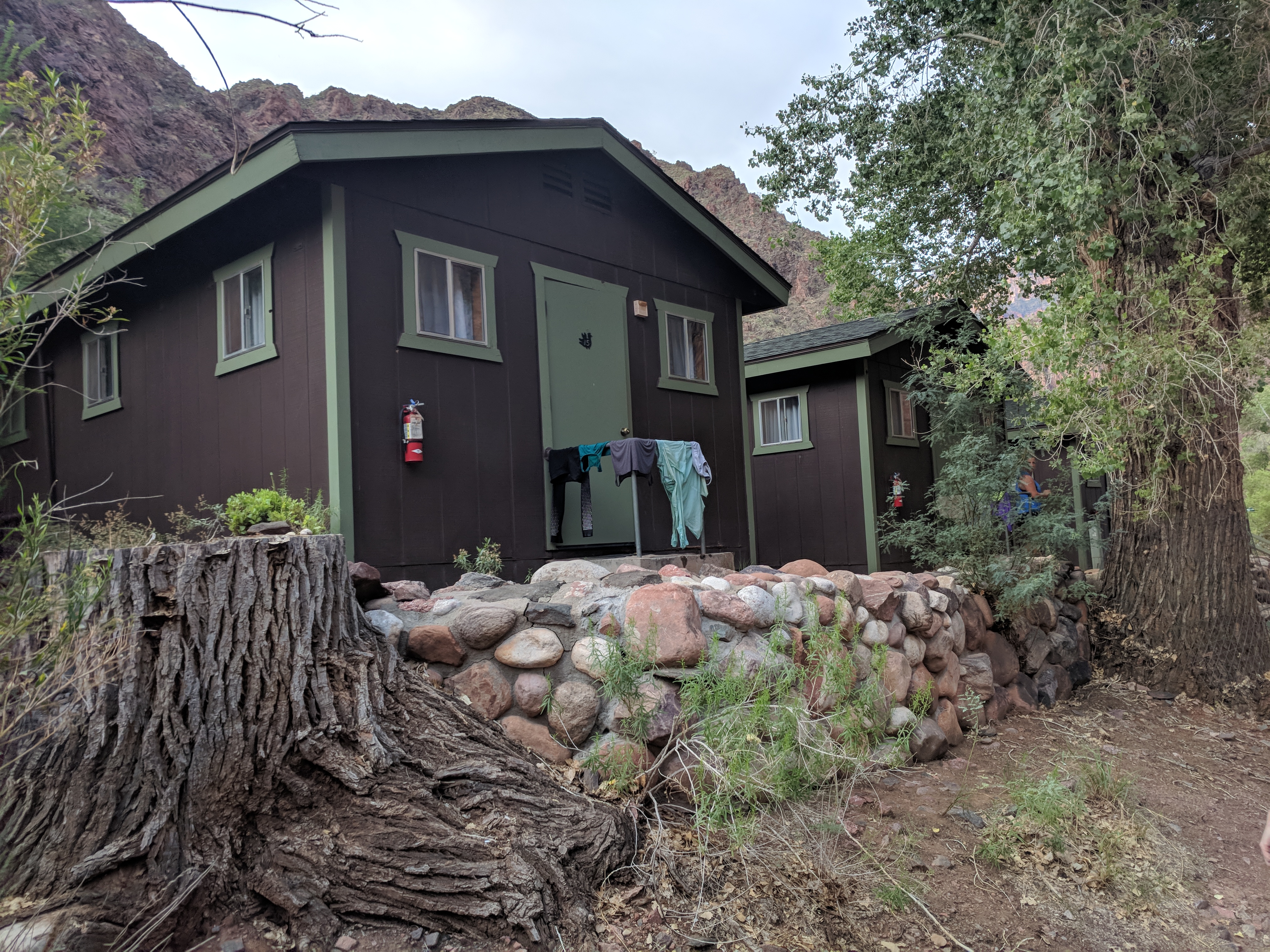
Image 5: Dormatories 2 |
This is where Dan and I watched the Ranger present the previous night. While not the most comfortable benches, after 14 miles, it is a very welcome seat.
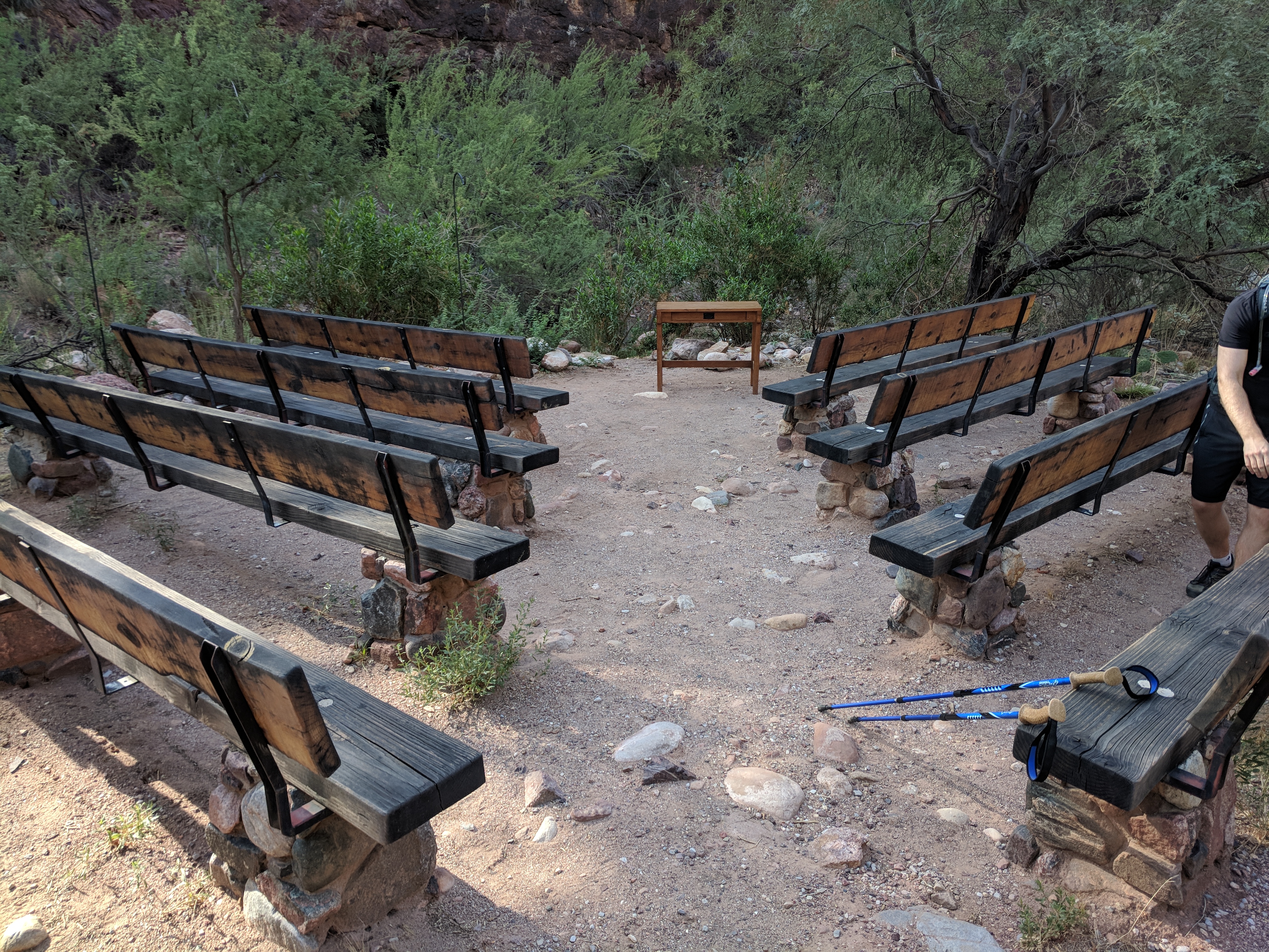
Image 6: Ranger Ampetheater |
Our hiking party headed Continuing walking towards the river through the Bright Angel Campground. There were many encampments setup, so I did not take pictures of these people. There were many people walking from rafts on the river to the Phantom Ranch to get supplies and ice. After passing the campground, the trail splits east west. To the east is the black bridge, the beach on the Colorado River and a water spiget for driking water. To the west is the mule pen and the silver bridge. At this time, I decided to walk the loop across the Silver Bridge, down the river trail and across the Black bridge and back to this split.
The image below is of the Silver Bridge sign before the crossing. It tells the story of the birdge, which was builtto support the water pipe supplying the entire south resort area.
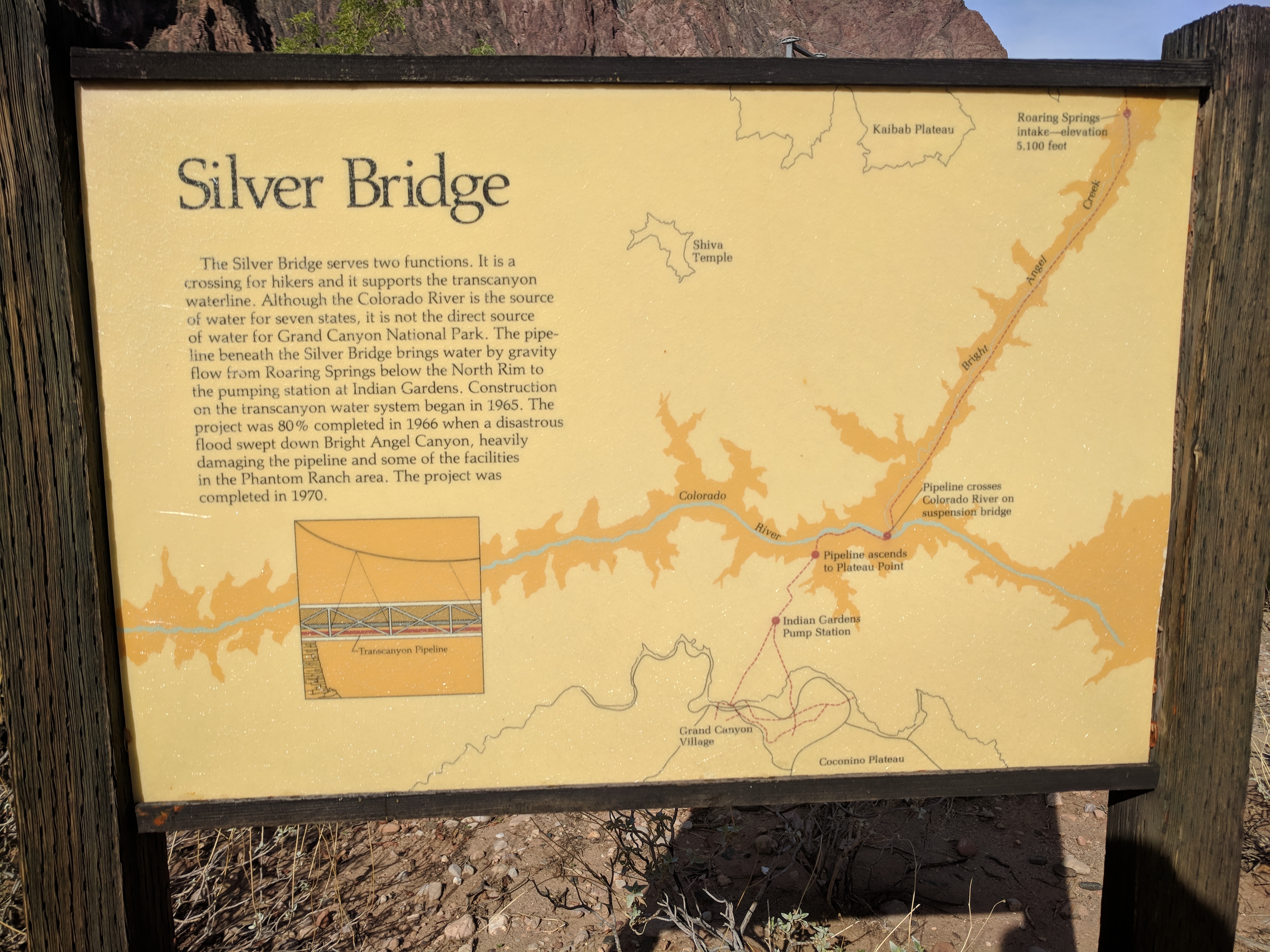
Image 7: Silver Bridge Sign |
The three cool features of this bridge are that is supports the water pipe, shortens the Bright Angel trail hike and does not allow mules to cross.

Image 8: Silver Bridge from North Bank |
The bridge is NOT wide, and should be crossed single file. Wait for others to cross, don't attempt to pass in the mid span. While possible, it is very awkward. I was also able to get the bridge to ocilate veritally and horizontally with some weight shifting. I did not even have to jump to make it wavy.
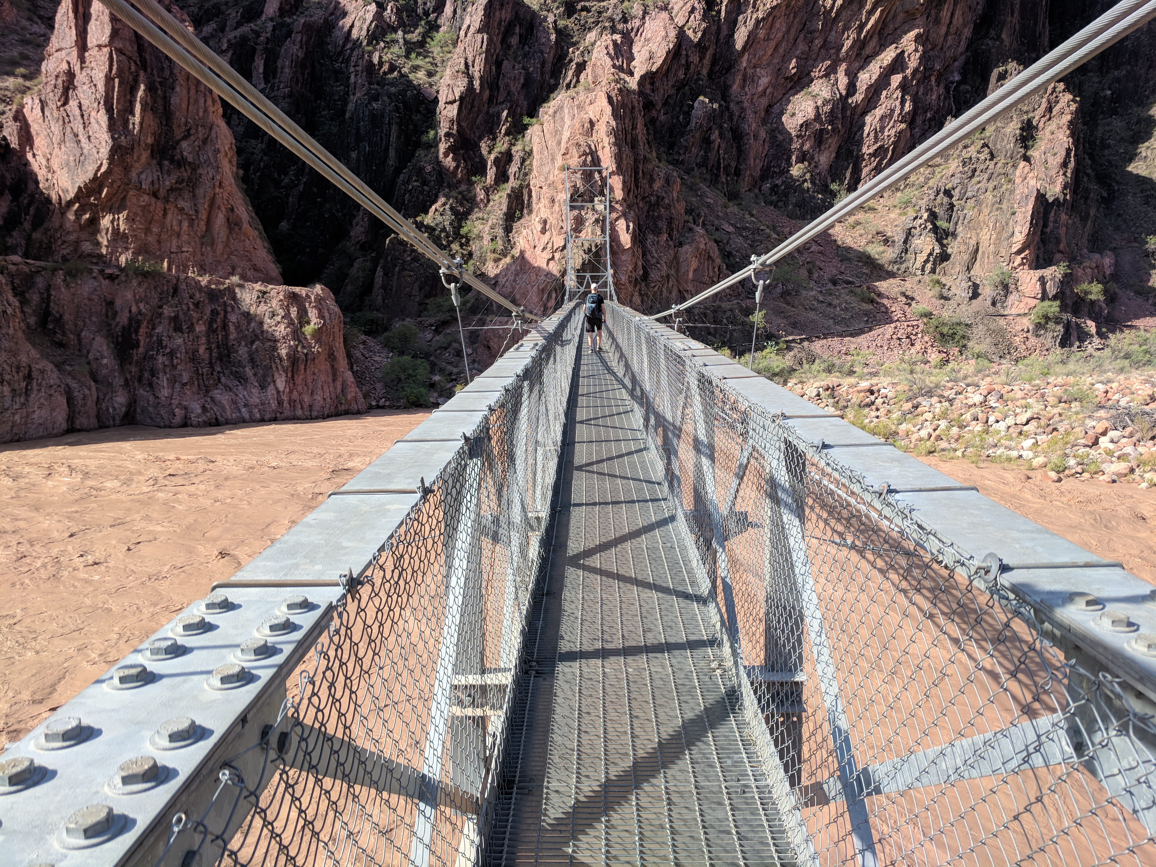
Image 9: Silver Bridge Crossing |
The bridge is a glorious example of a slender suspension bridge. In the image below, you can see the black bridge in the background. Load the image in an new tab to see the higher resolution version, where the Black Bridge is more visible.
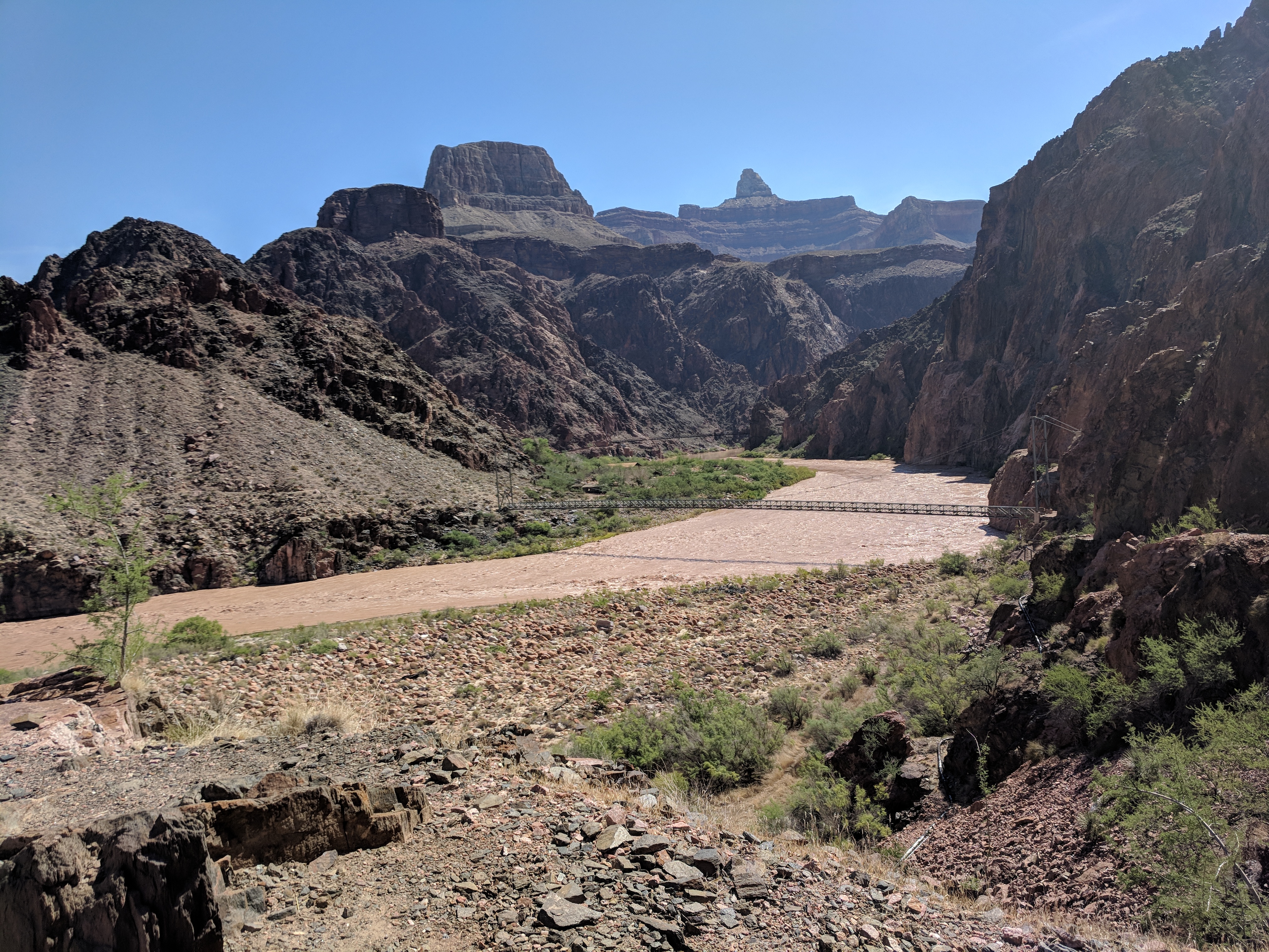
Image 10: Silver Bridge from the South Bank |
Looking down at the river, I can see why the Park Service does not recommend swiming in the river. I am a very good swimmer, but would not want to test that without a vest and a plan.
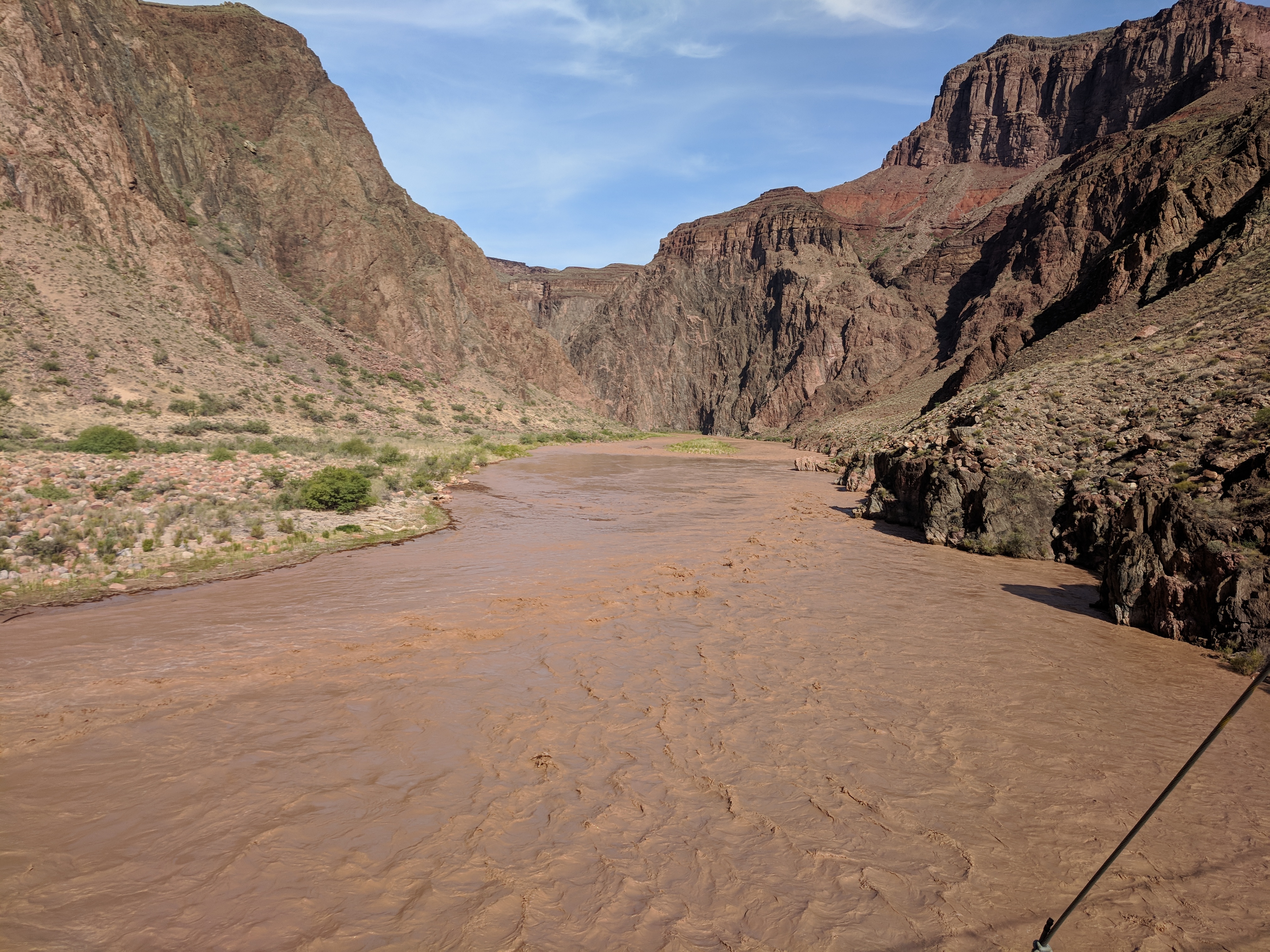
Image 11: Standing on Silver Bridge Looking West |
Walking on the River trail along the south bank, you go up hill about 100ft. From here you get a wonderful view of the South bank. The next few images are of the south bank taken from the River Trail. The stone barn has been there since 1935.
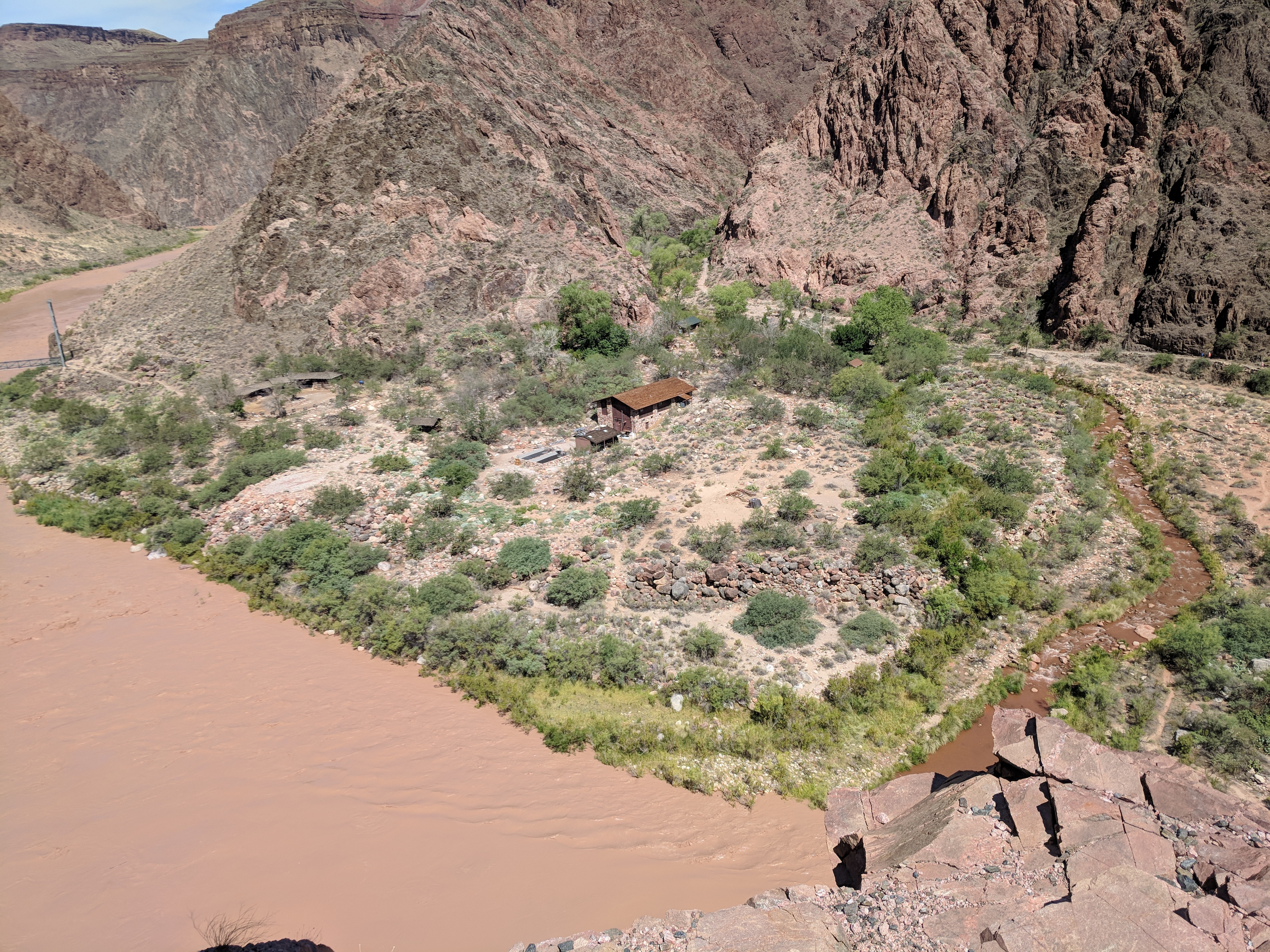
Image 12: River Trail Looking at the Mule Pen |
Rafters are able to stop at the Phantom Ranch via this beach seen below.
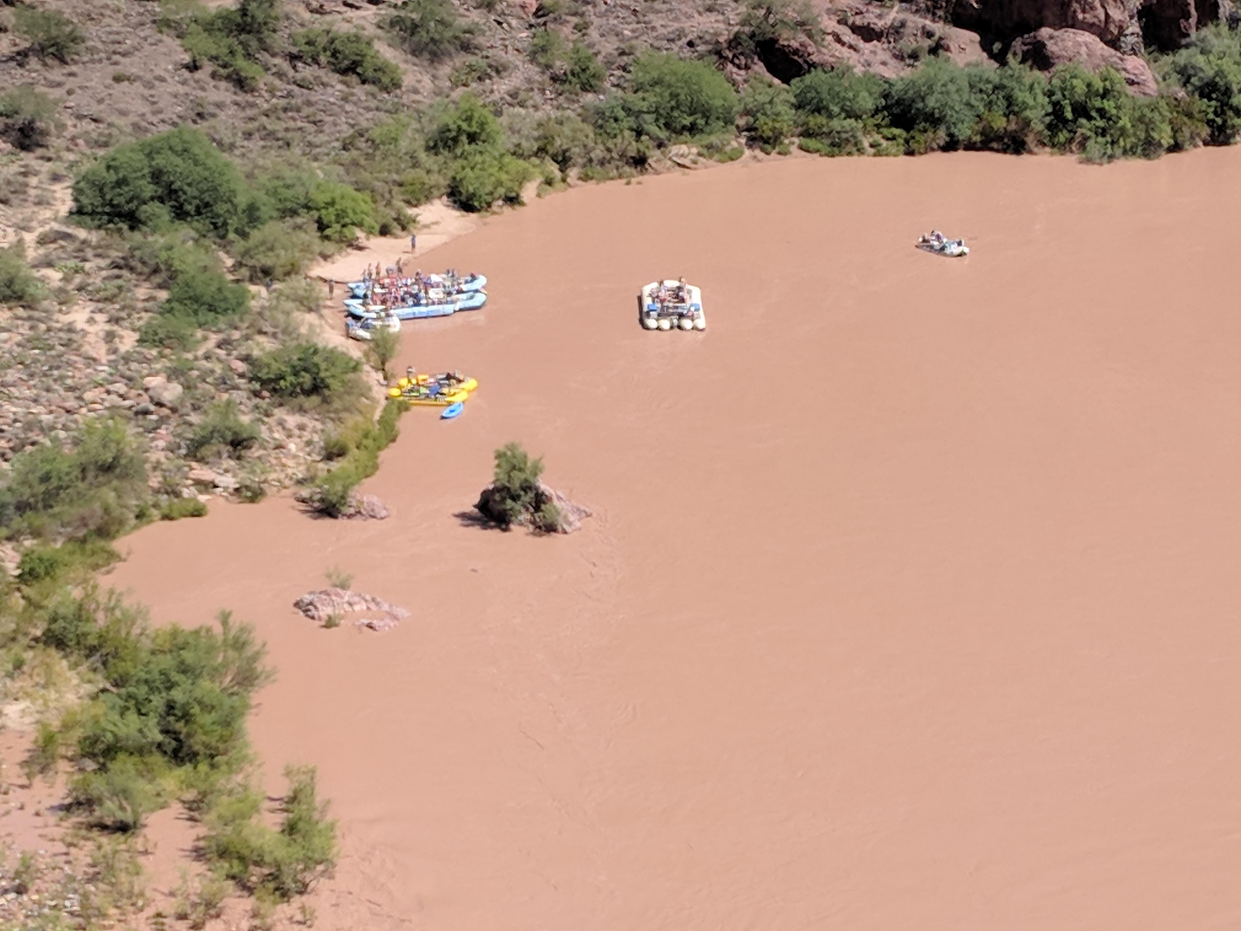
Image 13: River Trail Looking at the Beach |
Rafters pass below the Black Bridge just prior to the beach.
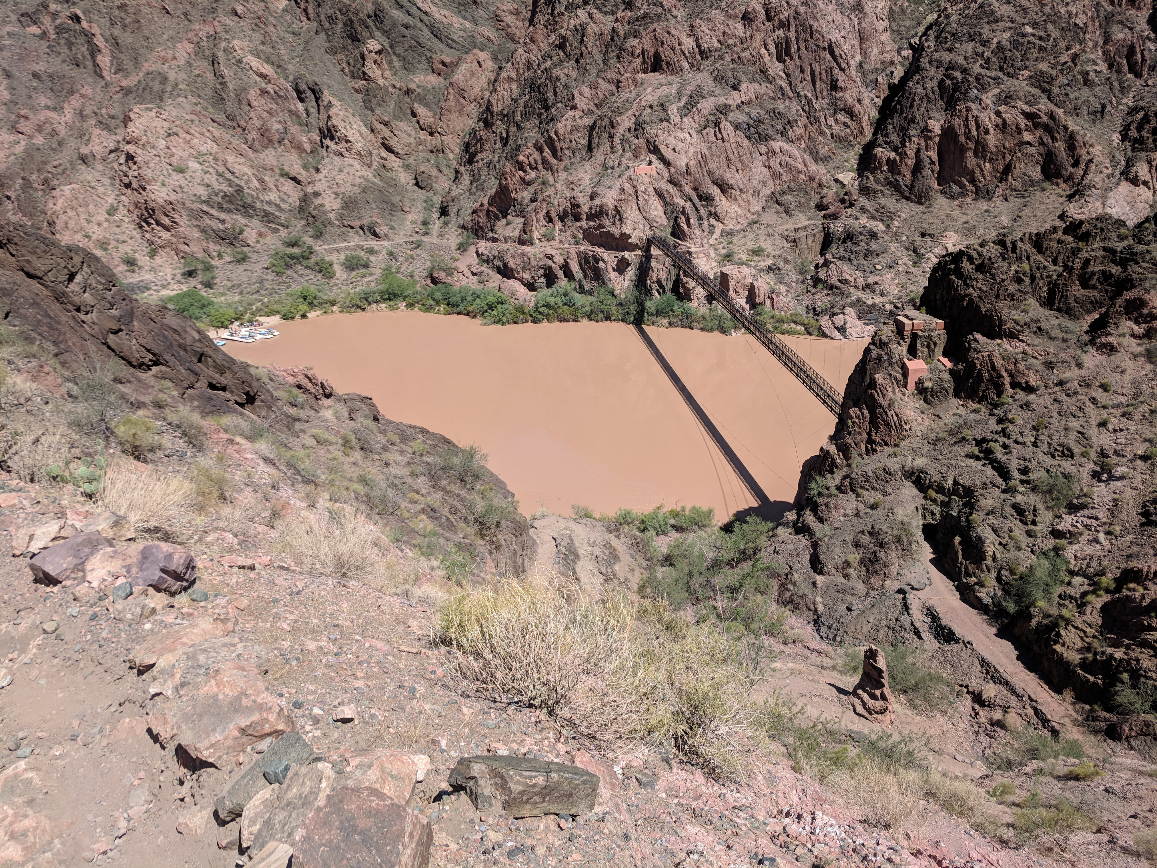
Image 14: River Trail Looking at the Black Bridge |
The river trail merges with the South Kaibab Trail. This is the view looking back up. Fun fact: The South Kaibab Trail is a ridge trail and has very little shade at any time and day and NO water sources along its length.

Image 15: River Trail Looking up the South Kiabab Trail |
To get to the Black Bridge, you pass through this tunnel.
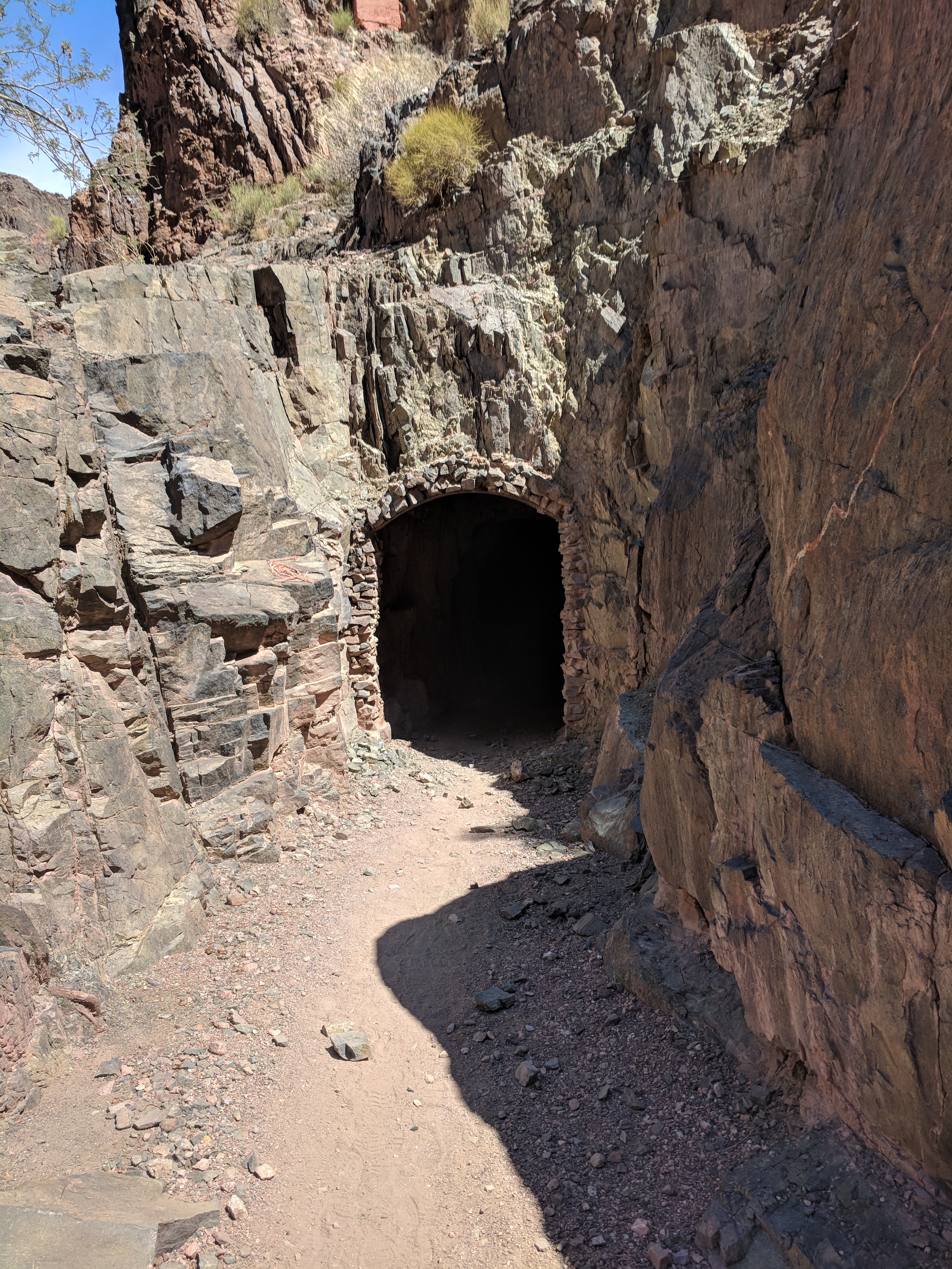
Image 16: South Kaibab Trail Tunnel to Black Bridge |
And emerge directly on the bridge.

Image 17: South Kaibab Tunnel Exit to Black Bridge |
This is another beautiful suspension birdge. This one is more stable, moving much less under my attempts to excite it dynamically. Probably makes sence since the burros traverse this bridge.

Image 18: Black Bridge Looking from North Shore |
Looking up the river, I saw the structures on the north bank and a tower at the bend on the south bank. It gives a good scale of how far this is as that south bank tower is about 8ft tall with a center window. Enlarge teh photo to see this detail.
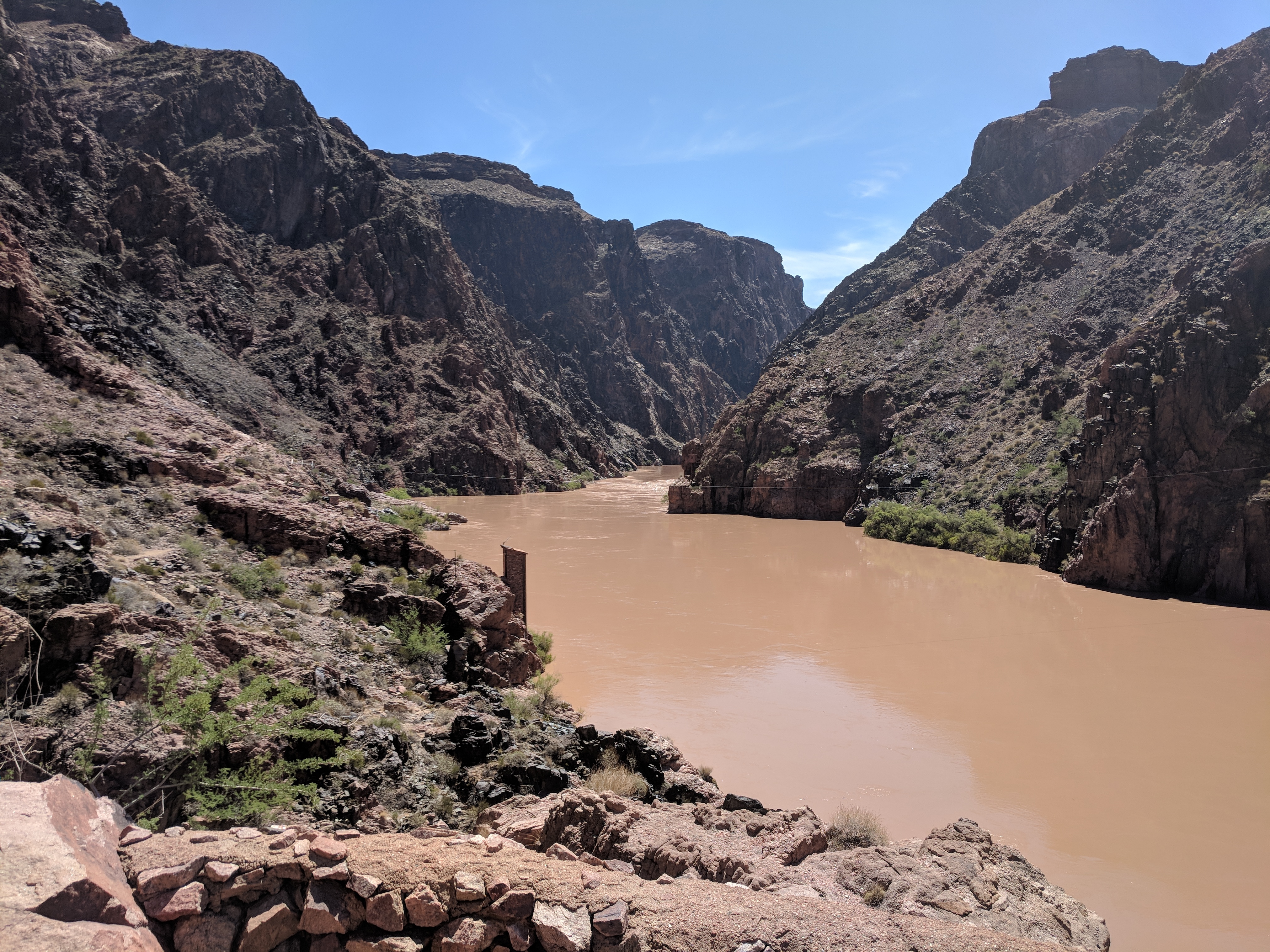
Image 19: Colorado Upstream from the North Bank at Black Bridge |
Back at the beach, I stopped to cool my feet in teh 50°F River water. It stung at first, but then made my legs comfortably numb. I met travelers adventuring on the river. One party was changing riders. Two were to hike out of the canyon while two were hiking down. One of the party staying on the raft decided to run up the trail to meet the two inbound and direct them to the next beach where they would meed up. I don't know how that worked out, but I wished them well and headed back to the canteen.

Image 20: Beach from North Shore near Black Bridge |
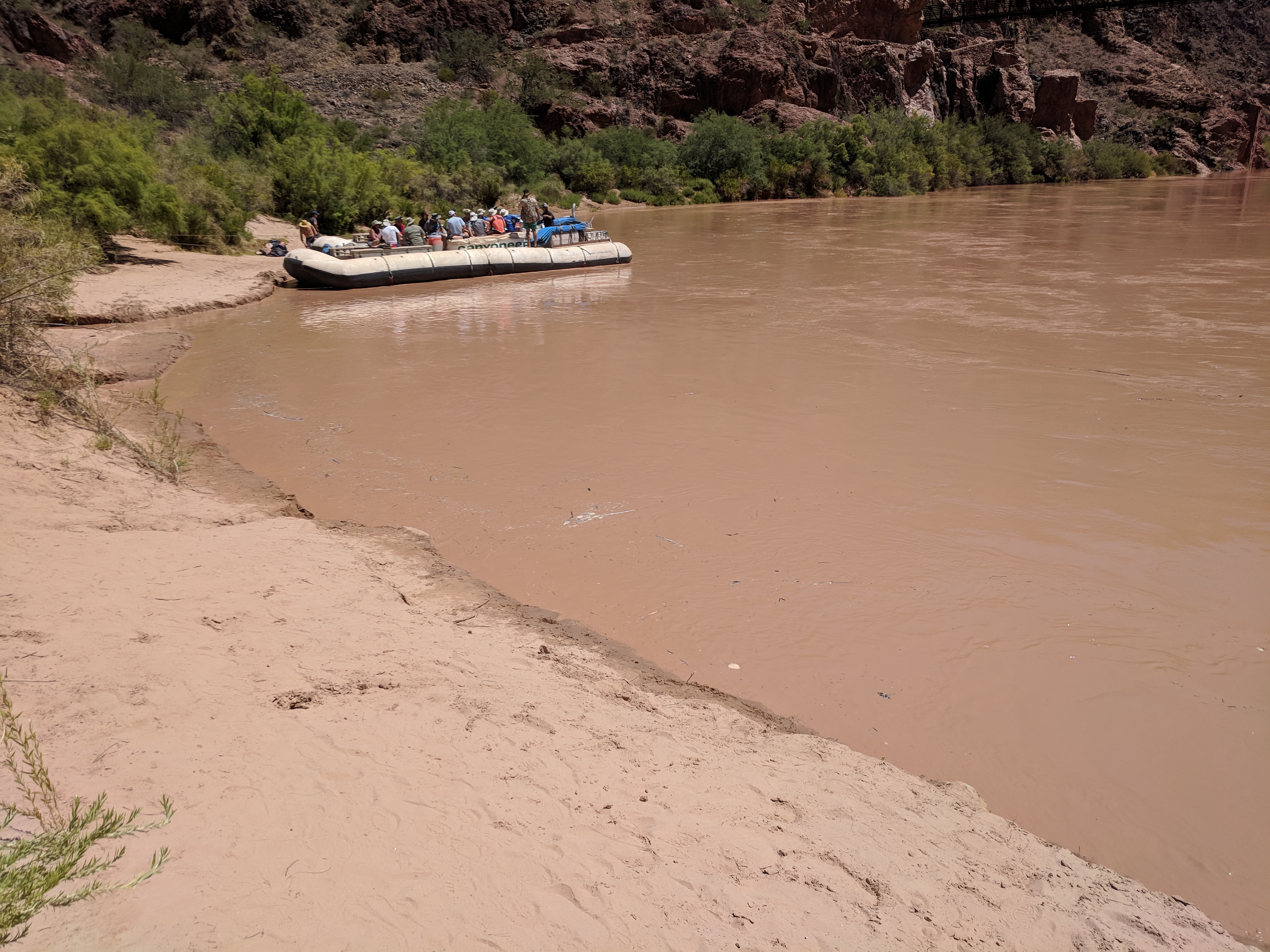
Image 21: Beach at Phantom Ranch |
While walking back, I saw the Ranger Station. I remembered that the Ranger Station has the only compressor driven air conditioner in the Bright Angel Valley. I stopped in to see what they had and to cool down. It is just a small lobby with a table, two chairs and some books. There I found a book about two gentlmen who hiked the entire length of the Tonto Trail. In it they referenced a song that was made up and expanded upon by the gentlemen during their hike. Below are the lyrics they shared with posterity.
Main Body of Message.
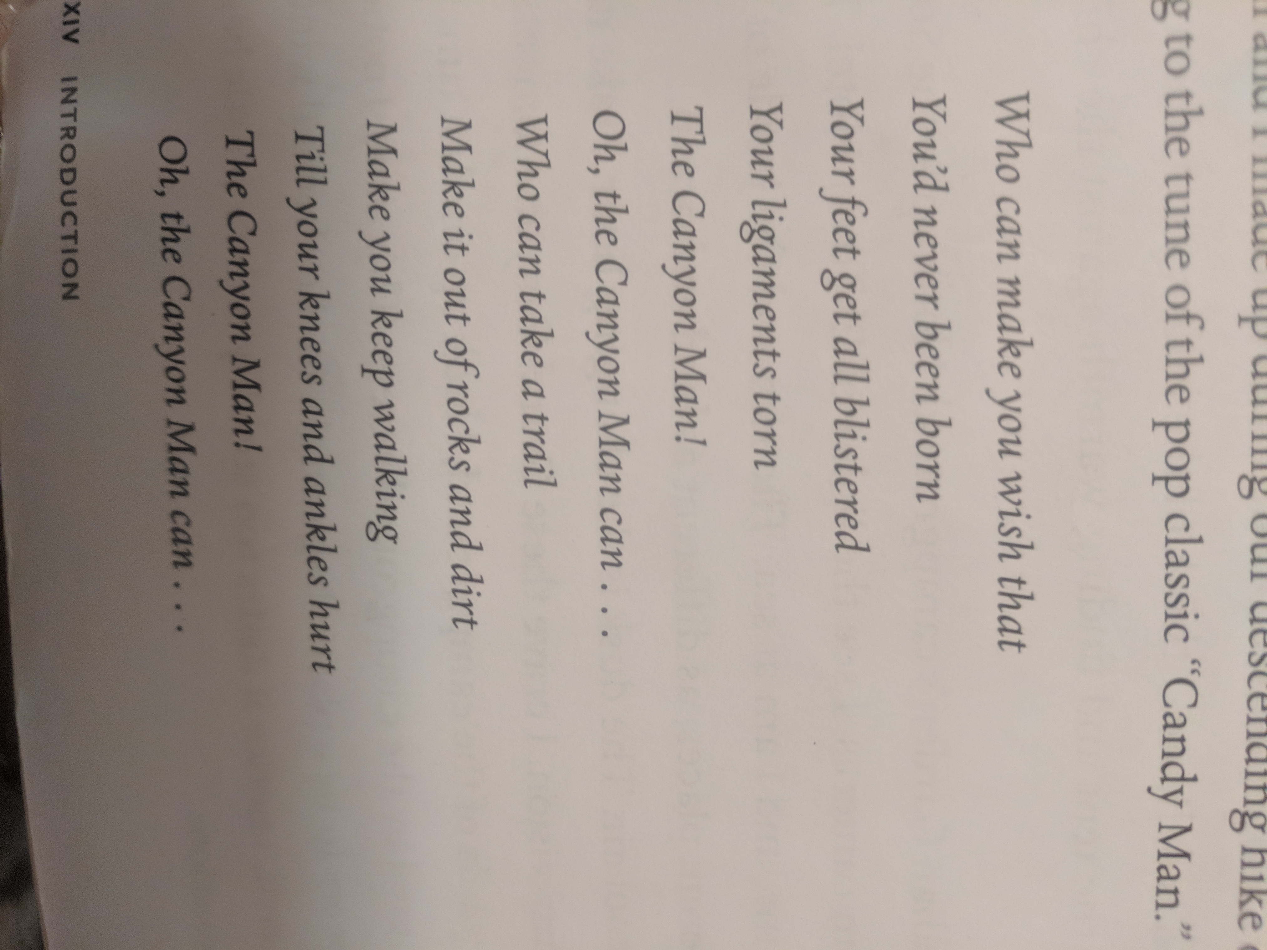
Image 24: Canyon Man Lyrics |
This second day was a day of recovery for me. I spend time explorign the world where the Bright Angel valley met the Colorado River. It was an amazing experience that I could have expanded to allow some other trail hikes. As it was, I survived and would not change the experince.
Christopher W. Erwin
Posted: 12/28/2018 01:45CST
This post describes the North Rim Bright Angel hike down to the Phantom Ranch. If you are contemplating the hike, expand this post and scroll to the end of this post for the final thoughts on the Bright Angel North Trail.
The morning after arriving on the North Rim, we were greeted by chilly weather and a decent breakfast in the Lodge. The food was good, though a bit over priced, which is what I have come to expect from our National Parks System. I enjoyed a hearty breaksfast with plenty of protien before we set out on our hike. It was my chance to have a good meal with my wife and son before we separated for about three days. The next image is of the view we had from our breakfast table.
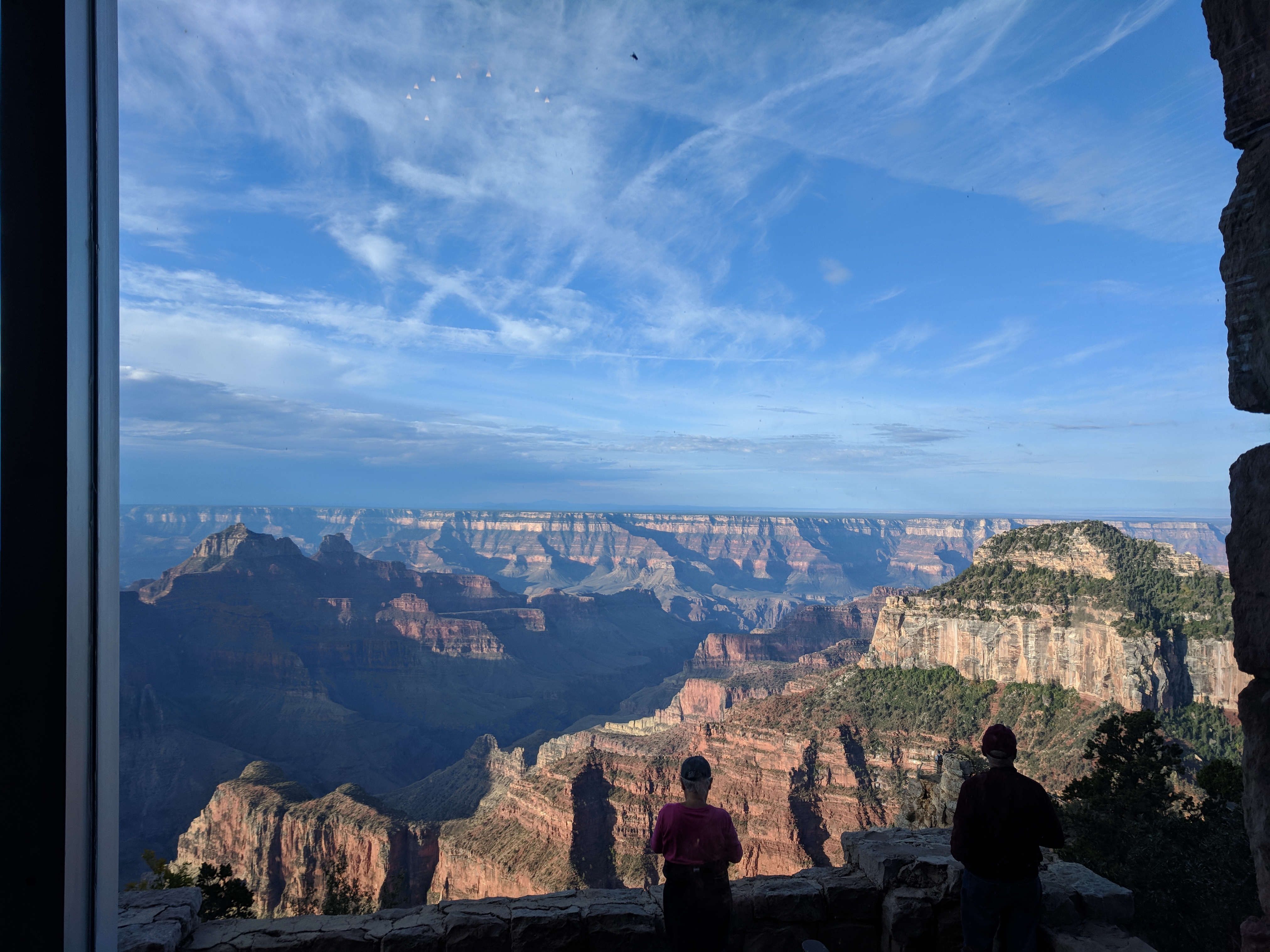
Image 1: North Lodge Morning View |
From the dining room and the lobby, where the picture was taken, you can see most the valley that we will be hiking. The next image is of a picture in the lobby showing approximately where the Phantom Ranch is lcoated in the view.
|
Image 2: The Destination |
With breakfast completed, we met at the North Kaibab Trailhead and bid our loved one's farewell. i hiked with my brother, my sister and her boyfriend (later husband). Below is an image of the optimistic hikers just before we set off. My wife and parents took several picures, before my son photobombed us. We set off at about 8:30am.

Image 3: The Optimitic Hikers |
The North trail is 14 miles according to the park information. Using a conservative 2 miles per hour estimate, we estimated that we should arrive at the Phantom Ranch by 3:00pm. This was important, becasue we had a dinner appointment at 6:30pm. 10 hours seemed like plenty of time as we began our walk down hill.
|
Image 4: Pine Forest |
My sister was driving us at a quick pace as she hoped to visit the Ribbon Falls along the route. The North trail is starts cool and well shaded. Sometimes, the trail will be wet and you will find washouts along the trail. These are repaired seasonally by the park service and all work is completed by hand. Because of one of these washouts, we did not have to deal with mules on the trail. That reduced the noticable smell of urine and poop on the trail.
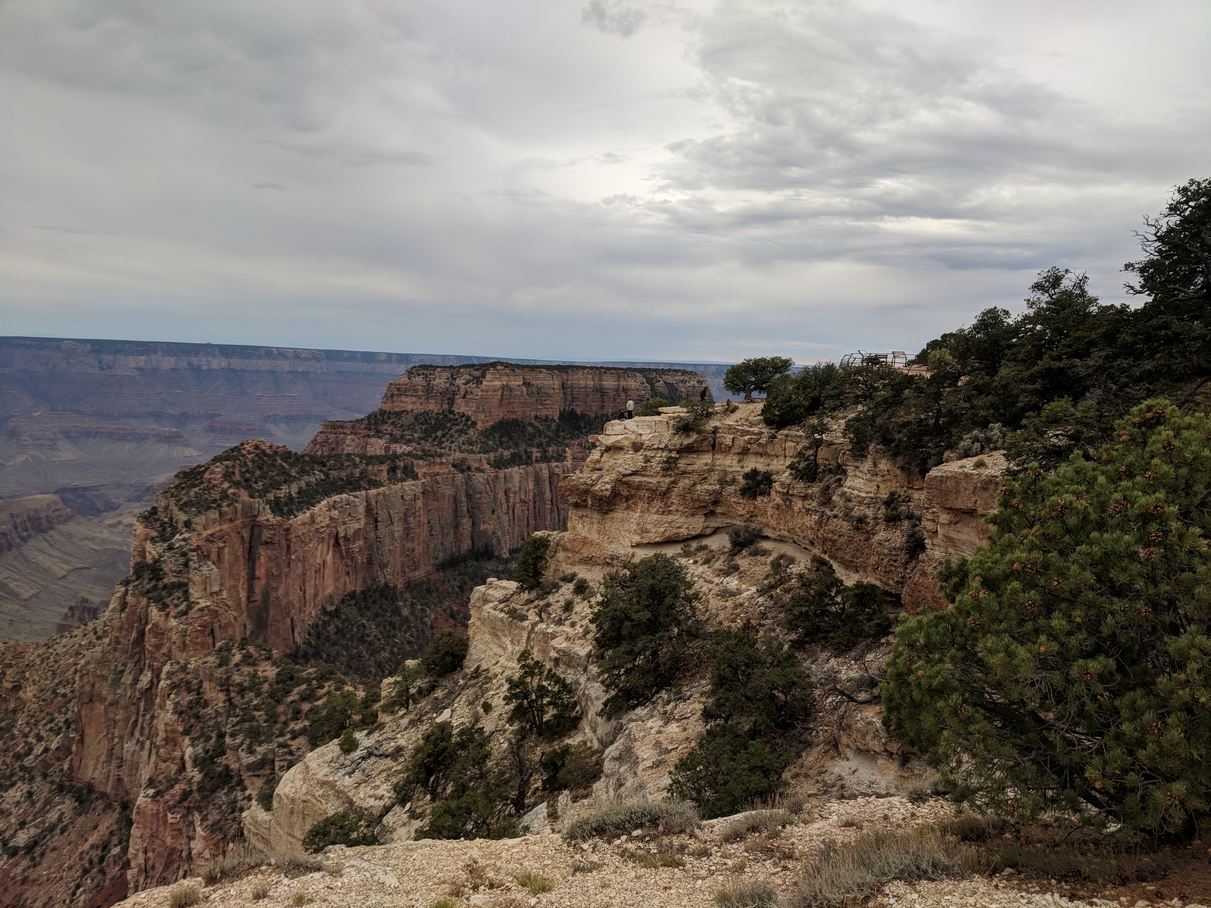
Image 5: Climate Transition |
As we continued down the trail, temperatures increased and the foliage became more arid. As we approached the Roaring Springs, we stopped and topped off our water bottles. I highly recommend doing this to anyone attempting this hike. This is the last water source on the trail that you do not have to filter and treat before you drink. The Roaring Springs in a natural spring that provides all the daily water needs of the South Rim resort. The Cottonwood Capmpground water was not working this summer.
While on the trail, you will cross paths with many people. People going in the opposite direction will be a simple greeting, but those traveling in the same direction become conversants. A simple one sentence at a time conversation that goes on as we overtake eachother at the other's rest stop.
It was at the Roaring springs, that we met our first such group. Three men ran past us up trail as we were in our first three miles. When we got to the springs, we ahd a conversation and found out that they had been running acorss the canyon all night. Through the dark, they had run the entire Kaibab trail and were not running back. That is the equivalent distance of 2 marathons AND four vertical miles. Just setting off with three days to do 30 miles, and we felt like underachievers.
Just beofre the story, I noted the shift from temperate to arid. This following image shows the different climates in the same image. In the foreground is the temerate pine forest, with the arid desert in the background. After the spring, we were firmly in the arid zone with the majority of the plant life in the bottom of the valley along the river. We continued on from Roaring Springs after a 15 minute break. The time was just after 10:00am.
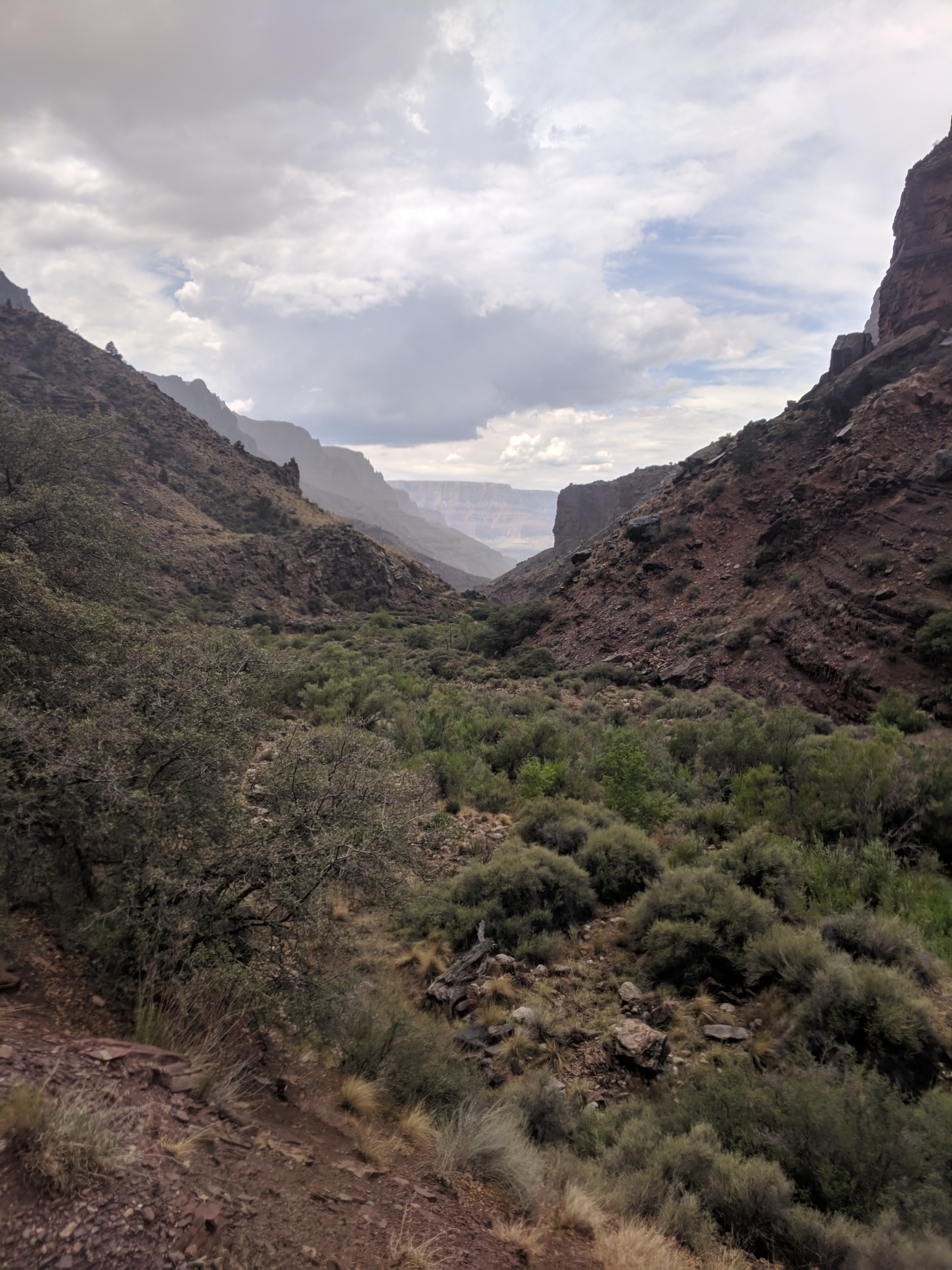
Image 6: It's Getting Dryer! |
The temperature was getting hotter and the as we approached the Manzanita Creek. The trail was also becoming more and more rugged. Thick neddled cactus plants lined the path edges as a reminder to stay vigilant and on the path. The sun continued was rising overhead, increasing the heat of the day. At this point, I was sweating profusely and drinking my water steadily.
Soon we arrived at a rickety bridge witha Sign indicating the Ribbon Falls were this way. A 1.5 mile hike lead up a side valley to the ribbon falls. I stopped near a tree for shade and left the other hikers to go and visit. I snapped the one image below as I waited and tried to let my body cool off.
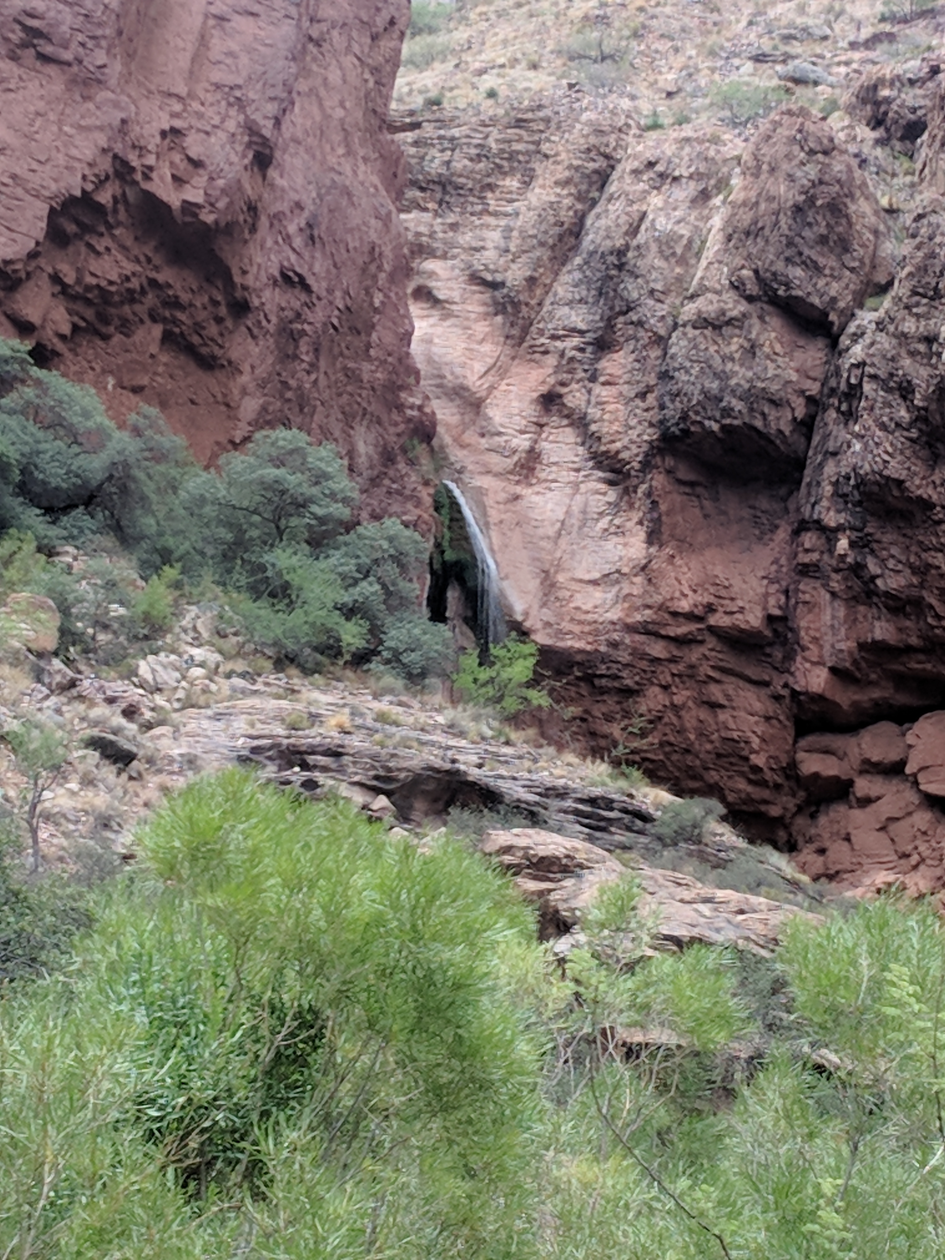
Image 7: Ribbom Falls |
From the Ribbon Falls on, there was no shade. There was no water, and the creek was inaccesible until we reached The Box. The valley was hot; humidity was high; there was no breeze; and there was not shade. About 3 miles after the Ribbon Falls Trail, the canyon walls became more and more vertical. At the hottest part of the day, we were entering the Box. The trail was a chizzled path in the rock. Sitting temptingly 6ft below the trail, was a flowing torrent of 56 degree water, which was completely inaccessible.
The Box is a miserable experince, made worse by the fact that we were walkign through it between 2:00pm and 4:00pm. It wound on with about six bridges, despite the map only showing three. Hot and miserable was the entire experince and my pace slowed to less than 1 mile per hour. I also ran out of water.
At one point, dizzy and fatigues, I shimmied down a boulder and dropped a hose into the river to filter myself some water. I managed to extract pint, which I swiftly drank up. Two pints later, I continued on the journey with my brother, as my sister and beau continued hoping to get to the Phantom Ranch before dinner. Two bends later, we passed a location where other hikers were able to climb into the river and take a cooking dip. We did not join them as we thought dinner was still a possibility.
But then the canyon tops began to open and we could see more sky. Lush brush filled the area around the trail. Still hot and miserable, we pushed on around the final bend below:
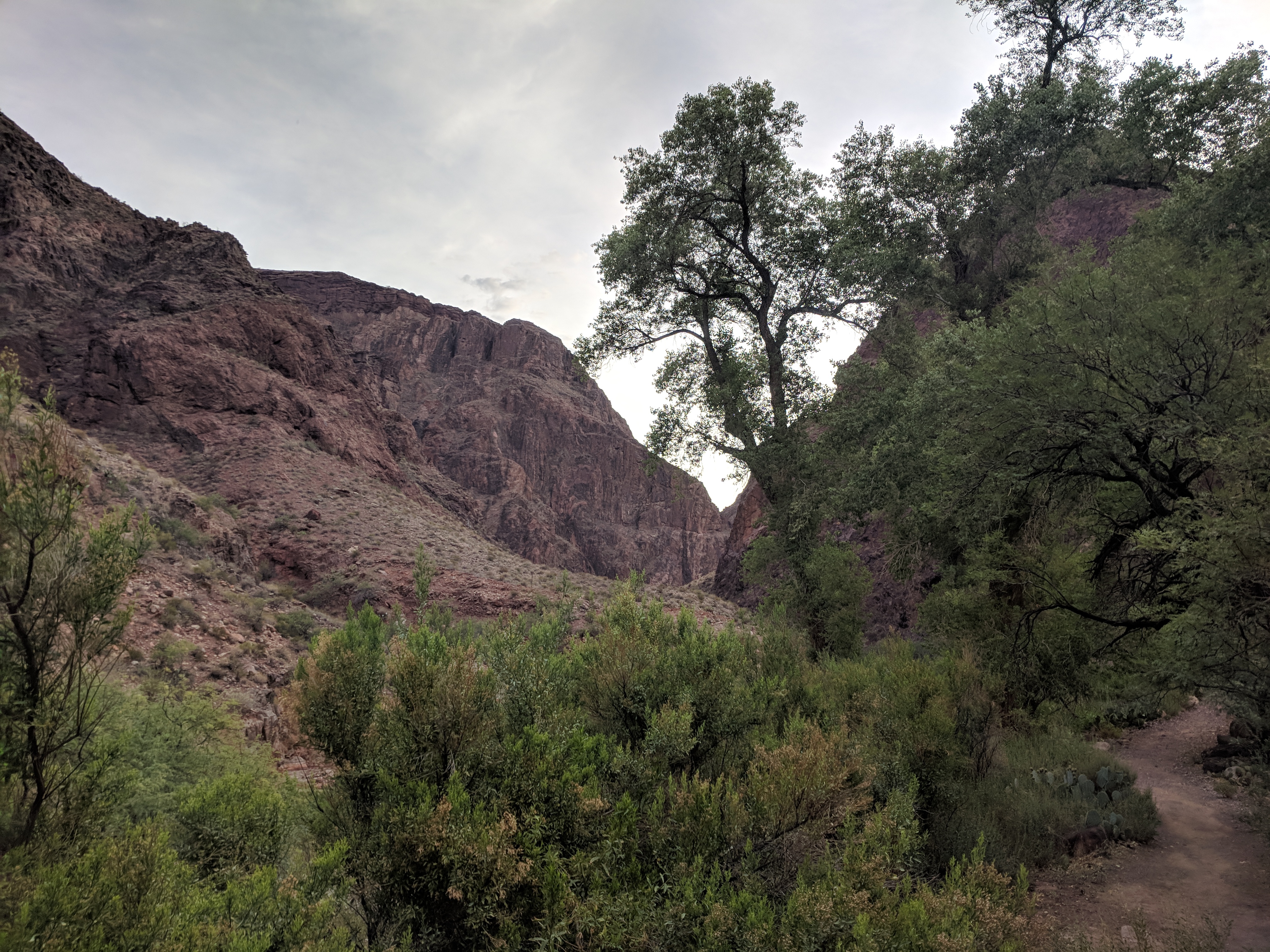
Image 8: Last Bend before Phantom Ranch |
At 5:00, we walked upto this sign:
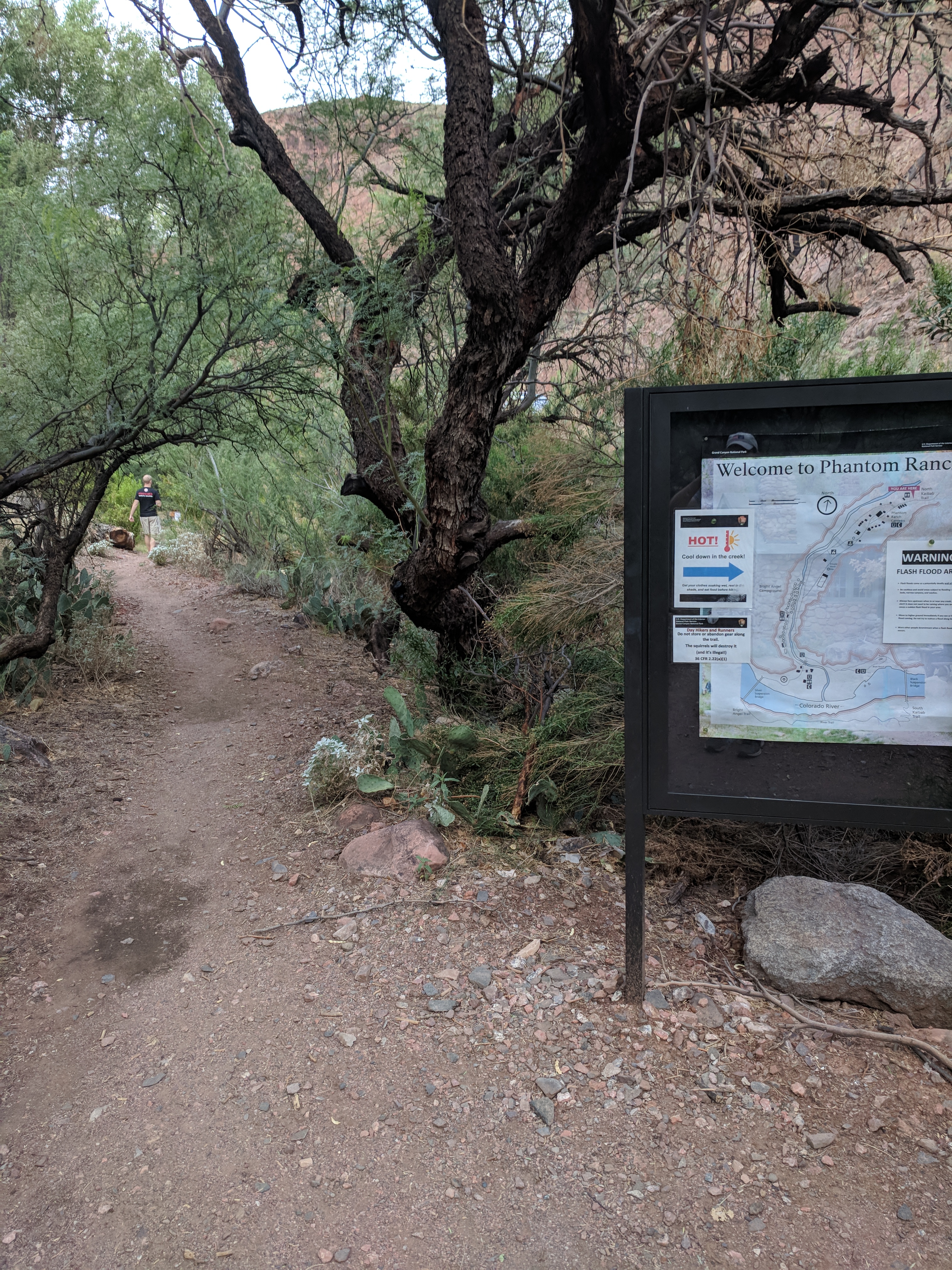
Image 9: The most welcome welcome sign! |

Image 10: Welcome Sign in Detail. |
We had 90 minuts before dinner, so we headed in to get the lay of the land. Once we checked in and verified where dinner was served, we took a quick dip in the creek to cool off.
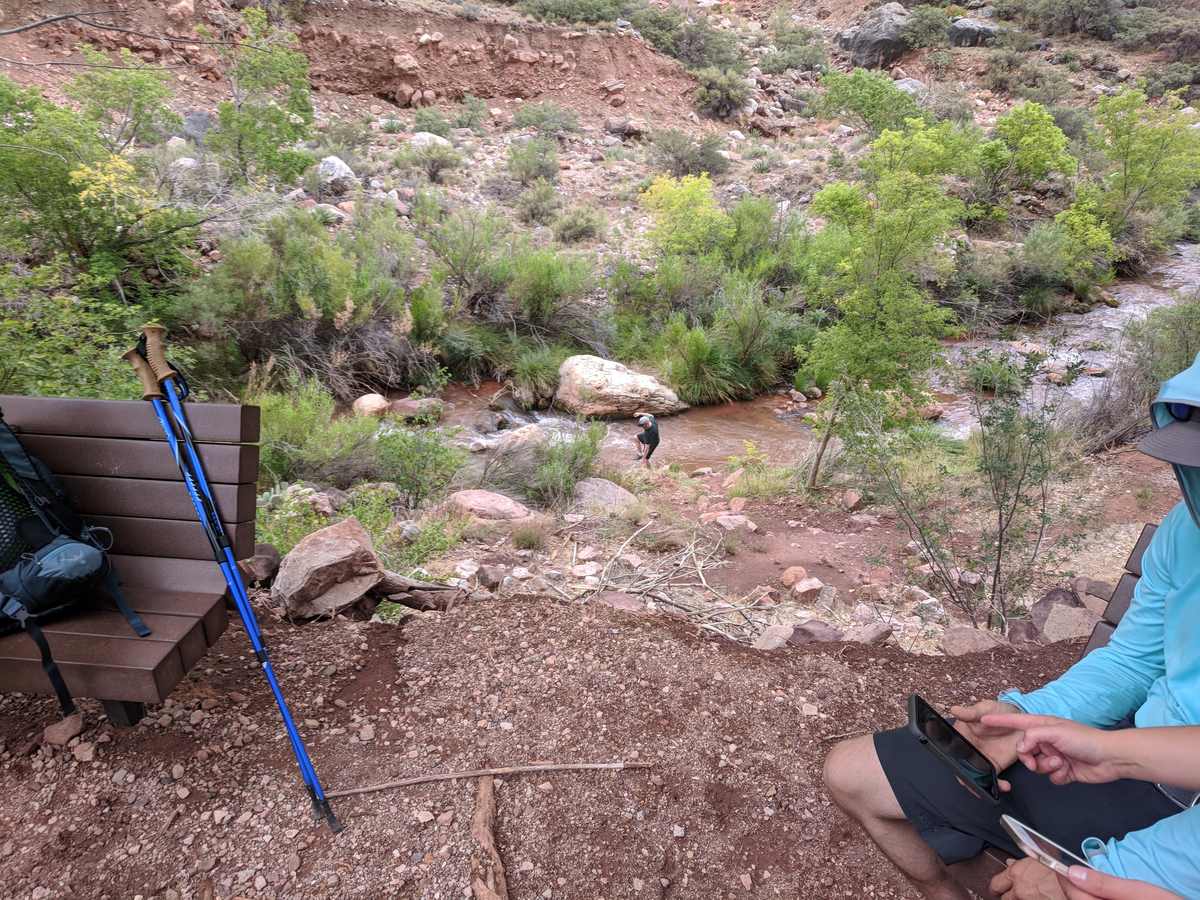
Image 11: Taking a Dip in the Creek. |
My legs were sore, I was walking with tiny steps and my legs burned when I strided further than a hobble. My step counter said I had done 23,000 steps, and my two GPS units disagreed with 16.5 and 18.2 miles respectively for the estimated distance. I hobbled around for the next 24 hours. I had no issues with my socks, shoes or any clothing. My issues was waiting for lactic acid to get out of my leg muscles and rehydrating after the ordeal.
1. Don't get caught in The Box in the middle of the day. Start earlier and keep up the pace; or start later and skip the dinner.
2. Bring 1 gallon of water per person.
3. Stretch when you are resting to help reduce lactic acid.
4. Travel at your own pace. Don't let others rush you long.
Christopher W. Erwin
Posted: 12/27/2018 11:45CST
This post describes the beginning of the trip and covers the locations visited on the North Rim portion of the excursion through the Grand Canyon. The drive from Las Vegas and the sites to see on the North Rim. The hike in and through the canyon will be in the next post.
For the cheapest flights form most places in the country, I recommend traveling to one of the most cost competetive airports in the country. McCarran International Airport in Las Vegas, NV provided our kicking off point. Can you hear the "Vivaaaaa Las Vegas"?
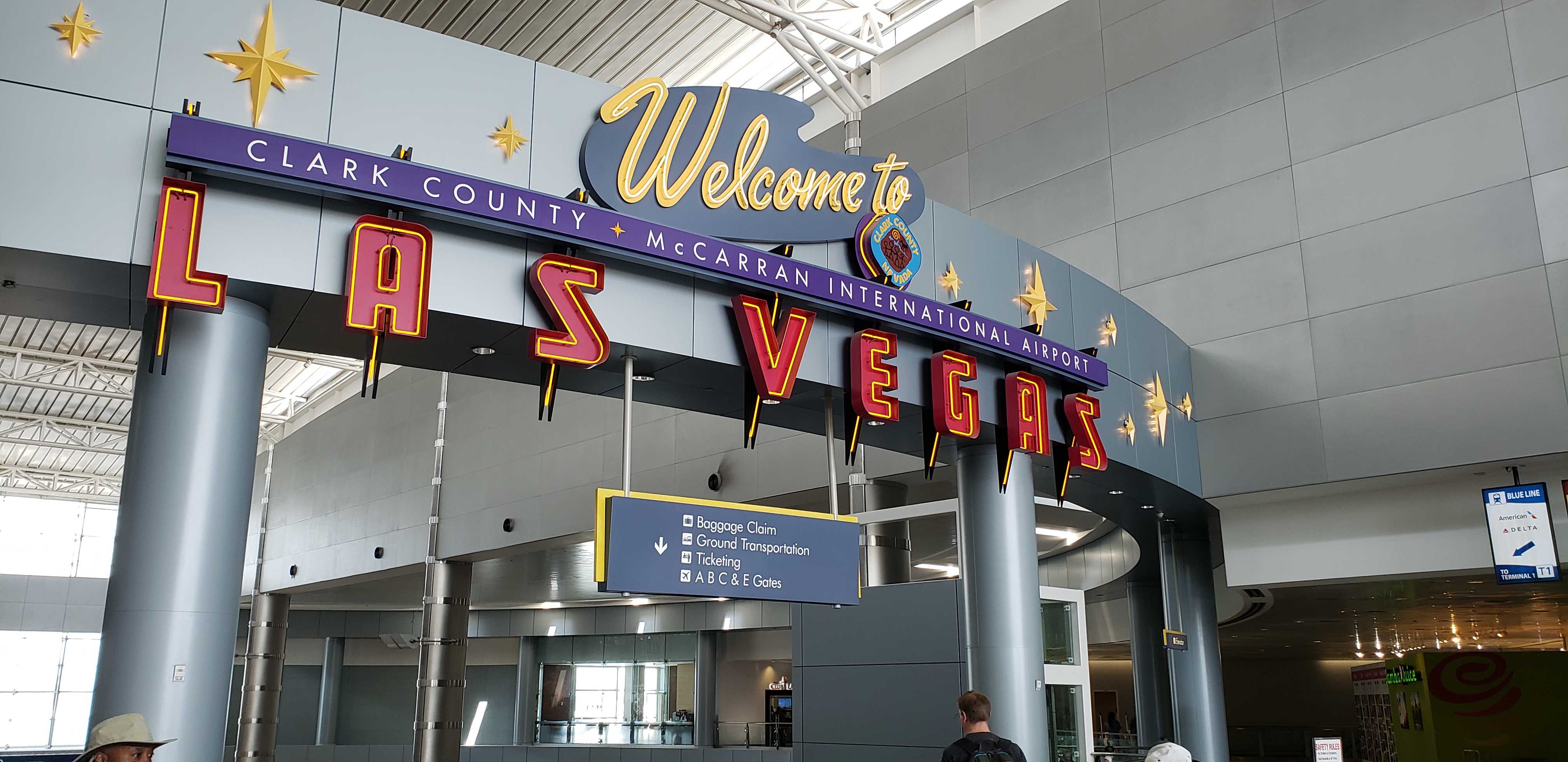
Image 1: Viva! Las Vegas |
McCarran also has a large selection of rental companies to choose from and a huge selection of cars. I selected a Ford Expedition for this trip, because I was bringing six people. We set out from Vegas on I-15 North, towards Salt Lake City. As you leave Las Vegas, the climbing to the top of the Colorado Plateau begins almost immediately. The views will be of an arid landscape with high ridge lines as you travel up the Virgin River Valley. This will remain the case until you enter the Virgin River Gorge. Emerging on the east side, you will be minutes from Utah.

Image 2: Driving to the North Rim |
In Utah, you will have your last chance to get supplies without the National Park markup. We stopped at the Walmart Supercenter in Hurricane, UT. We also filled up the SUV as this would be the cheapest gas for the next 400 miles. As we left Hurricane, we continued to climb to the top of the Kaibab Plateau. This formation is the gentle ridge at the top of the Colorado Plateau. The road was a two lane road with almost no traffic. And yet, I found myself being passed at 70mph. As we climbed, the scenery became less as less arid. From Fredonia to Jacob Lake, we completed the transition from arid landscape to a pine coniferous forest. Traveling south from Jacob Lake on the Grand Canyon Highway, we encountered misty fog covered forests.

Image 3: North Kaibab Forest |
We continued to climb until we reached the high point near the Kaibab Lodge. From there a gentle descent to the North Rim Lodge. The North Rim Lodge is located on the Bright Angel Plateau near Bright Angel Point. The roads snakes along the west side of the plateau offering stunning views of the Roaring Springs Canyon from the Car. When you arrive at the parking lot, you need only walk to the path on the west side of the lot to see your first view of the Grand Canyon.
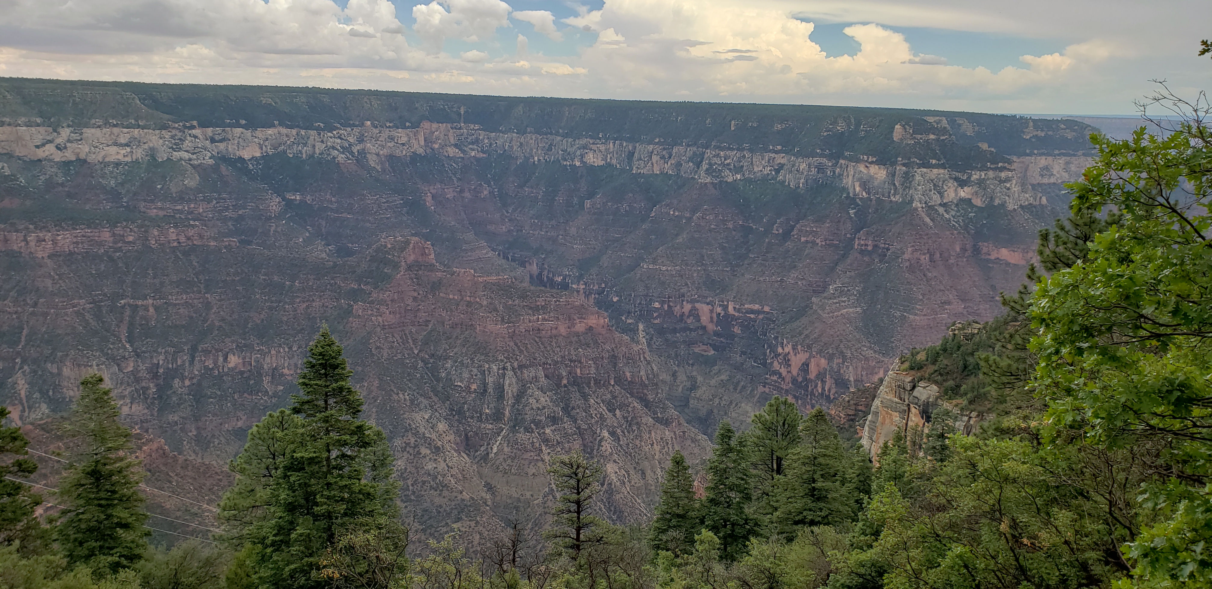
Image 4: North Rim Lodge Parking Lot Overlook |
This was my son's first view of the Grand Canyon, and he approved. He did not know that this was only a tiny branch canyon off the Bright Angel Canyon. A better view is to come at Bright Angel Point, further down the post. Note the hood is up as it was quite cold in July, about 55°F.

Image 5: Gabriel Approves |
We checked into the North Rim Lodge, which is a series of cabins that can sleep up to four, though that is on bunk beds and a single double bed. The couch, with my lovely wife sitting on it, is not suitable for sleeping, unless the floor sounds like a good option to you.

Image 6: Inside North Rim Cabin (Futon) |
The cabins are split in two with the bathroom in the center and each side having a sink. This was good, as the doors could be closed allowing Grandma and Gabriel to sleep without hearing me snoring.

Image 7: Inside North Rim Cabin (Bathroom & Crossover) |
Gabriel claimed the top bunk. If I had it to do again, I would have gotten another cabin. The price is very high for such sparse accommodations, but the views are second to none.

Image 8: Inside North Rim Cabin (Bunk Beds - Gabriel Approved) |
After moving the bags, we walked out to Bright Angel Point. The view below if of the Bright Angel Canyon, which four of us were to hike down the next day. It doesn't look so bad from here.

Image 9: Bright Angel Canyon |
A confident Dan showing off the path of our future travel. Yeah, I don't have a copy with his eyes open. That far cliff is about 1800ft lower and about 25 miles as the crow flies from where the picture was taken.
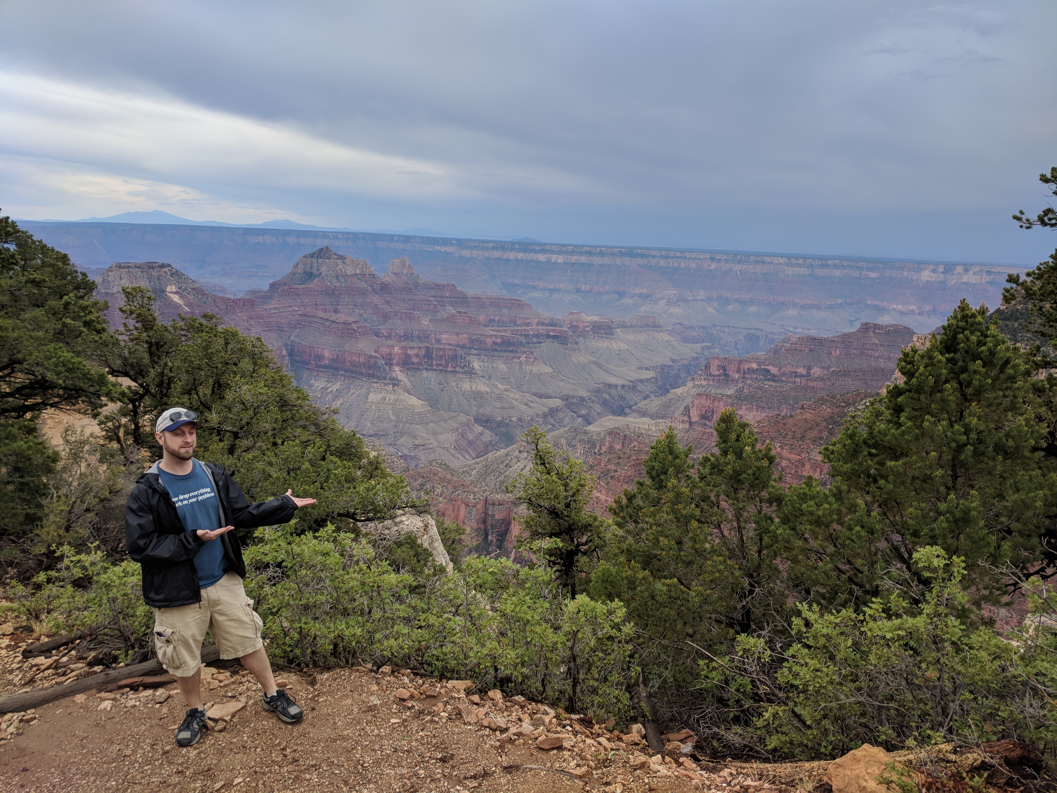
Image 10: Dan Showing off the Bright Angel Canyon |
If you walk through the lodge, you will find the trail to Bright Angel Point. Below is a panoramic view from Bright Angel Point. The butte in the center of the image is the Oza Butte. Several thought that Dragon Head, which is actually six miles to the west and not in the view. The small peak to the right of Oza is the Buddha Temple.

Image 11: Panoramic View of Bright Angel Canyon and Oza Butte |
Heading into the Lodge, you walk along trails lined with chain link overlooking long drops. Definitely, not for those afraid of heights. Though once you get back to the lodge, you get this wonderful view, which you can enjoy while eating breakfast.

Image 12: View from the North Lodge Restaurant |
If you want to see the best views, you need to leave the lodge and go down a side road to the Walhalla Plateau. The map below shows the path and several of the overlooks accessible by car with minimal walking are the overlooks. From these locations, you can see the entire east side of the grand canyon and to the west to the Hermit's Rest.
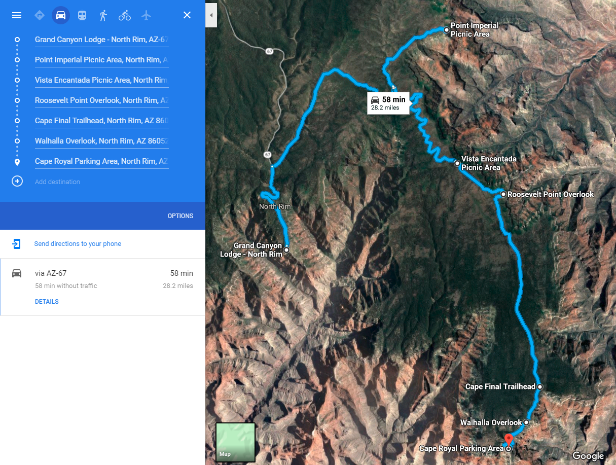
Image 13: Great Views Of the North Rim |
Arriving late, we traveled the longest route to see Cape Royal before nightfall. If the image appears inverted, open the image in a new tab by clicking HERE, and it will appear normal.
At cope royal, you will find the Angel's Window, which is lined by handrails and safe for the stable footed. My father, who just turned 80, had no trouble walking out to the point. The views will be a bit much for those with a fear of heights. When combined with a stiff breeze, even I was forces to pause for a second when a large gust of wind came blowing by as I leaned on the railings. But the views into the canyon were amazing.

Image 14: Cape Royal - Angel's Window Walkout |
The Angels Window is a walk out on a natural stone land bridge. The window is the hole in the stone which can be seen below. Don't think that you are walking on eroding rock with a hole in it while you are walking out. Instead recall that it has been there for thousands of years relatively unchanged.

Image 15: Cape Royal - Angel's Window |
The view from atop the rocks at Cape Royal Overlook is amazing. We arrived about an hour before sunset and enjoyed the stunning view below. The walking paths are a combination of asphalt pavement and compacted stone for easy access.

Image 16: Panoramic View of Cape Royal Overlook |
If you would like to view the full size image, click HERE.
We all lined up for a family picture, with the canyon in the background.
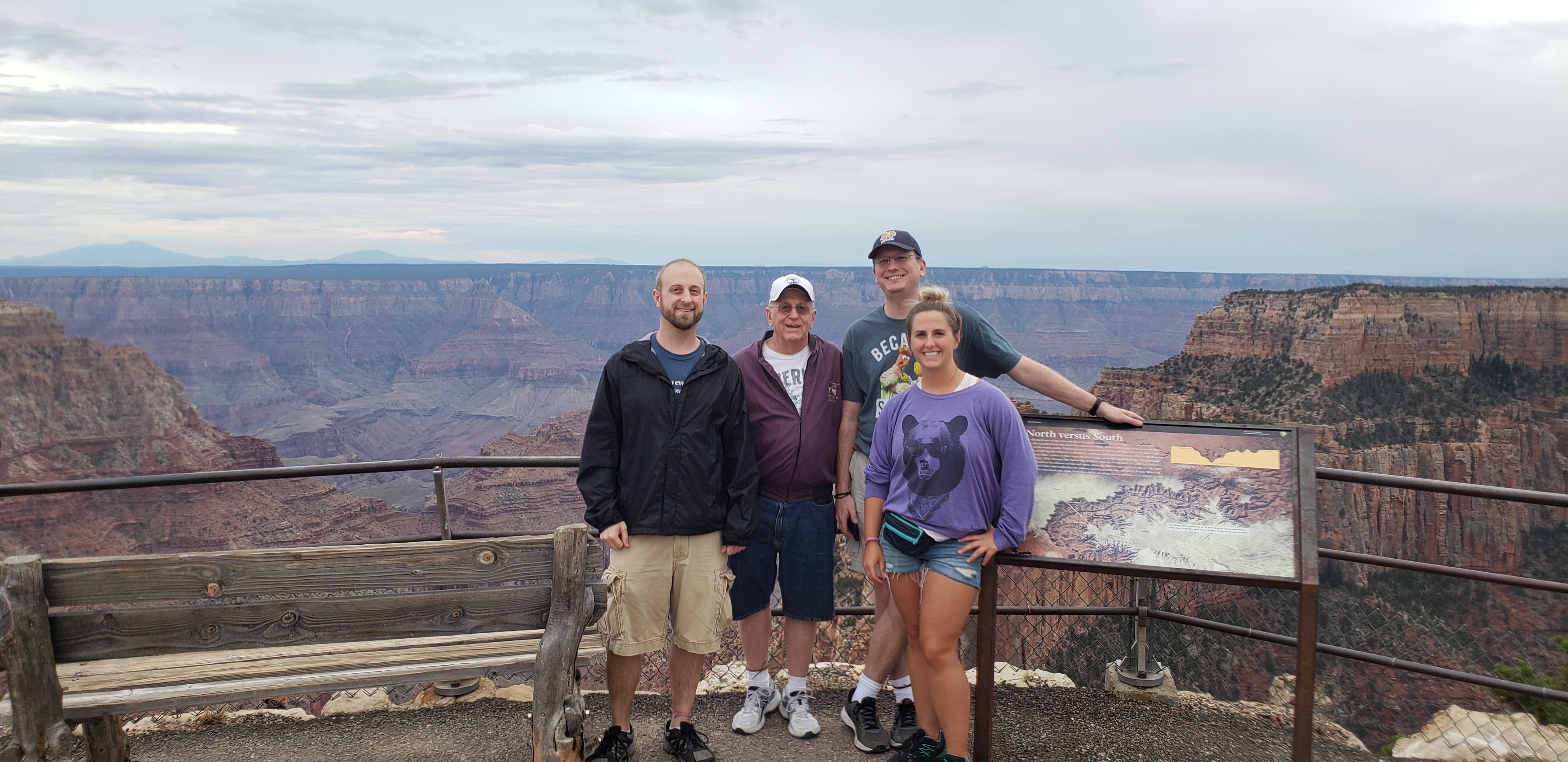
Image 17: Family Picture with Vishnu Creek in the Background |
Off to the side, there were areas where we walked out on to the rock. With a 500+ ft fall at the edge, we stayed a good distance form it. The constant breezes reminded me to stay away from the edge. The last time I was here, I walked right up to edges like these when I was fearless and stupid at 20 years old.

Image 18: Wandering off the Path |
From the rock out crop you get an even better view down Vishnu Creek. Following the center valley, up and other right in the image, you will see black rocks at the end of the valley. This is the Vishnu Basement Rocks on the south bank of the Colorado River. Though you cannot see it in the image, the Colorado is right there, as evidences by the dark granite and schist comprising the lowest levels of the canyon walls.
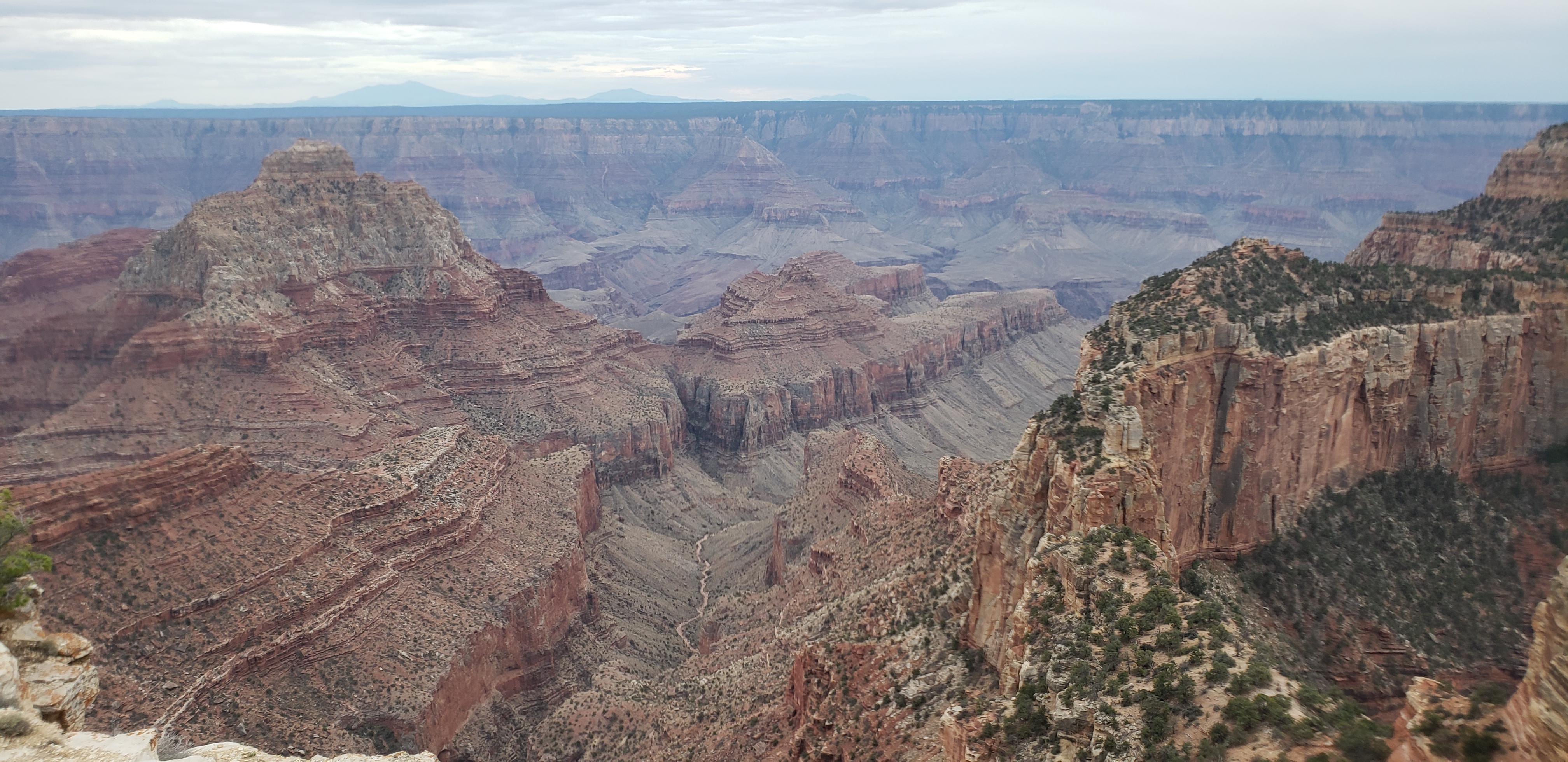
Image 19: View of Vishnu Creek below Cape Royal |
As mentioned earlier, one can walk out along the ridges past the railings as long as your ego with allow you to. The next image below is of the same valley, but the wider view captured the photographers and tripod standing on the ledge. A woman is sitting with here, legs over the edge. This is a fairly common site. The sandstone ridge they walked to get to that point looked wrought with peril. I do not recommend traveling out that far.
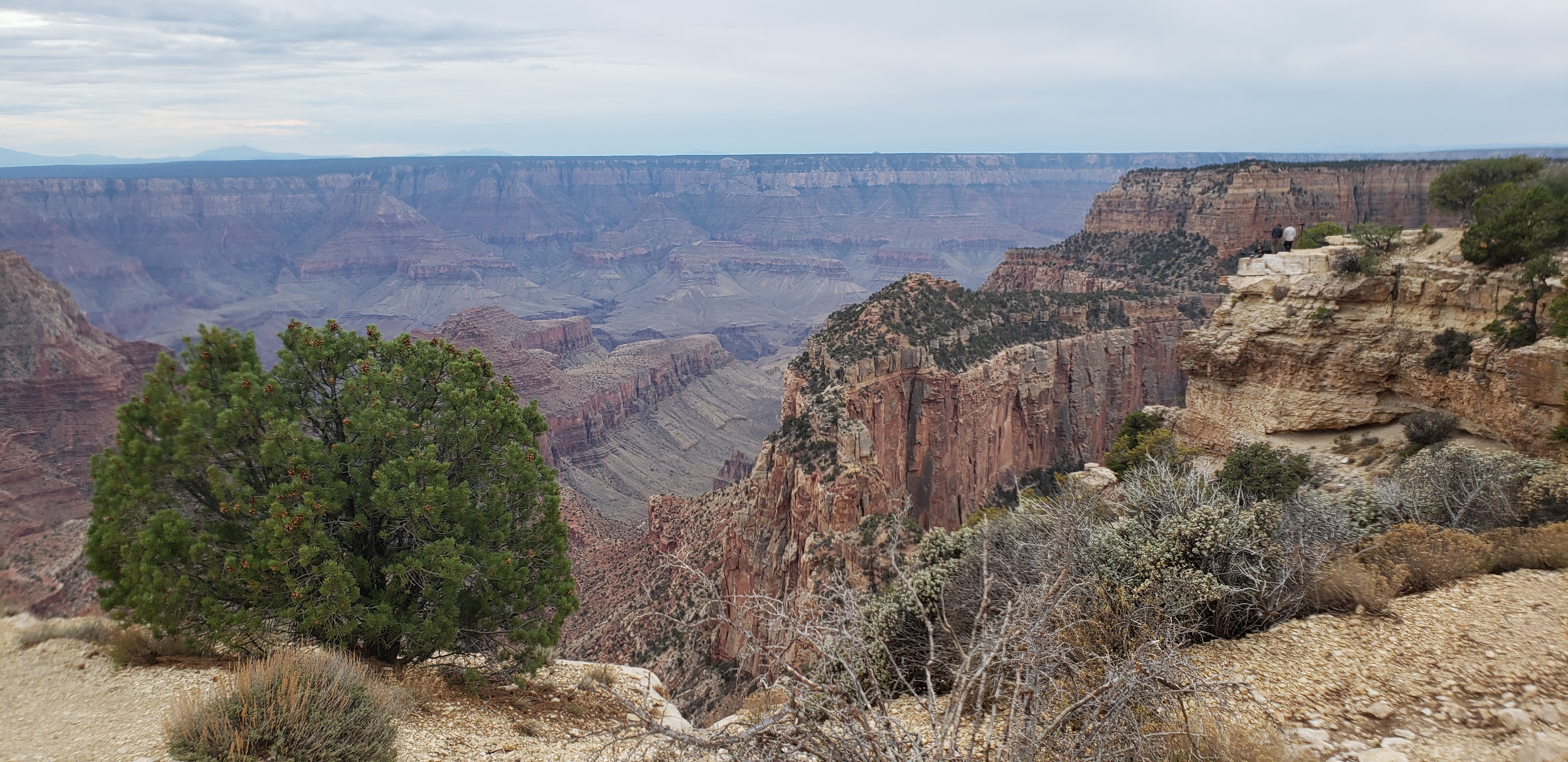
Image 20: View of Vishnu Creek below Cape Royal |
After talking in the splendor of Cape Royal, we jumped back in the car and went to Walhalla Point. Walhalla Point provides an amazing view of the east canyon. The Desert View tower is in the center of the image, but is only a few pixels at this distance. The grey mountain shadow on the right side is Humphreys Peak, north of flagstaff. Another amazing view.
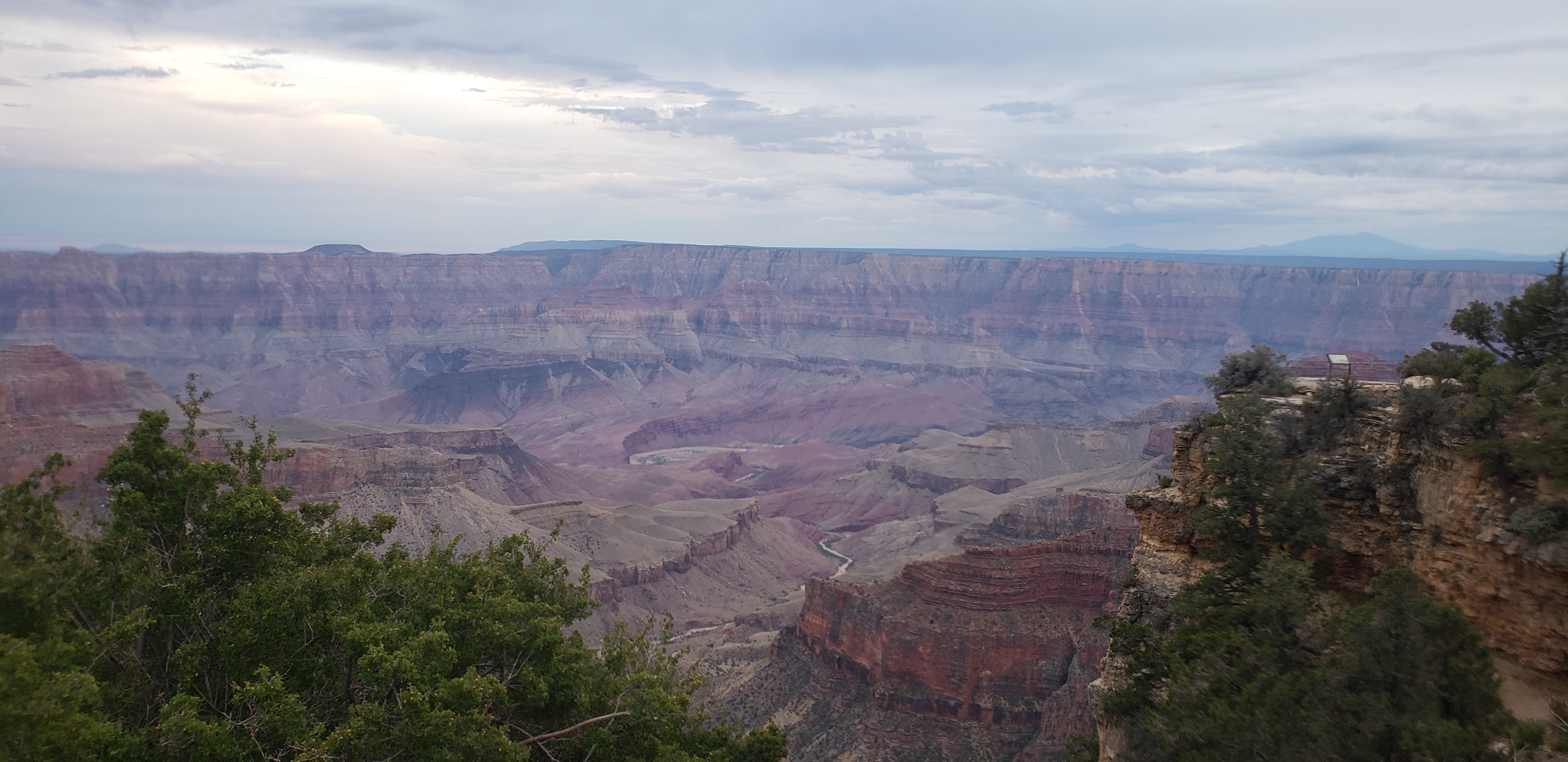
Image 21: Unkar Creek from Walhalla Point |
So, I ran out to the overlook point for the image below. It adds some scale, and lets you know that these overlooks involve a bit of a walk. But the walks are relatively short, and well worth it. If you view the full size image ( HERE), you can almost see the "Because Science" on my shirt. Proof that I am the waving idiot.
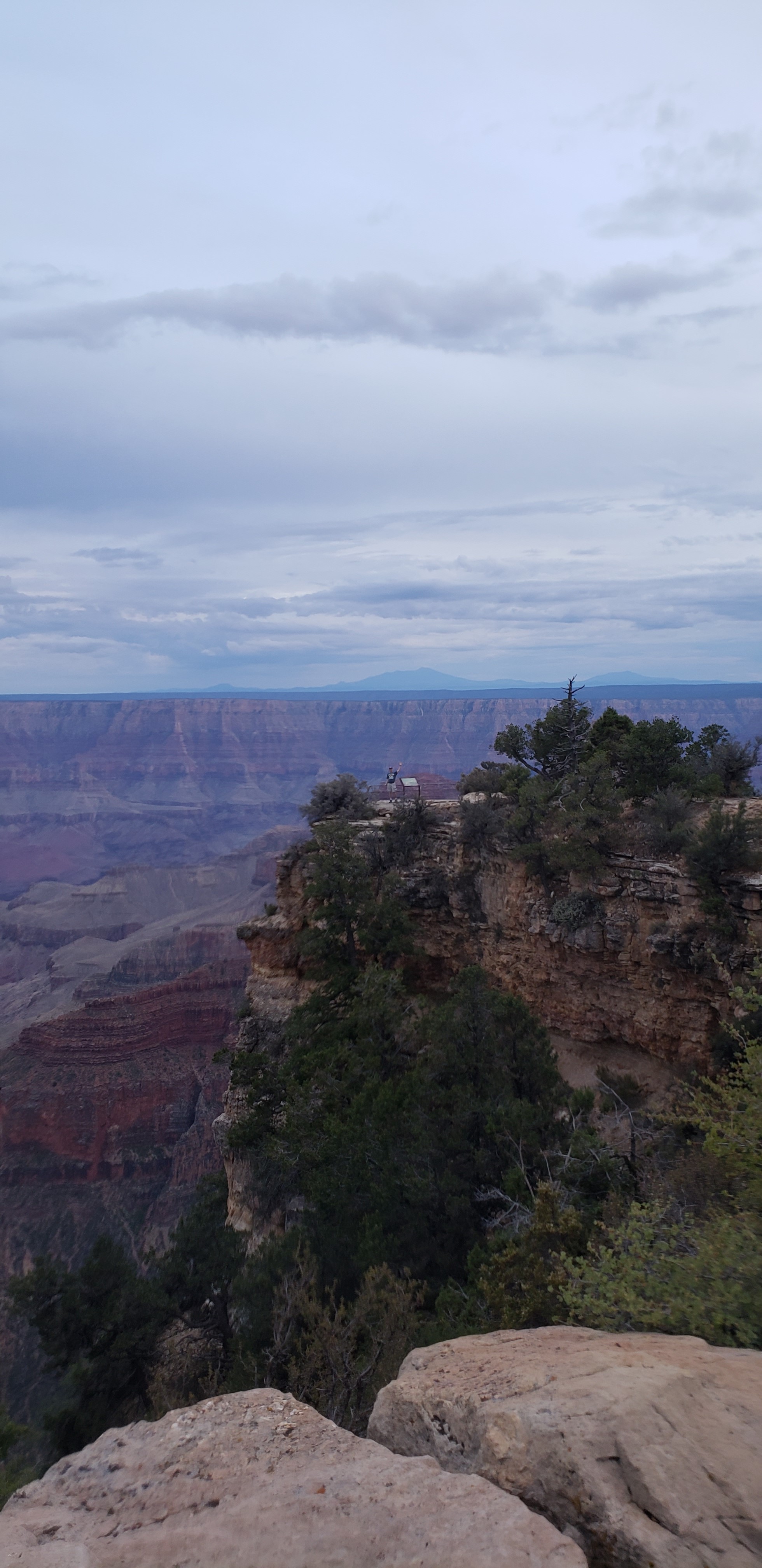
Image 22: Waving Idiot... Wait That's Me! |
From the Walhalla Overlook, you can see Cape Royal. The highest rock outcrop is the Angels Window. Point to the left in the distance is Vishnu Temple and Rama's Shrine to connected to the left side of Vishnu Temple. The views keep coming.
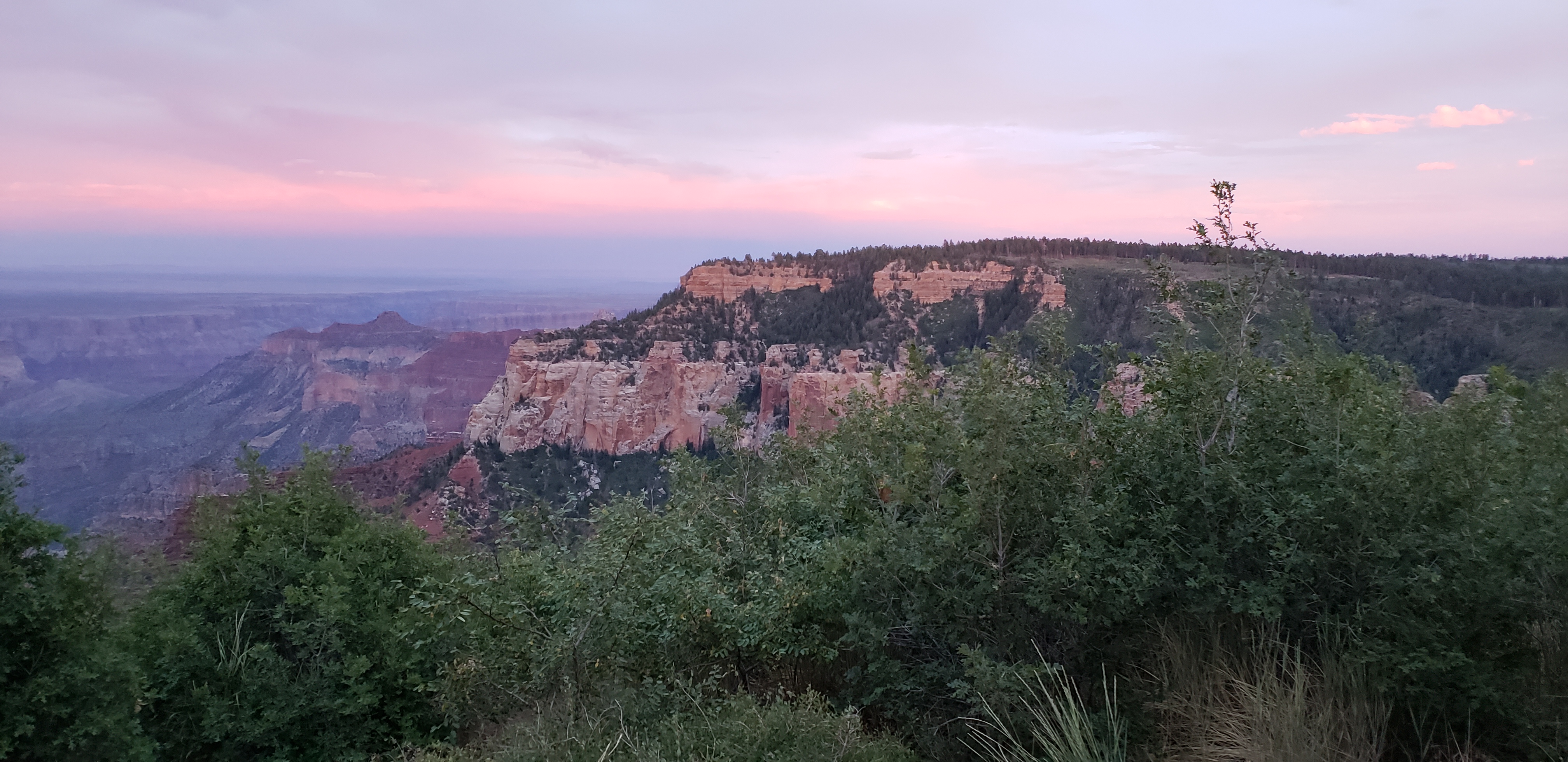
Image 23: Cape Royal from Walhalla Overlook |
We stopped at several more overlooks, but as the light was fading the images are less impressive.
If I was to re-plan the trip today, I would have added a day to take a drive to Point Sublime. We did not have the time in our itinerary to make this 2 hour drive to the Point Sublime. The Google Map showing the route is posted below. The park recommendations you should travel in a four wheel drive vehicle with high ground clearance, a winch and a chainsaw. The parks service does not actively maintain this gravel road. If you take a rental and breakdown, get yourself to the state road before you call the rental roadside, as you will be violating the terms of use with this drive.
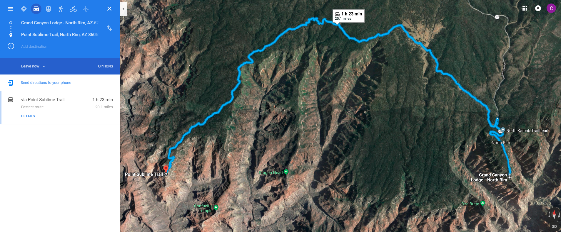
Image 24: Map to Point Sublime |
The North Rim was one of my favorite parts of this trip. If I had it to do over again, I would have spent more time on the North Rim. It is far less touristy with many overlooks and trail to be traveled. I have no regrets from this awesome trip, but this short amount of time spent may be the closest I will come. It gives me a reason to go back!
Christopher W. Erwin
Posted: 10/07/2018 00:20CDT
Seventeen years in the making, I returned to the grand canyon to perform a hike through the canyon. In 2001, I hiked down the Bright Angel Trail to the Three Mile Rest House. I spent about five minutes there filling my water bottle and enjoying the view. Following the park recommendations, I did not try to hike further, and hiked back out. I left before 5:00am and was out before 10:00am. Later the same day, I traveled to the South Kaibab Trail later that afternoon and hiked in to the Cedar Ridge. I was attacked by horse flies and ran out of the canyon. I have longed to go back and travel further than I did that day ever since. The following is a cataloging of my 2018 Hike Through the Grand Canyon.
In 2015, I decided that I was going to make this journey happen. I discussed with my siblings and plotted a course. We had trips planned for 2016 and 2017, so we set the time frame for 2018.
The work started with a review of the hiking options. I purchased the National Geographic Grand Canyon Map Set, with maps #261, #262, and #263. These maps provide all the trails available for hiking within the canyon. Google Maps includes good data on most of these trails, though not all. The North Rim trails include the North Kaibab (kῑ bâb) and North Bass Trails. The South Rim trails include the Bright Angel, South Kaibab, Hermit, Boucher (boo-shāy), South Bass, Grandview, New Hance, and Tanner Trails. The Tonto Trail runs east to west on the south plateau for 50+ miles connecting all the trails that I have listed. Most of the trails run from the rim to the river, though few trails run along the river for any significant distance. There are many other back country trails that I do not list, as my goal was specific to crossing the canyon. Every trail I list has back country camping options, all of which require camping permits.
I am not an experienced hiker nor an experienced camper. With the experience of previous day hikes, I decided that I did not want to camp in the canyon. The distance of the hike is enough of a challenge, and I did not wish to add sleep deprivation to the experience. People who do not mind camping have far more options for hiking than I reviewed. I decided to pursue accommodations at the Phantom Ranch. I will describe more about the Phantom Ranch reservation process later.
Knowing that we were staying in the Phantom Ranch, the trail list becomes far more restricted. A realistic maximum daily distance for travel within the canyon is about 16 miles. Some super-hikers or ultra-marathoners will be capable of doing more, but the climate and conditions are brutal for most of the year, and care should be taken when planning a hike in the back country.
On the North Rim, the only option was the North Kaibab Trail. Below is a map and elevation plot for the North Kaibab Trail. Listed at 13.5 miles, after hiking it I believe it to be closer to 16 miles. There are several items of interest available for exploration for any hiker. There are two rest stops with water available seasonally and a ranger station in the upper canyon. As you descend, there is the cottonwood campground and the ribbon falls, which adds half a mile. More Trail information will be provided during the hike description in a later post.
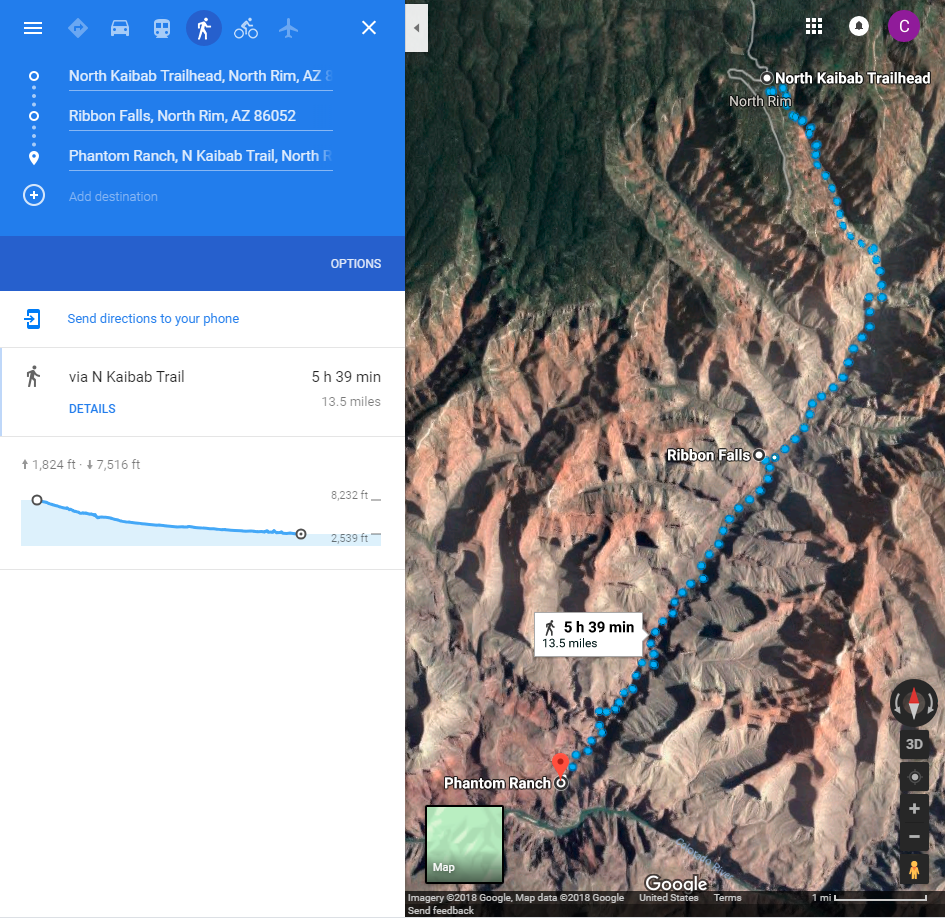
Image 1: North Rim Trail |
On the South Rim, we have three options, one of which was pretty unrealistic. The Bright Angel and South Kaibab Trails are realistic, and Hermit Trail is more of a pipe dream based on my physical abilities.
The Bright Angel is the most developed trail. It has three rest stops with water and the most campgrounds of all but the Tonto Trail. At 9.6 miles long, it is the longer of the realistic options. The additional distance can be made up for by the availability of water. You do not need to carry as much water along this route. Pipe Creek Beach, the Indian Garden and two rest houses are the items of interest along the trail. If you are willing to add 3 miles to your trip, you can head to Plateau Point for a great view of the Colorado River. More Trail information will be provided during the hike description in a later post.
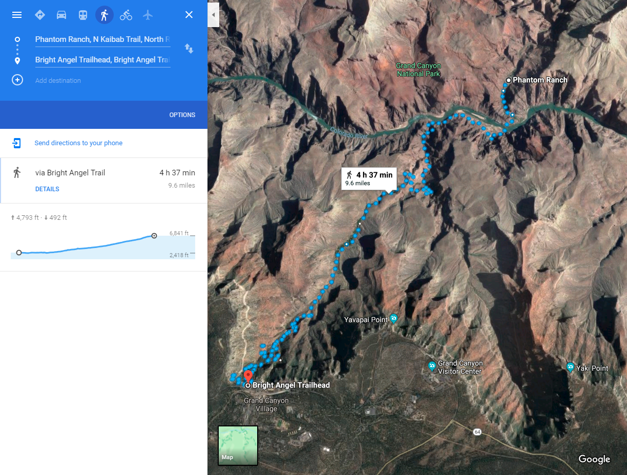
Image 2: Bright Angel Trail |
South Kaibab Trail is the shortest trail at 6.8 miles. It is the preferred route in and out for the staff at the Phantom Ranch. The top of the trail begins near Yaki Point and travels down the Cedar Ridge. Because it travels along the ridge, the views are amazing, but there are few opportunities for shade. I experienced direct sunlight all afternoon in 2001 and would expect shade only in the morning in the upper canyon. There is no water and almost no shade on this trail. On hot summer days the Phantom Ranch staff find relief near Skeleton Point, where they will crawl under a rock outcrop and take a nap to bring down their core body temperature. This is THE trail for the great views, but be prepared for the challenge. On my rest day in the canyon, I encountered three Austrian women who braved this trail during the middle of the day. They were all dehydrated and suffering from heat exhaustion when I encountered them.
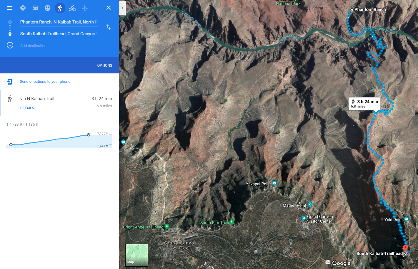
Image 3: South Kaibab Trail |
Phantom Ranch is a historic oasis nestled at the bottom of Grand Canyon. It is on the north side of the Colorado River tucked in beside Bright Angel Creek. Phantom Ranch is the only lodging below the canyon rim, and can only be reached by mule, on foot or by rafting the Colorado River.
In the 1920’s, the National Park Service selected the Fred Harvey Company to build a tourist facility within the canyon. Mary Jane Colter was commissioned to draft the plans for the facility. She produced sketches for a series of cabins. Everyone was pleased and announced they would name it Roosevelt’s Chalets. Upon which she snatched up her work and declared, “Not if you are going to be using my work”. A consummate perfectionist, she had already chosen the name: Phantom Ranch. The rustic cabins and main lodge are built of wood and native stone blending with the natural beauty of the setting.
The overnight accommodations consist of Cabins and Dormitories. The Cabin accommodations vary in size and accommodate from 2 to 10 people. Cabins are equipped with bedding, cold water sink, toilet, liquid soap, and hand towels. Showers, bath towels, hot water sinks, and liquid soap-shampoo combination are provided at a central location. Pricing for cabins is based on double occupancy, additional guests may stay with an additional charge. Dormitories are available to hikers only. There are 2 male dorms and 2 female dorms. Each dorm has 5 bunk beds, a shower and restroom. Bedding and towels are provided for each guest occupying a dorm bed. Children must be at least 6 years old to stay in a dormitory.
If you are hiking the canyon or meeting /departing a whitewater trip, and wish to stay or eat at Phantom Ranch in a cabin or a dorm, you must call the Central Reservations Office. Due to the popularity and high demand for Phantom Ranch reservations, bookings are awarded based on a lottery and the unclaimed reservations are sold on a first come first serve basis. Room inventory opens for sale 13 months prior to your desired arrival date, on the first day of each month.
The Phantom Ranch Canteen serves breakfast and dinner, which must be reserved in advance. Breakfast and Dinner meals MUST be reserved well in advance of your trail descent. It is highly recommended that you secure your meal reservations at the same time as your overnight accommodations at Phantom Ranch. There are a limited number of meals available at each seating. I will provide more detail in a future post.
The Canteen is available for all visitors during specific hours, with snacks, beverages stamps, T-shirts, postcards, headlamps and first-aid supplies are available for sale.
After traveling the canyon, a little known fact is that there are often open bunks in the dormitories. On an average weeknight, there will be 2-3 available bunks in the dorms. You can call Central Reservations for openings, or check with the staff in the dining hall for openings when you arrive. Two British gents wandered into camp and found accommodations while I was in the canyon. Despite this, there were two open bunks each night in the cabins.
At the time that I was making reservations, it was the luck of the phone lottery. On the first of the month, I would try calling with thousands of others, competing for the reservations that month. I will detail that in a later section of this post.
With the trail evaluation under way, one thing caught my eye. The North Rim was more than 1,000ft higher than the South Rim according to Google. According to the park service, the number is actually closer to 2,600ft. This seemed like an obvious reason to start in the North and hike to the South. And so began the plan.
I laid out a plan for two teams. In my family, several were not interested in this hiking endeavor, such as my wife and son. My son would later declare them Team Foot and Team Car. Both teams would fly to Las Vegas, and drive in caravan to The North Rim Lodge. From there, we would split into our teams. Team Foot would venture into the canyon, only to emerge on the third day. Team Car would drive to Page, AZ for one day of touristy activities, while Team Foot traverses the canyon. Teams will re-unite on day 3 at the Grand Canyon South Rim. After a day to explore the South Rim, we planned a recovery day in Flagstaff and then traveled back to Las Vegas. Image 2 shows the driving route.

Image 4: Planned Driving Route |
I sent out emails to interested parties with descriptions and estimated pricing to gage interest. Once I had that list of interested individuals, I began chasing the Phantom Ranch reservations. The North Rim Lodge does not open until April due to large snow volumes, so the chase was on for March.
The reservation process began on March 1, 2017 at 8:00am CDT. I started calling with my desk phone and cell phone from my desk at work. (I used PTO for this time for my co-workers who read this) I did not get through until almost 11:00 and all the reservations for the month of April were already taken. This disappointment would repeat in April and May. Many months later, I would later learn why this was the case. Canyoneering companies setup phone banks to get as many reservations as possible, and resell the reservations at $1,000 per night. When I was in the canyon, all cabins went to individuals traveling with one of three canyoneering companies.
On June 1st, I lined up three cell phones, and one land line. After two hours of dialing, we got through. After attempting several dates, the operator informed me of the first opening she found and I scheduled the visit based on those dates and fronted the deposits. I forwarded the dates to all interested parties and I awaited replies. Of the interested parties, only four were able to schedule the time off to take this trip.
The next section will cover the North Rim and interesting Sites of Note.
Christopher W. Erwin
Posted: 08/29/2017 08:08CST
I have visisted Fripp Island, South Carlonia six times during my life. It is a wonderful quiet island; perfect for a relaxing vacation with no plans, but plenty to do. Aside from swimming in the ocean or the pool and biking around the island, there is Hunting Island State Park just to the north. The island is home to campgrounds, hiking trails, beaches and the second tallest light house in South Carolina.

Image 1: Hunting Island Light House |

Image 2: Light House Drawing (Handout Scan) |
I climbed the stairs with my son to the top. And he enjoyed it so much, we did it a second time! He posed for a picture where he was pointing at Fripp Island, where we were staying.
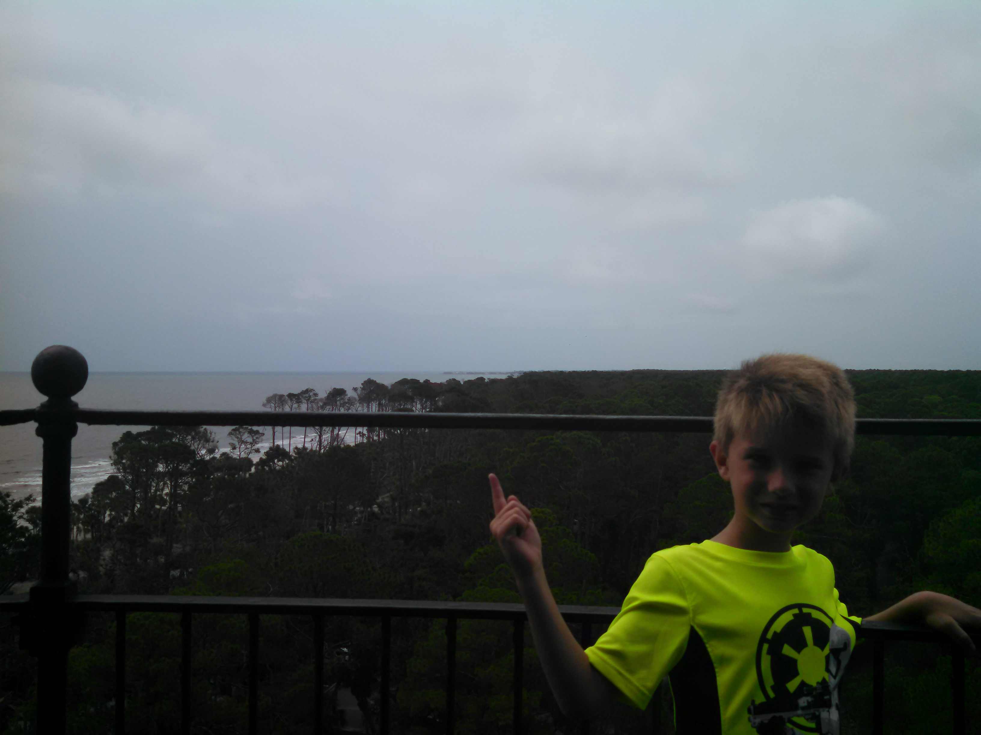
Image 3: My Son Poiting at Fripp Island |
There was also a handout that tells the history of the Lighthouse, which I have provided below:

Image 4: History of Hunting Island |
Overall, it was a nice historic site with a great view of the island. If you find yourself in the Beaufort SC area, it is a very nice place to visit for a few hours.
I hope you enjoy my summary of Christopher W. Erwin
Christopher W. Erwin
Posted: 10/30/2016 22:11CST
Last Month my Family and I traveled to the beautiful island of Kauai, Hawaii for a family Vacation. I had been to Hawaii before, but never to Kauai. Based on previous experinces on Maui, we knew that hiking is a wonderful activity to plan for on the islands.
With no poisionous animals on the islands, a properly planned hike is a very safe activity. The most dangerous animals you could encounter are wild boars, but if you take care to not get between family groups they tend to stay away. My sister is an avid hiker and suggested we hike along the Napali Coast to the Kalalau Beach. After reviewing the 11 mile Kalalau Trail, I suggested a shorter day hike to the Hanakapi'ai Falls. This 8 mile hike seemed mor reasonable than the 22 mile round trip she was suggesting. The folliwng image is of the waterfall that I took while resting after completing the four mile hike to the falls.
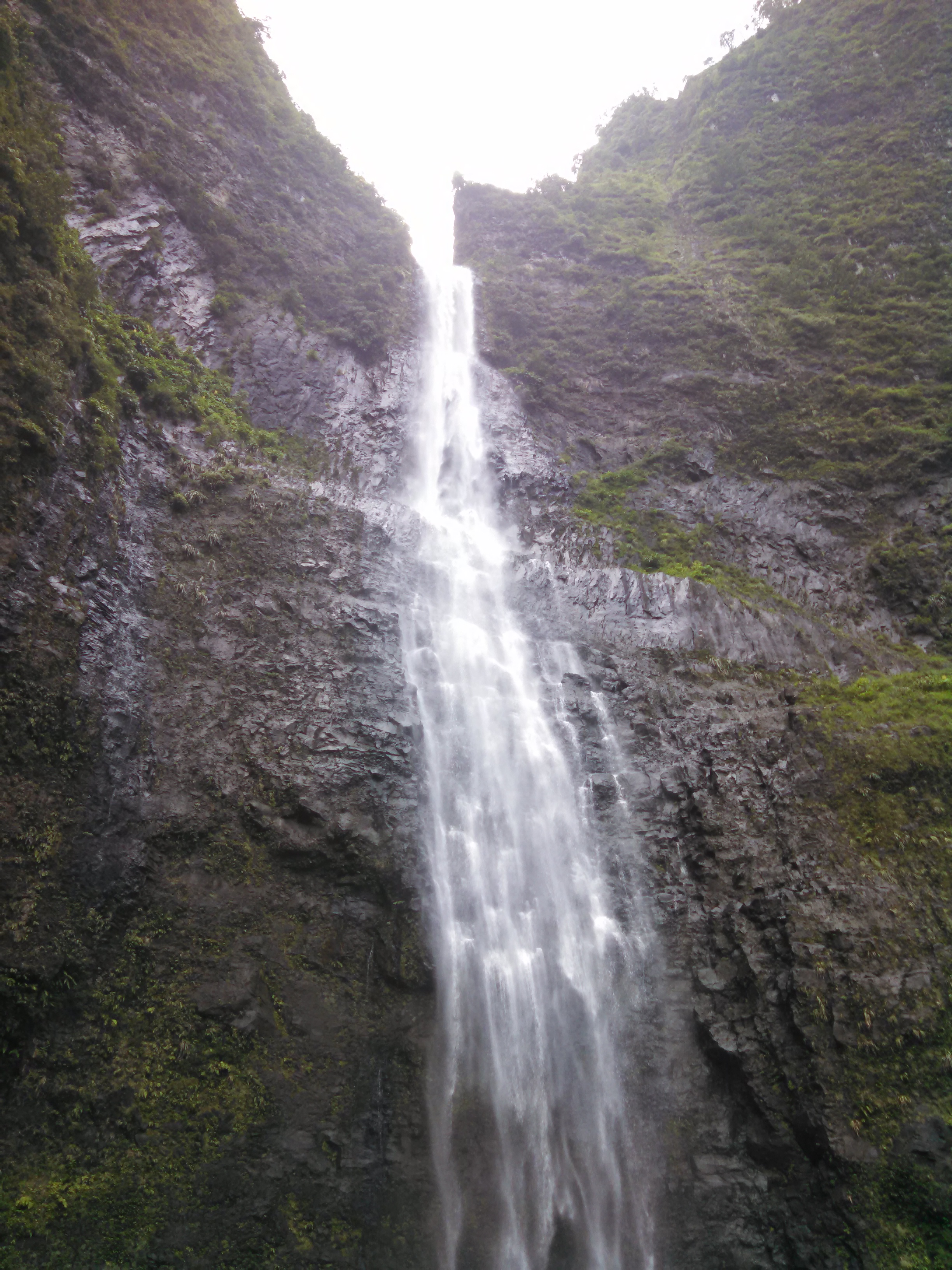
Image 1: Hanakapai'ai Falls |
The Hanakapai'ai Falls is located mid way up the Hanakapi'ai Valley on the Napali Coast on the northwest side of Kauai. The Hanakapi'ai Valley is located two miles down the Kalalau trail, which begins at the Ke'e Beach. The following map is borrowed from Hawaii-Guide.com to show the trail layout.

Trail Map |
The Napali is a beautiful green and rocky coast that is only accessible for part of the year. During the winter months, the coast is battered by waves as high as 60 feet and high winds out of the northwest. For the remainder of the year, it is a tropical paradise with only one beach and receiveing approximately 300-400 inches of rain per year.

Image 2: Photo of the Napali Coast from one of the Early Points |
The trail begins by wrapping along the coast traveling up and down the rocky outcrops providing beautiful views down the coast. Below is my brother, Dan, in his now typical captain pose.
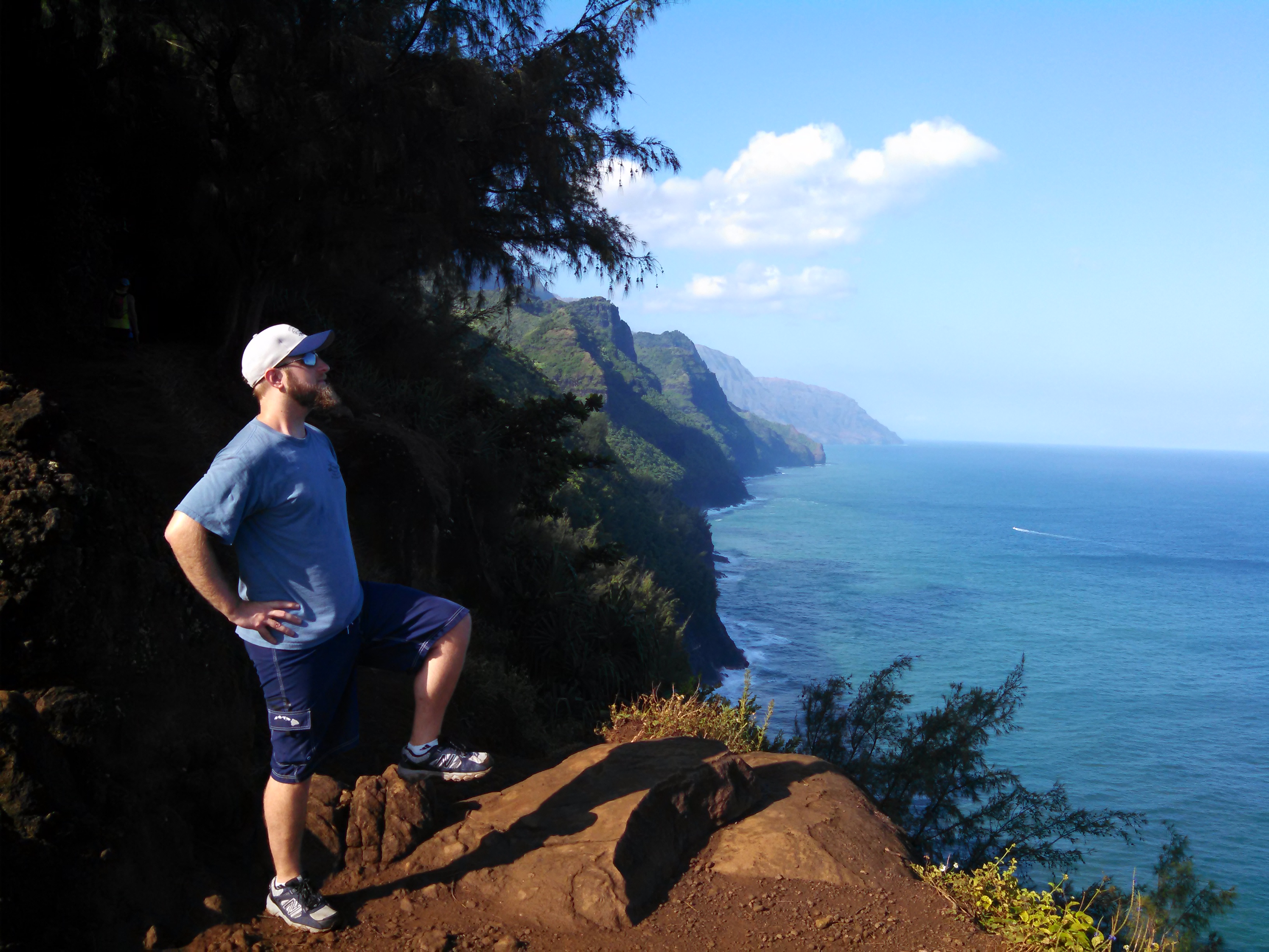
Image 3: Dan in his Captain's Pose |
After reaching the falls, Dan was taken to celebrate the occation.

Image 4: Dan Celebrating Our Arrival |
The falls are approximately 300ft tall. Due to the terratin of the valley, I could not get a wide shot that captured the full height of the falls.
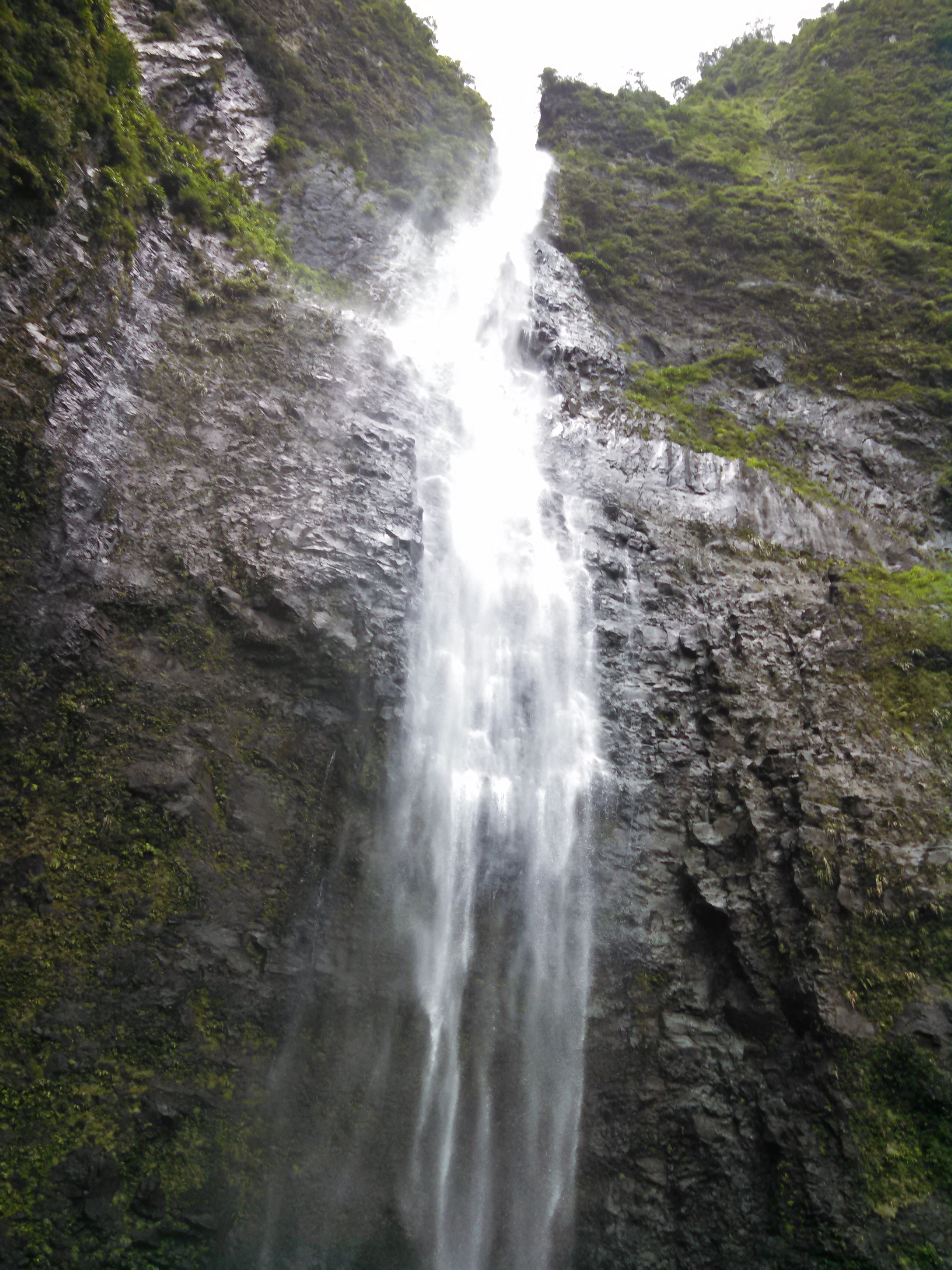
Image 5: The Falls from the End of the Pool |
So I have a couple of zoomed shots.

Image 6: Top of Falls Zoomed View |
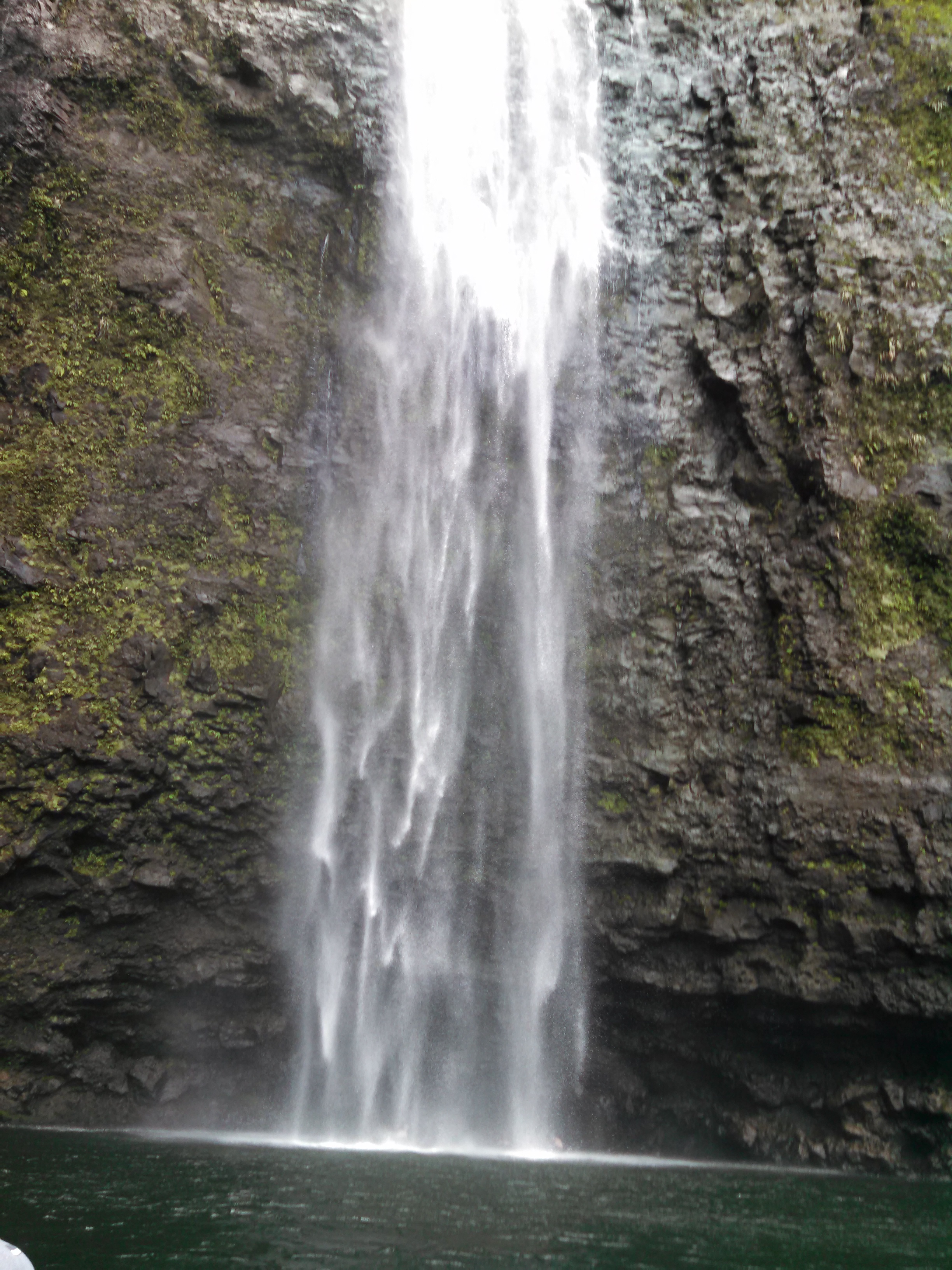
Image 7: Lower Falls |
We went for a swim behind the falls,

Image 8: Family Members under the Falls |
and Dan did his Captain Thing.
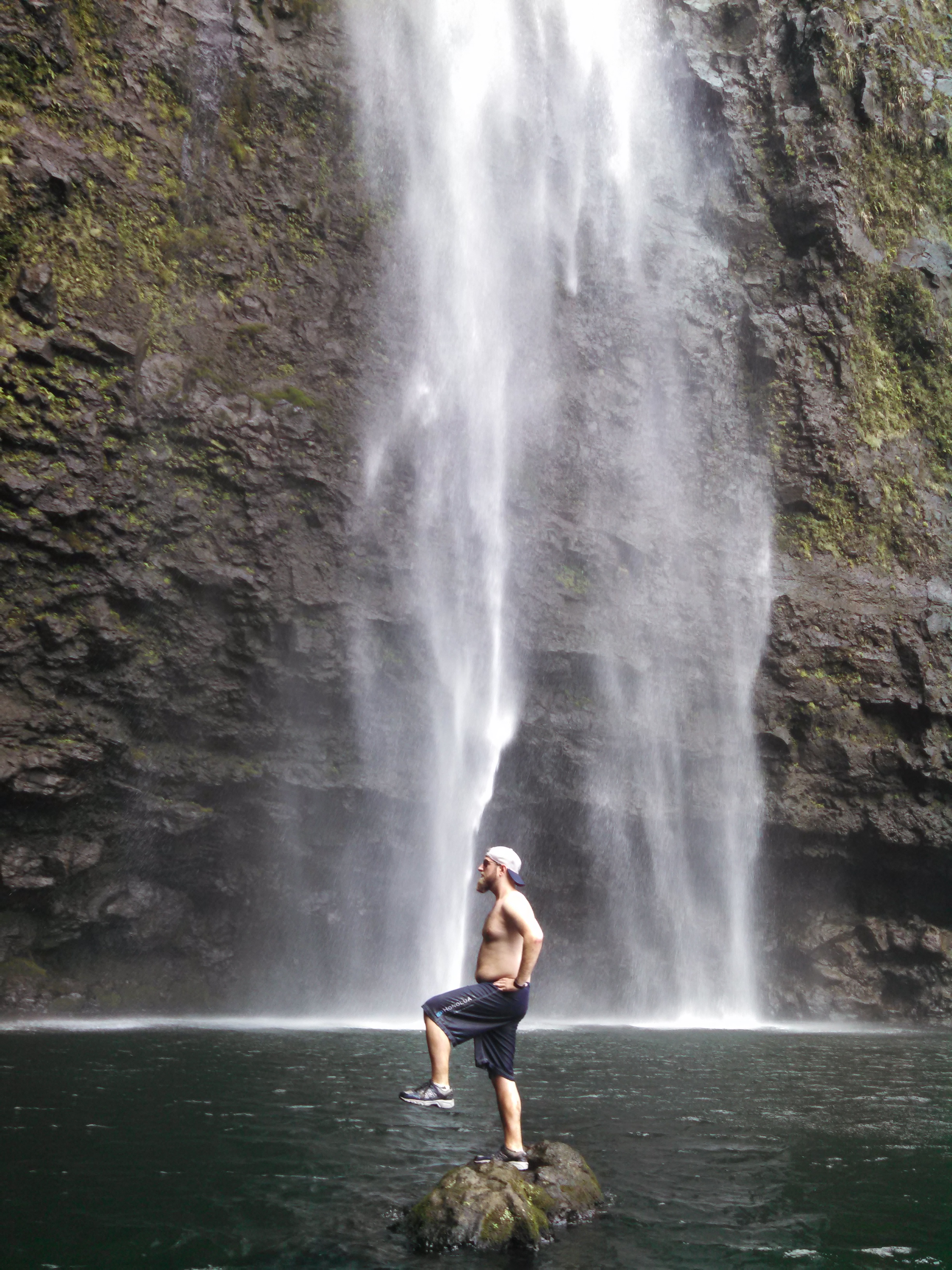
Image 9: Dan doing his Captain Thing |
We finished swimming, and I truned around to take one last look before I departed.

Image 10: One Last Look as I Departed |
And now for some final thoughts on the hike... This is among the more difficult hikes I have accomplished. The diffculty was not the distance or heat. The difficulty was the footing. The trail is a muddy un-maintained jungle trail with rocks that I freqnetly used to avoid stepping in the wet inches thick mud that made up the trail. I frequently found myself sliding along until my foot encounterd one of these rocks. Another difficulty is the lack of trail markings. We had a 100 yard detour caused by my sister following a pig trail and missing a stream crossing. The GPS in my phone and the Polaris Navigation App put us on the right track after that oops. Also, given the poor markings, and a downed tree, I may have made the same errant call during the hike. The trail is frequently partially covered with new growth as branches look to fill all the open spaces. The point is to be prepared, bring enough water, and a navigaion aide. The hike is difficult, but easily accomplishable for amateur hikers in decent shape. If you are not sure, begin with the Kalalau Trail. If that seems very hard to you, then you may want to skip the Hanakapai'ai Trail. As wonderful as the falls are, they are not worth the life of any person. And a location such as this is so remote that there is no cell service and help may be 8-10 hours away, so plan accordingly.
I hope you enjoyed my presentation of the Hanakapi'ai Falls.
Christopher W. Erwin
Posted: 02/13/2016 11:11CST
Last Month my Family and I traveled to the San Diego area for a family Vacation. We planned the trip not knowing what we would be doing on the trip. As it turns out, we had one of our busiest, most fun and still relaxing trips. One of the more intereresting finds was Galetta Meadows Sky Art in Borrego Springs, CA.
 Image 1: Borrego Springs From Overlook off Montezuma-Borrego Highway
The image above shows the entire valley taken at dusk as we were departing. We arrived to the valley around mid-morning with little infomration in regards to where the Sky Art sculptures were located. Borrego Springs is sparsley populated with lots of open desert landscape. One website suggested using the De Anza Country Club as a GPS destination, and traveling east along San Ysidro Dr. South of San Yosidro Dr, we saw the first sculptures:
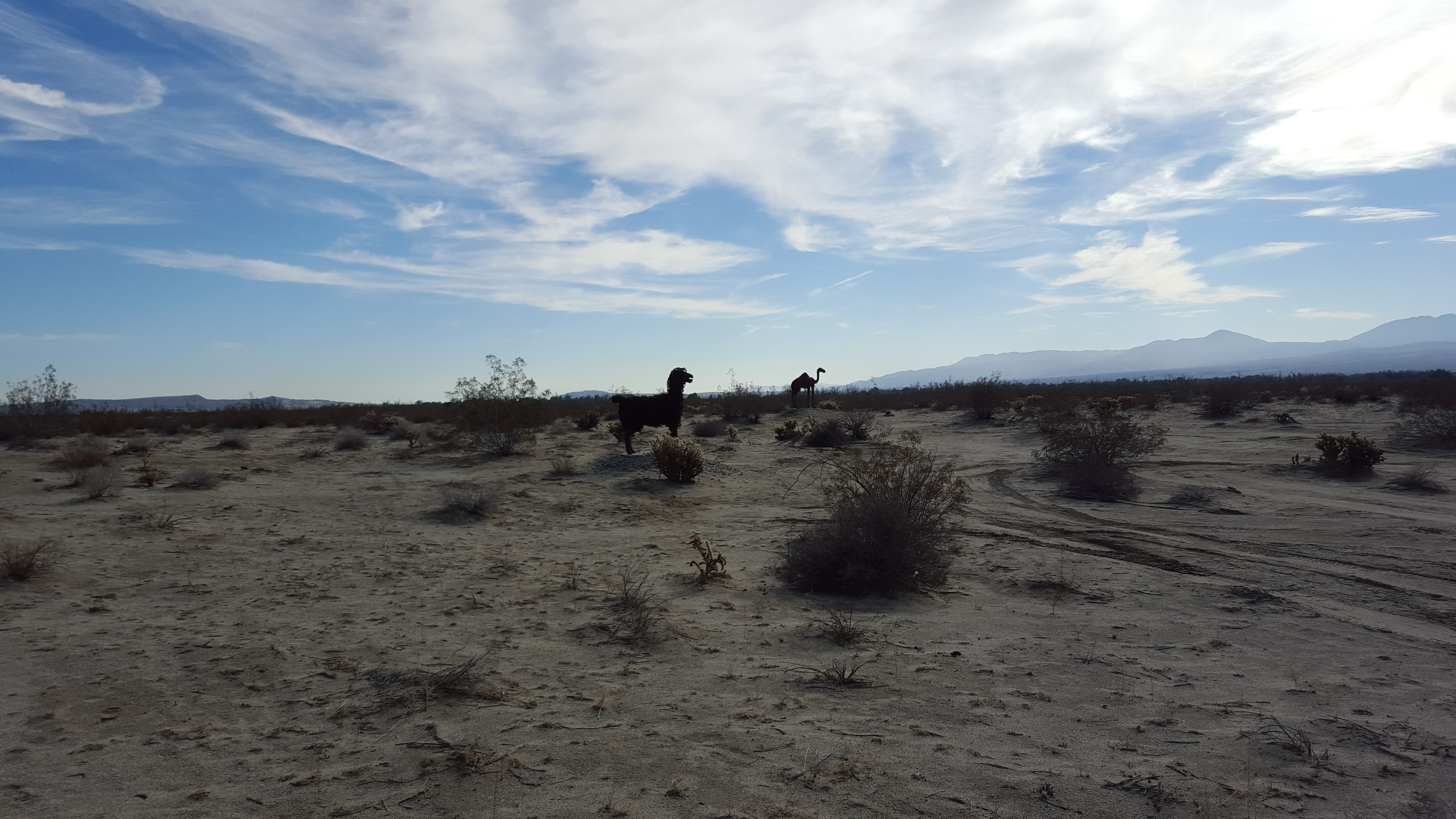 Image 2: Animals in the Desert
We got out of our cars and walked over to see them, and were amazed by the scale and detail. The wool was made of cut and curled steel. So I would not want to hug it, but tons of effor was put into these sculptures.
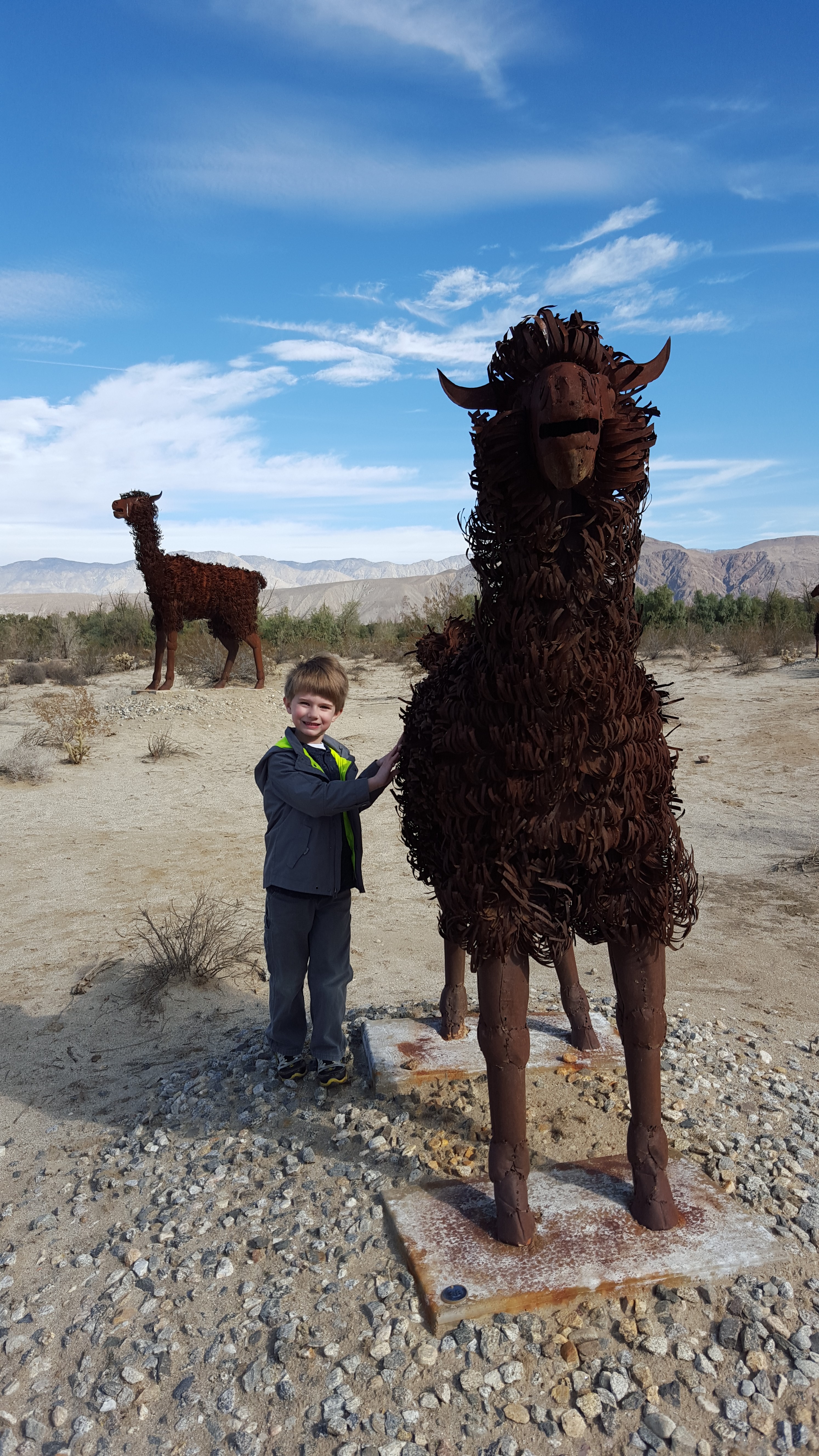
Image 3: Gabe and the LifeSize Llama |
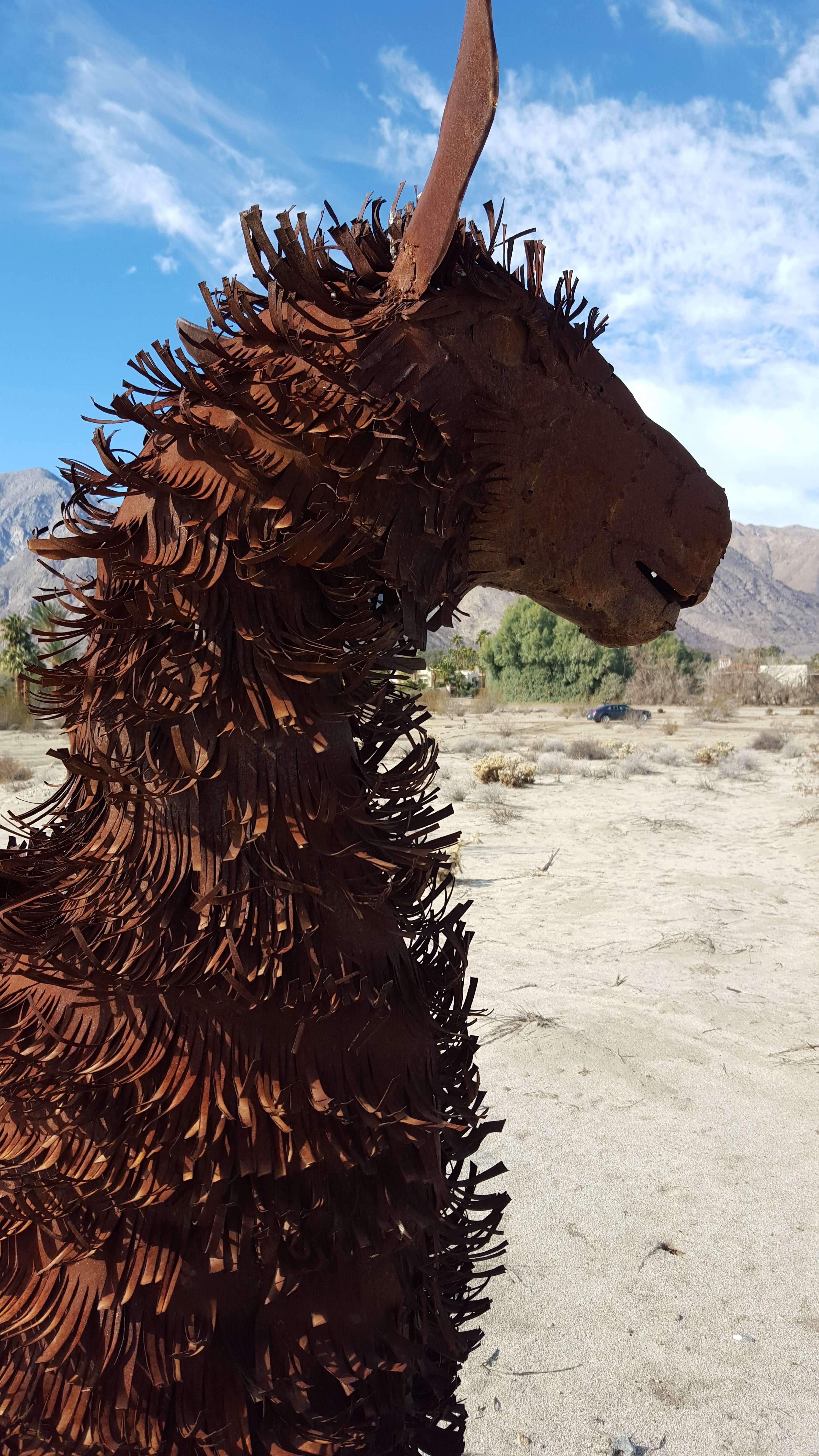
Image 4: Llama Head 1 |

Image 5: Llama Head 2 |
Off in the distance, I saw saw something massive. Our curiosity was peaked and we decided go see what it was...
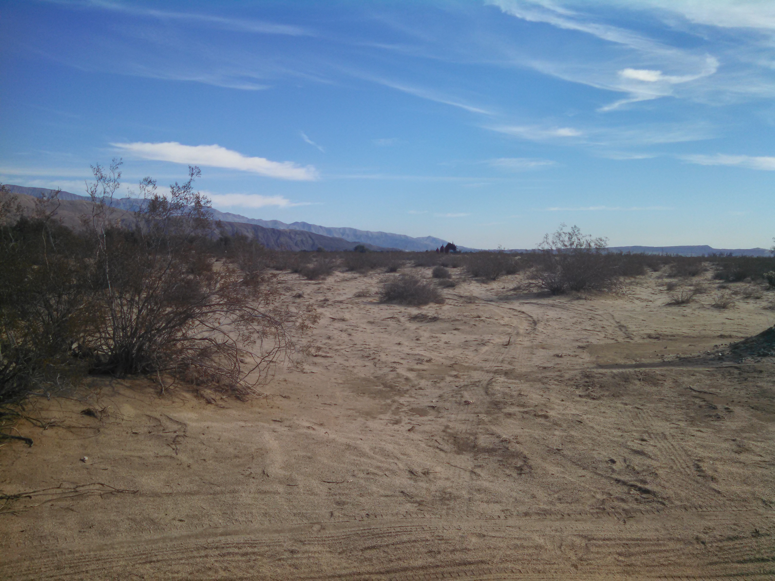 Image 6: Off in the Distance
When we got there, we found a giant Serpent. By far the largest and most impressive of the sculptures , it spanned across the road in five massive parts. The gallery has several photos with my 47" son for a size reference.
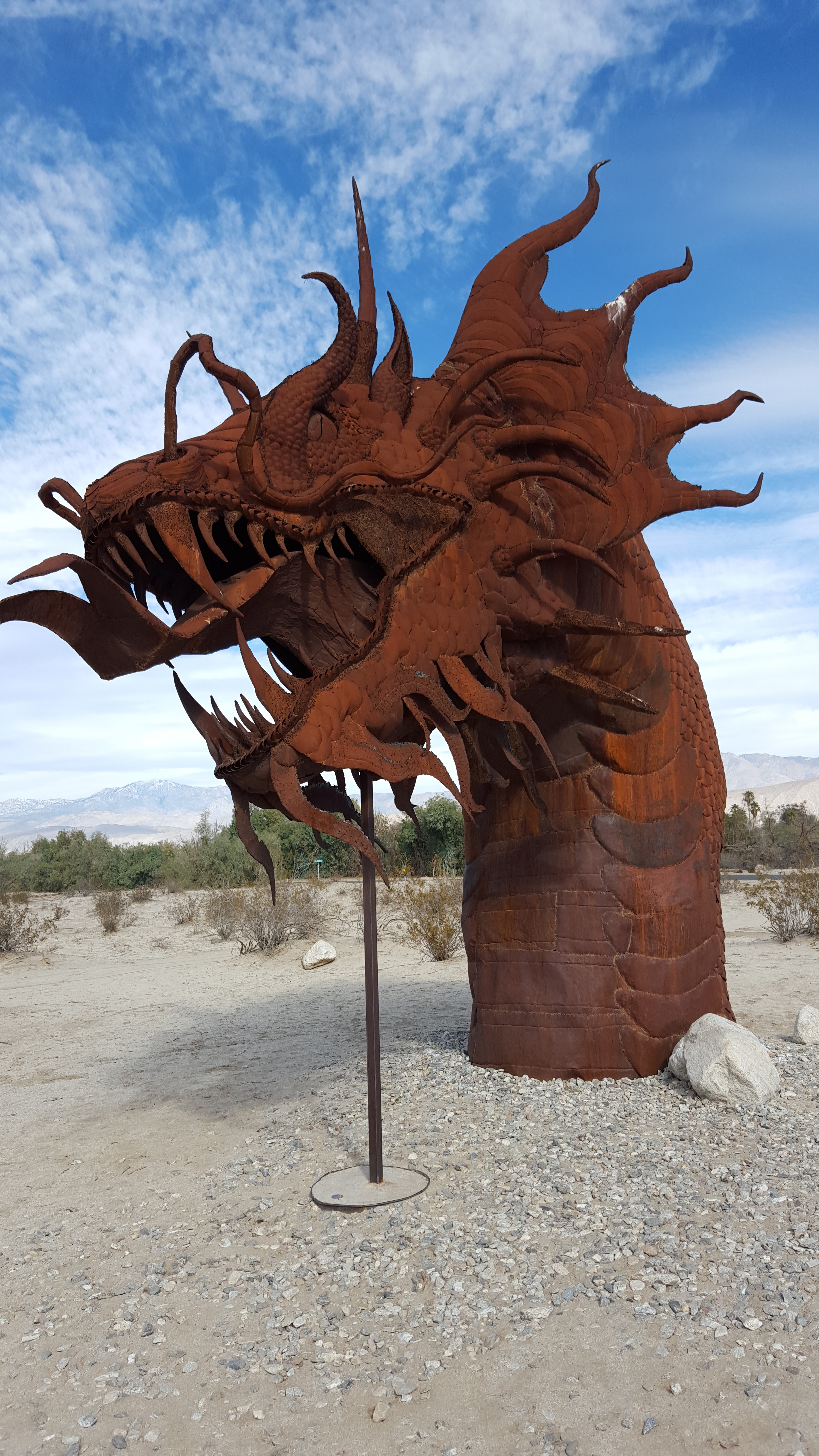 Image 7: Mythical Sand Syrpent
After viewing this magnificent sculpture, we looked around and saw more within eyeshot. We spent the remainder of the day traversing the desert looking at all these amazing sculptures. We did find 113 of the purported 140 sculptures, taking a picture of each and noting the numbered metal tag on each one. My son found this particularly fun, as he wanted to touch each one.
So if you are still reading, then perhaps you are thinking of doing this yourself! I recommend it most highly as a family friendly activity. You will be able to drive upto almost every sculpture, with only a few being down a rock road that is best suited to an SUV. Please read on if you would like my suggestions for how to do this right.
The Map provided by Galletta Meadows is suitabel for running a family sculture hunt. If you are not interested in that aspect, then I have posted a Google Earth File that shows the locations of all the sculptures we found. Regardless of your approach, bring sunscreen and water, as you are in the desert. Fortunately, you are never more than a short walk form civilization. Beware, there are many beautiful and painful cactus species around these scultures. I stepped on one inadvertently and had to pick out the needles form my shoe to ensure they did nto find their way into my foot.
I suggest starting on the southern sculptures and moving northward through them. When driving to the southern scultpuires, you will have to go a significant distance on a rough offroad trail. This is best suited to an SUV, but I did it in a Chrysler 300. I was worried about my oil pan in a few places. Because of the seclusion, these sculptures can take longer to visit than the entire northern potion.
You can drive upto every sculpture; though some are more demanding on the vehicle than others. Go slow and drive safely and you may have as much fun as we did.
While heading to the northern scultpires, we stopped in town for lunch at Carlee's Place. I recommend this restaurant, as the food and service were great.
I hope you areable to get to Borrego Springs to discover this amazing dispaly of art.
Christopher W. Erwin
Posted: 01/01/2016 22:56CST
As of January 1, 2016, the official United States(US) debt is approximately $18 trillion(1). As staggering as this number is, the far more frightening reality is that this is NOT an accurate picture of the US debt obligations.
Dr. Laurence J. Kotlikoff, in testimony before congress in February of 2015 condemned Congress for “cooking the books.” “The US fiscal gap currently stands at $210 trillion [for 2014]… it is 16 times more than the official US debt, which indicates precisely how useless official debt is for understanding our nation’s true fiscal position.”(2) Dr. Kotlikoff accuses Congresses of “cooking the books.” “Congress’s economically arbitrary decisions as to what to put on and what to keep off the books have not been innocent. Successive Congresses, whether dominated by Republicans or Democrats, have spent the postwar accumulating massive net fiscal obligations virtually all of which have been kept off the books.”(3) “U.S. postwar generational policy is accurately characterized as “Take As You Go.” Over the decades Republican and Democratic Congresses and Administrations have taken ever-larger amounts of resources from young workers and transferred them to old retirees. The resources taken from the young to give to the old were called, in the main, “taxes.” And the young were effectively told, “Don’t worry. We are calling these resources taxes, but when you are old, you will receive massive transfer payments that more than make up for what you are paying now.”(4) Every Congressman is aware of these facts and either choose to ignore them or do not care about the consequences to American public or the greater economy, as increasing the nation’s debt will lead to higher interest rates, higher inflation rates, slower economic growth, weaker job markets, and higher taxes.
How did we get to this debt picture? “For most of our history, Congress did a far better job of limiting its activities to what was both moral and constitutional. As a result, federal spending was only 3 to 5 percent of the gross domestic product from our founding until the 1920s, in contrast with today’s 25 percent. Close to three-quarters of today’s federal spending can be described as Congress taking the earnings of one American to give to another through thousands of handout programs, such as farm subsidies, business bailouts and welfare.”(5) This lack of fiscal discipline and a failure to recognize the moral corruption of using government force to supplement tasks, which have historically been the purview of private charities. Once upon a time “the purpose of taxes was to pay the inevitable costs of government. To the political left, however, taxes have long been seen as a way to redistribute income and finance other social experiments based on liberal ideology.”(6)
What can we do about it? With the passing of the last budget just before the Christmas 2015 recess, it has become obvious that Congress, even under Republican control, are not capable of restraining spending in any manner. It is time to take the advice of our founding fathers and call for a convention of states to propose amendments to the US constitution. In this convention, we may propose amendments to limit the spending and taxation of congress. Mark Levin’s The Liberty Amendments proposes two such amendments in Chapter 5, and provides far more detailed support that I can convey in this short triste.(7) Such amendments were proposed in the past by such leading lights as Milton Freeman, with one attempt coming within one vote of passage in the US Senate in 1995.(8) It is time for the American people to stand up through the State Legislatures to correct the wrongs perpetrated by the Federal Government on the US citizens.
~Christopher W Erwin
References: (1) - US Debt Clock http://www.usdebtclock.org/ (2) - Kotlikoff , Laurence J. America’s Fiscal Insolvency and Its Generational Consequences. Testimony to the Senate Budget Committee, February 25, 2015, p5 http://www.budget.senate.gov/republican/public/index.cfm?a=Files.Serve&File_id=5e791473-386f-4149-8db0-00e50fdcdbf8 (3) - Ibid, p3 (4) - Ibid, p9 (5) - Williams, Walter. “A Minorty View: Spending and Morality,” George Mason University, July 9, 2014. http://econfaculty.gmu.edu/wew/articles/14/SpendingAndMorality.htm (6) - Sowell, Thomas. “A Taxing Experince: Cut the National Debt by Reducing Spending” Captialism Magazine, Nov 25, 2004. http://capitalismmagazine.com/2004/11/a-taxing-experience-cut-the-national-debt-by-reducing-spending/ (7) - Levin, Mark R. The Liberty Amendments. Threshold Editons, New York, NY. 2013. (8) - Webiste: (8) https://www.govtrack.us/congress/votes/104-1995/s98
Posted: 03/30/2013
What does it mean to have representation, or the consent of the governed?
Does it mean that we simply show up every two years to vote for members of congress and, depending on the cycle, for senator and president? Is that the beginning and end of it? Or do we actually get to know what they are doing and when they are doing it? How can there be consent of the governed, the core of our republic(1), if we do not know what our representatives are doing? Or worse, we find out too late what they have done?
Main Body of Message.
Sign Off
That is exactly what happened with Obamacare(2), Dodd-Frank(3), and all the continuing resolutions of the last three years.
Are you aware of what the great political philosophers called this? Thomas Jefferson and Alexis de Tocqueville referred to this type of behavior as “democratic despotism” (4). While some may cringe or roll eyes at such a statement, this is happening and I can lay out example after example of this occurring.
Here is an example from a few weeks ago, from the faux news site Politico: “The Senate’s “Gang of Eight” is preparing to leave town with a deal on immigration reform in limbo, stalled by a fight between Big Labor and Big Business. … In a closed-door session that stretched late into Thursday night, things got heated. Sources said negotiations grew extremely tense after business groups balked. There were more talks on Friday — but no more progress, even though negotiations continued in a rare Friday night session of the Senate.”(5)
We have eight senators haggling over details with big business and big labor, in a closed door meeting. We have negotiations going on with some people who have access to these eight individuals, and we have no idea what is going on. Who are these eight senators? What are they deciding on? You and I are not at the table; and what I mean by that is there are no open hearings nor any public debate. How can we know what is going on when we have no knowledge of what is being discussed? This is not the actions of a representative republic. I do not even know if my representative or senators are in on the discussions. This is NOT representation, and “We the People” are going to be left with whatever these buffoons do.
This is the exact tyrannical model that was used to pass Obamacare. There were no hearings nor time for debate on the floor. At 10:31PM EST on 3/21/2010, Nancy Pelosi knew she had the requisite 219 votes. She had her stooge bring forward the bill and 17 minutes later the law had passed. The vote was held less than 24 hours after the bill was posted to the representatives. Barely enough time to read the 2600 pages, let alone understand them. I remember that day well, as I sent a scathing email to my congress woman with what I found in first 80 pages. This was the kind of horrible legislation where we have to “pass the bill before we find out what is in it”(6). And we are still discovering new horrors today. The same tyrannical model was used for Dodd-Frank and many other pieces of legislation form the Pelosi stained 111th Congress.
How can we possibly participate in our government if we do not know what they are doing? I do not want direct democracy, nor majority rule. I want DUE DELIBERATION. These bills should go through “regular order” in the house and senate. This is a fundamental principle for a functional representative republic. The parliamentary process is supposed to be open and deliberative so as to allow “We the People” to watch and, if we choose, to participate. It gives us the time to call our representatives, write letters, attend committee hearings, or even organize for or against a particular bill or amendment. Right now, we do not know what is going on, and those eight buffoons want it that way. The Senate is supposed to be the most deliberative body and the House is supposed to represent the people. What jokes. “We the People” don’t have the foggiest idea what is going on. All we know is general information from leaks regarding secret negotiations.(5)
This is why Thomas Jefferson, despite supporting the constitution, warned of some “evils” that he did not like. In the post script to a letter to Madison, he wrote: “I think it would be well to provide in our constitutions, that there shall always be a twelvemonth between the engrossing a bill and passing it; that it should then be offered to its passage without changing a word; and that if circumstances should be thought to require a speedier passage, it should take two-thirds of both Houses, instead of a bare majority.”(7) This is how important due deliberation was to the author of Declaration of Independence. Due deliberation is essential to a Republic.
In addition, Benjamin Franklin warned: “…Government but what may be a blessing to the people if well administered, and believe farther that this is likely to be well administered for a course of years, and can only end in Despotism, as other forms have done before it, when the people shall become so corrupted as to need despotic Government, being incapable of any other.”(8) As Franklin exited Independence Hall after his speech was read by James Wilson, Franklin was asked, “Well, Doctor, what have we got—a Republic or a Monarchy?” His response was, “A Republic, if you can keep it.” (9)
Just as Franklin and Jefferson warned, our federal government has nation has become unmoored from our Constitution. We no longer live in a Constitutional Republic, but Ameritopia; where men posing as masterminds plot our future in secret. They make plans on how to enact their will, while hiding their actions and intentions from “We the People.” In 225 years, have we come to the point where despotism is our end? I cannot believe it is over. I will not spend my sunset years “telling our children and children’s children what it was once like in the United States when men were free.”(10)
When you see our representatives acting in secret, without the disinfecting light of day shining on their deeds, it is time for them to go. No explanations, no excuses, no party loyalty. Whether democrat or republican, if they act in secret, it is time to send them home. This should also apply to those who support advocates of these policies like Pelosi and Boehner. Take the time to see how your representative and Senators voted, and be prepared to work towards replacing them if they have acted in support of despotism.
~Christopher W Erwin
References: (1) - Declaration of Independence, Paragraph 2 (2) - Webiste: HR3590:Thomas.gov (3) - Webiste: HR4173:Thomas.gov (4) - de Tocqueville, Alexis. Democracy in America. Volume 2, Part 4, Chapter 6. (5) - Webiste: Politico.com (6) - Webiste: Pelosi Speech (7) - Webiste: Writings of Thomas Jefferson, Letter to Madison 12/20/1787 (8) - Webiste: Benjamin Franklin’s Speech on the last day of the Constitutional Convention (9) - Webiste: A Dictionary of Quotations (10) - Webiste: Ronald Reagan, A Time for Choosing.
Posted: 07/04/2012
When I was young, the Fourth of July served as a summertime holiday with fireworks. I was raised to love this country and to respect those who had founded it. Men like George Washington, John Adams and Thomas Jefferson were spoken of with reverence in my history classes. The topic of the revolution was covered in 7th grade history and then again in a high school history class, but it was not until after college that I truly learned about what it means to be an American.
Years and many books later, I have begun to understand the amazing and unique actions of our founding fathers. These men of honor were well versed in history, and all too well aware that the history of mankind is one of tyranny and oppression. Because they were versed in philosophy, they understood the nature of man. The continental congress looked to philosophers like John Locke for an intellectual explanation of the American experience, and in an act of ultimate defiance, set out to create a government for a society unique in the pages of history.
Up until the 1900s, the American continent was one of isolation. No royalty, no bishops, no overarching government. While Kings granted charters for men to settle colonies, they had no influence on the daily affairs. Governments were instituted among men for the preservation of their societies. And with little incident, these governments served to foster society until the mid-1700s. Americans had become proficient with regards to self-governance. Even the farmers living on the edge of the wilderness were able to operate on simple rules and codes of conduct to maintain order in the society. This lead to a individualistic mindset that is uniquely American and I believe is best conveyed by an interview of revolutionary war veteran Levi Preston by young historian Mellon Chamberlain in 1843, more than 65 years after the revolution:
This interview which was almost lost to history existed in only one historical record, and was plucked from obscurity by a contemporary historian.(2) It conveys the unique American mindset, which grew and was nurtured by the people in isolation from the tyrannies and wars of Europe. This was the American mindset that was set afire by English actions. Many more people than the founders sacrificed their lives, fortunes and sacred honor.
On July 2, 1776, after much debate and contemplation, the Second Continental Congress voted for independence, and two days later approved the Declaration of Independence. With this action, they embarked on the single greatest experiment in human self-governance the world has ever known. As Abraham Lincoln would later describe, “a nation conceived in liberty, and dedicated to the proposition that all men are created equal.”
Freedom, or Liberty, is the idea that we will celebrate on July 4th. As we go about our day, I entreat you to take ten minutes and read those 1350 words which Jefferson penned to paper and contemplate their meaning, for they serve as the framework of the greatest nation that man has ever known.
We must understand our history and the legacy passed on to us if we are to understand where we want to be tomorrow. Ronald Reagan put it best, “Freedom is never more than one generation from extinction. We didn’t pass it to our children in the blood stream. It must be fought for, protected, and handed on for them to do the same, or one day we will spend our sunset years telling our children and our children’s children what it was once like in the United States where men were free.”(3)
Happy 4th of July!
~Christopher W. Erwin
References: (1) - Hon. Mellon Chaimberlain. "Why Captain Levi Preston Fought: An INterview with One of the Survivors" Danvers Historical Collections 8. 1920, p.68-70 (2) - Fischer, David Hackett. Paul Revere's Ride. New York & Oxford University Press, 1994 p.163,397 (3) - Ronald Reagan. Address to the Phoenix Chamber of Commerce, March 30, 1961.
Posted: 05/02/2011
I have been hearing and seeing a lot of bad information regarding why Gas prices are so high and domestic Oil Production and Refining. There is so much, I will not be able to address them all; but let us see how long until I get bored...
1. The Obama Administration has been claiming credit for increasing oil production to the highest levels since 2003. (2)
While oil production was up through 2009, and estimated to be up for 2010, Obama cannot claim credit. Almost all of the increase is due to increased production of one Oil Well: BP’s Thunder Horse. The Thunder Horse lease dates from 1988 (Reagan) and 1994 (Clinton). The discovery well was drilled in 1999, and the platform was set in 2005, during the George W. Bush Administration. (3) In fact, the Deep Water Moratorium means that oil companies are not searching for new fields like thunder horse, which can take decades to develop once they are found.
2. One area where we [Obama Administration] have focused our efforts since the start of the administration – long before this current spike – is increasing responsible domestic energy production – including oil and gas. (2)
Then Obama administration has been nothing but Hostile to the Oil Companies as I will now make the Case:
A. Oil Permits… In 2009, Secretary Salazar cancelled a Five Year Leasing Plan for the Offshore that his Republican predecessor had previously approved. (3) More recently he has voided approved leases in Utah(4) and is canceling leases for exploratory drilling in and off the coast of Alaska (5). In fact the Bureau of Ocean Energy Management, Regulation and Enforcement (BOEMRE) has a backlog of more than 330 permits awaiting approval. (6) BOEMRE has been dragging their feet refusing to approve permits to the point where a Federal Judge has ruled that the agency has 30 days as of April 10th to give cause or approve 7 of these permits. (7) Shell has even abandoned a $4 Billion investment in a project on the North Slope of Alaska because the permits are being held up by the EPA. (11)
And this is only the beginning. How can we have domestic production if we cannot get the permits to drill for it? How can we find more if we cannot get permits for exploratory wells?
B. Oil Pipelines… Canada, our neighbor to the north, is our greatest source of oil. Ant they have discovered billions of barrels in the tar sands of Alberta. The Canadian PM has been pushing for a pipline to run from Alberta down to Oklahoma called the Keystone XL Pipeline. (8) The Obama Administration will not approve the project because Oil form Tar sands is not green. (9) Agree or not, this is not a pro-growth, or pro oil production policy, which Obama supposedly promotes.
Even if the State department does not want to approve a pipeline crossing the border, the pipeline could still carry oil from the fields in North Dakota. The Bakken formation, which lies under a large portion of North Dakota into Canada, is a rock formation with up to 18 Billion Barrels of Shale Oil. (10) Presently, the oil is shipped by rail or tanker trucks to refineries, but as production has expanded by 2.5 times in the past three years, there is not enough rail capacity to move the oil. A pipeline is supposed to be built to be built to the Keystone XL Line. (12) Unfortunately, since the Keystone Line is not getting its permits approved, neither is the Bakken line. All of these pipelines are privately funded and all are waiting for various forms of government approval. This is bureaucracy at work!
C. Removal of Oil Company Subsidies… Politicians like to say that Oil Companies receive subsidies. The American oil companies do not receive one nickel form the government. They receive tax deductions, which politicians call a subsidy. (13) This tax deduction is akin to construction companies devaluing their equipment over time; it allows an oil company to deduct the drops in production of wells that are nearing the end of their productive life. (13 & 14) When politicians talk about cutting this subsidy, they are not going to reduce spending; they are going to take even more in taxes from the oil companies. (15)
D. Overseas Subsidies… If you are an overseas company, then you can get money from the US government. Petrobras, Brazil’s state-owned oil company received $2 Billion for oil exploration. (15) Exxon Mobil cannot get a permit, but Petrobras gets $2 Billion!?! Crony-capitalism anyone?
3. Who profits the most form Oil? Government. The oil companies make about $0.3 per gallon sold. Federal, State and local governments make up to $0.90 per gallon! (16) Oil companies may make billions, but they have to sell multiple hundreds of billions in gasoline and petrol products (plastics) to make that profit. The government makes hundreds of times their profits for doing nothing but holing out their hand. This is a better deal than the mob’s protection racket, especially since the government holds a monopoly on the use of force.
I could go on and on for many more pages, but I think you get the point. Agree or not, there is no shortage of oil, there is only a regulatory strangulation of domestic production. While oil trades on an open international market, the production of oil is far too regulated and controlled to be considered free.
This is the Economic Truth of Oil. Check my references for yourself and do your own research.
I hope you find this as interesting and informative as I do. As John Adams stated:
“Facts are stubborn things; and whatever may be our wishes, our inclinations, or the dictates of our passion, they cannot alter the state of facts and evidence.” (1)
References: (1) - John Adams, 'Argument in Defense of the Soldiers in the Boston Massacre Trials,' December 1770 (2) - Webiste: http://www.whitehouse.gov/blog/2011/03/08/expanding-safe-and-responsible-energy-production (3) - Webiste: www.redstate.com/vladimir/2011/03/11/white-house-falsely-takes-credit-for-oil-production-increase/ (4) - Webiste: http://www.washingtonpost.com/wp-dyn/content/article/2009/02/04/AR2009020401785.html (5) - Webiste: http://www.foxnews.com/us/2010/05/27/ap-source-salazar-calls-delaying-exploratory-drilling-arctic-ocean/ (6) - Webiste: http://www.gomr.boemre.gov/homepg/offshore/safety/well_permits.html (7) - Webiste: http://www.bloomberg.com/news/2011-03-10/u-s-asks-appeals-court-to-delay-30-day-order-on-drill-permits.html (8) - Webiste: http://www.transcanada.com/keystone.html (9) - Webiste: http://news.yahoo.com/s/ap/20110204/ap_on_bi_ge/us_oil_pipeline (10) - Webiste: http://www.nd.gov/ndic/ic-press/bakken-form-06.pdf (11) - Webiste: http://www.foxnews.com/us/2011/04/25/energy-america-oil-drilling-denial/ (12) - Webiste: http://www.bakkenlink.com/pdf/Notice_of_Open_Season_Final%209_27_10.pdf (13) - Webiste: http://freerepublic.com/focus/f-news/2713591/posts (14) - Webiste: http://www.consumerenergyreport.com/2010/11/28/addressing-oil-company-subsidies/ (15) - Webiste: http://www.americanthinker.com/2011/05/about_those_oil_subsidies.html (16) - Webiste: http://www.dailymarkets.com/economy/2011/04/27/gasoline-taxes-vs-exxon-profit-per-gallon/
From time to time, something comes along that inpires me to write. This is a collection of those times.
It is here where my conservative views and libertarian beliefs will be expounded upon. My mind set is conservative, which means that my positions are guided by knowledge and experience. When we encounter new intellectual terrain, then I err on the side of liberty.
Where things get interesting is when people make the mistake of assuming we are in new intellectual terrain. The woeful teaching of history has led to many not having an adequate knowledge of what has been tried, especially when referring to government.
This site is designed and created by Christopher W Erwin
This site is hosted by Bluehost
Based on layouts by Matthew James Taylor